Issued by Brett Kobernik on Sunday morning, December 9, 2018
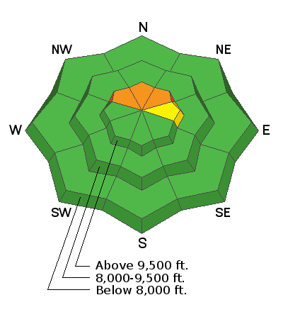
The majority of the terrain across the Skyline has a LOW to MODERATE avalanche danger. However, a CONSIDERABLE danger remains on steep slopes above 9500' that face northwest, north and northeast. The chances for triggering and avalanche are low but if you trigger one, it could be 2 to 4 feet deep and un-survivable.
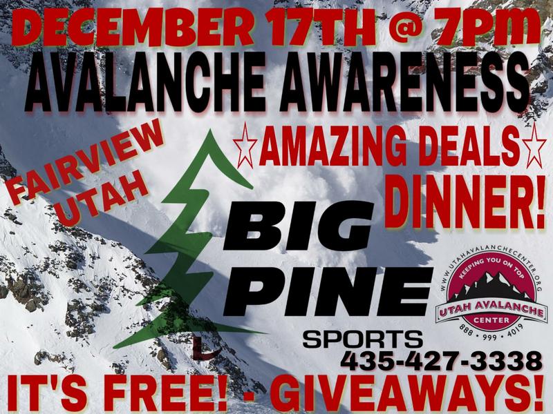
I'll be doing our annual avalanche presentation at Big Pine Sports on December 17th, 2018 at 7pm. It's free to attend and there will be food and drinks, good deals and some giveaways!
I'll discuss the start to our winter and current avalanche conditions. I'm thinking that I'll also review an accident or two that has occurred on the Skyline. There is always a lot to learn when reviewing accidents.
Weather and Snow
Westerly wind has been light to moderate in speed and should decrease as the day goes on. Overnight mountain temperatures were in the teens to low 20s and should reach a high in the upper 20s. We'll see partly cloudy skies although clouds may linger along the peaks today.
The couple of storms that will roll through mid week don't look real promising for snow. The first one Tuesday looks like it'll only bring a trace or so of snow. The next one on Wednesday afternoon is looking fairly small also with only a few inches of snow. I'd say if we get 5" from both storms combined we'd be doing good. The long term looks decent for snowfall with numerous systems moving through over the 10 day period.
The snowpack is generally stable at this point but weak snow near the ground does exist in upper elevation northerly facing slopes. See the video from Friday for info on this.
Avalanche Problem #1
Persistent Weak Layer
Type
Location
Likelihood
Size
Description
I hate to sound like a broken record but that's what happens when loose sugar snow forms and gets buried in the snowpack. Slopes above about 9500' that face northwest, north and northeast are holding weak sugar snow near the ground. There is no doubt that it has gained some strength with all of the new snow since Thanksgiving smashing down on it. The hopes are that as we continue to add snow, the sugar snow will continue to get smashed and bond into a stronger layer. The more snow we get, the quicker this will happen, For now, continue to use caution if you're getting up into the higher elevation northerly terrain.
Additional Information
Weather Outlook:
Be sure to check out all of the recent backcountry observations in the link below.