Join us at our 2nd Annual Blizzard Ball

Forecast for the Skyline Area Mountains

Brett Kobernik
Issued by Brett Kobernik on
Thursday morning, December 26, 2024
ANTICIPATE INCREASING AVALANCHE DANGER THROUGH THE WEEKEND.
For today, the overall avalanche danger on the Manti Skyline is MODERATE.
Shallow human triggered avalanches are possible in the higher terrain.
Low
Moderate
Considerable
High
Extreme
Learn how to read the forecast here
Avalanche Watch
What: Heavy snowfall and drifting by strong winds will elevate backcountry avalanche danger over the next several days. Very dangerous conditions and HIGH avalanche danger are expected to develop in many areas
When: The Avalanche Watch is for rising avalanche danger, with very dangerous conditions continuing through the weekend and into next week.
Where: The Avalanche Watch is for the mountains of Northern and Central Utah as well as Southeastern Idaho, including The Wasatch Range. The Bear River Range. The Western Uinta Mountains and The Wasatch Plateau.
Impacts: Very dangerous avalanche conditions are expected to develop on many slopes. Avalanches can be triggered on slopes steeper than 30 degrees. They may also be triggered remotely (from a distance) or from below.
What to do: Avoid traveling on or underneath steep terrain at mid and upper elevations in the backcountry. Carry and know how to use avalanche rescue equipment. Find safer riding conditions on slopes less than 30 degrees with no overhead hazard.
Weather and Snow
Current Conditions: The Christmas storm only brought the low end of what I was anticipating for new snow. Totals averaged 3 inches. Temperatures have cooled into the mid teens. The wind has been fairly well behaved with generally light speeds from the southwest overnight.
Mountain Weather: More snow is on the way. The next impulse will be this morning bringing a few inches of new snow. High temperatures will get into the mid to upper 20s. Wind from the west northwest will start out light to moderate in speed and increase this afternoon. It could get pretty strong by this evening. We'll continue to see numerous periods of snow through the weekend. None of these alone look all that impressive but we could see a foot of new snow or better by Monday. What is notable is that it looks like it's going to be pretty windy and this is what will most likely make avalanche conditions dangerous.
Recent Avalanches
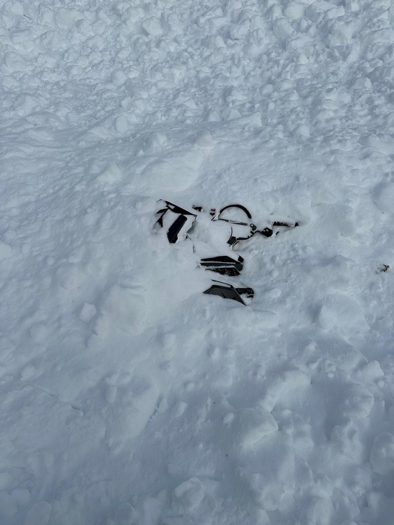
There have been no recent avalanches reported on the Skyline. There was a very close call in the Logan region on Tuesday where a snowmobile rider was caught and completely buried. DETAILS HERE. The reason I mention this is that we will most likely see similar conditions here on the Skyline after we add a few more layers of snow to our existing weak snowpack.
Ad
Avalanche Problem #1
New Snow
Type
Location
Likelihood
Size
Description
For today our main focus is on the new snow. Shallow soft slab avalanches are possible especially later in the day as the wind starts to drift snow. Watch for cracking in the snow surface as you travel. This is an indicator of unstable conditions.

Our focus is going to switch to how the old weak snow reacts to the new snow through the weekend. Our snowpack consists of a lot of loose sugary faceted snow. The most likely scenario is that it will become overloaded and will not be able to support additional layers of new snow. This old faceted snow will become what we refer to as a "Persistent Weak Layer". The reason we call it "Persistent" is that its unstable nature can persist for a long period of time. Eventually, it can gain strength and become stable but the message for right now is I am expecting conditions to become dangerous. We will probably be dealing with this Persistent Weak Layer for a while.
General Announcements
This forecast is from the U.S.D.A. Forest Service, which is solely responsible for its content. This forecast describes general avalanche conditions and local variations always occur.