UDOT PLANNED AVALANCHE CLOSURES!!

Forecast for the Skyline Area Mountains

Brett Kobernik
Issued by Brett Kobernik on
Friday morning, December 27, 2024
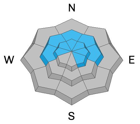
ANTICIPATE INCREASING AVALANCHE DANGER THROUGH THE WEEKEND.
For today, the overall avalanche danger on the Manti Skyline is CONSIDERABLE.
The avalanche danger is increasing due to additional snow and wind during the day and may reach HIGH DANGER by this afternoon.
Avoid being on or below steep slopes today.
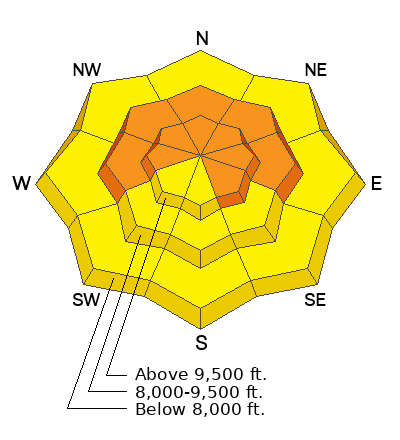
Low
Moderate
Considerable
High
Extreme
Learn how to read the forecast here
Avalanche Watch
What: Heavy snowfall and drifting by strong winds will elevate backcountry avalanche danger over the next several days. Very dangerous conditions and HIGH avalanche danger are expected to develop in many areas
When: The Avalanche Watch is for rising avalanche danger, with very dangerous conditions continuing through the weekend and into next week.
Where: The Avalanche Watch is for the The Western Uinta Mountains and The Wasatch Plateau (Manti Skyline).
Impacts: Very dangerous avalanche conditions are expected to develop on many slopes. Avalanches can be triggered on slopes steeper than 30 degrees. They may also be triggered remotely (from a distance) or from below.
What to do: Avoid traveling on or underneath steep terrain at mid and upper elevations in the backcountry. Carry and know how to use avalanche rescue equipment. Find safer riding conditions on slopes less than 30 degrees with no overhead hazard.
Weather and Snow
Current Conditions: During fieldwork on Thursday, my partner and I found a most unpleasant rain/rime crust that had formed on Christmas day. It was 1/8 to 1/4 inch thick and was up to at least 10,000' in elevation on all aspects. It was covered up by an inch or two of new snow that fell on Thursday morning. We picked up another 3 to 4 inches of snow overnight. The wind has been moderate in speed with some short periods of stronger gusts from the west. Temperatures were in the upper 20s on Thursday and are in the mid 20s this morning.
Mountain Weather: We should see a pretty good shot of snow today. I'm expecting 6 to 10 inches of snow by Saturday morning. Wind starts out fairly light this morning the will get strong from the northwest by late afternoon. Temperatures will get into the upper 20s. We should see a few more inches of snow on Saturday then another little shot Sunday night.
Recent Avalanches
There have been no recent avalanches reported. Check out all of the Skyline Avalanches and Observations in the link below in Additional Information.
Ad
Avalanche Problem #1
Persistent Weak Layer
Type
Location
Likelihood
Size
Description
The biggest threat out there today is the chance for triggering an avalanche that breaks into old weak sugary snow. The danger is increasing today with more snow and wind. It's like we're adding straws and we're not quite sure which one will break the camel's back. Things probably won't get real dangerous until this afternoon after more snow stacks up. This is when the wind is going to really start drifting snow as well.
Avalanche Problem #2
Wind Drifted Snow
Type
Location
Likelihood
Size
Description
You are going to want to pay attention to what the wind is doing today. It is probably going to start drifting snow this afternoon as speeds increase. Drifts that form in areas where there is old faceted snow is present, as described above, will be the most dangerous but watch for and avoid these on all aspects and elevations.
General Announcements
This forecast is from the U.S.D.A. Forest Service, which is solely responsible for its content. This forecast describes general avalanche conditions and local variations always occur.