Forecast for the Skyline Area Mountains

Brett Kobernik
Issued by Brett Kobernik for
Tuesday, December 21, 2021
ATTENTION!! IT APPEARS SIGNIFICANT WINTER STORMS ARE ON THEIR WAY. THIS COMBINED WITH A VERY UNSTABLE SNOWPACK WILL RESULT IN VERY DANGEROUS AVALANCHE CONDITIONS OVER THE HOLIDAYS.
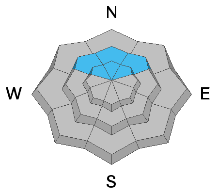
A CONSIDERABLE avalanche danger remains on upper elevation steep northwest, north and northeast facing slopes. Human triggered slab avalanches are likely in this terrain. Continue to avoid these steep slopes until we see conditions improve.
THE AVALANCHE DANGER WILL BE ON THE RISE AT THE END OF THE WEEK.
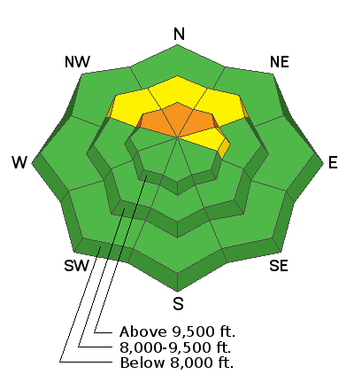
Low
Moderate
Considerable
High
Extreme
Learn how to read the forecast here
Weather and Snow
Current Conditions
No big change in conditions. Temperatures have remained pretty steady in the mid 20s for a number of days now and the wind has remained pretty light. Riding conditions are holding up although the snowpack remains very shallow.
Mountain Weather
We have two more days of mild weather before a period of storms moves in. Temperatures and wind will remain mild the next two days with plenty of sun. A decent storm will move through Thursday into Friday that looks like it may bring around a foot of snow. The weather pattern looks active over the next couple of weeks with quite a bit of water being advertised with the storms which could help our snowpack out a bunch.
Ad
Avalanche Problem #1
Persistent Weak Layer
Type
Location
Likelihood
Size
Description
The persistent layer of faceted sugary snow from October that is now buried is and will be the biggest threat for avalanches over the next couple of weeks. It is located above about 9000 feet on slopes that face northwest, north and northeast. Collapsing and cracking of the snowpack has been a common occurrence each day I've been out in the mountains. I expect to see more of the same today. I'll be avoiding slopes steeper than 30 degrees on the northerly facing slopes.