Get Your Ticket to the 32nd Annual Backcountry Benefit on September 11th! Support Forecasting, Awareness, and Education
Ad

Forecast for the Skyline Area Mountains

Brett Kobernik
Issued by Brett Kobernik on
Friday morning, December 18, 2015

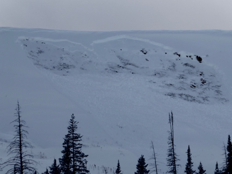
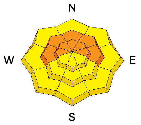
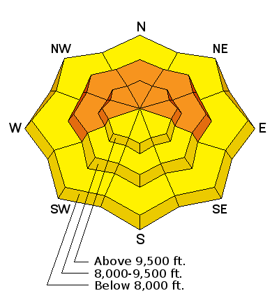
Weak old snow from November with a large amount of new snow added on top of it along with recent stronger winds has created a CONSIDERABLE avalanche danger in the mid and upper elevation terrain. The old weak snow will continue to make the avalanche conditions quite dangerous through the weekend. Human triggered avalanches are likely. Continue to avoid the steeper terrain in the mid and upper elevation terrain that faces west, north and east.

Low
Moderate
Considerable
High
Extreme
Learn how to read the forecast here
Recent Avalanches

I observed a number of avalanches on Thursday that released naturally early in the morning from a bump in wind speeds and a few inches of new snow. These all broke on weak snow near the ground that fell in November.

Date Region Place Trigger Depth Width Aspect Elevation Weakness
12/17/2015 Skyline Lake Canyon Natural 3.5' 400 Northeast 10200 Facets Details
12/17/2015 Skyline Skyline Summit Natural Northeast 9900 Facets Details
12/17/2015 Skyline Wedding Ring Ridge Natural Northeast 9900 Facets Details

Ad
Avalanche Problem #1
Persistent Weak Layer
Type
Location
Likelihood
Size
Description

The weak snow near the ground will continue to be unstable producing sketchy avalanche conditions through the weekend and perhaps next week as well.

Additional Information

General Announcements

We will publish full detailed advisories Saturday and Sunday mornings by 7am. We will also be publishing basic avalanche danger ratings & info during the week.

If you are getting out into the mountains, we love to hear from you! You can SUBMIT OBSERVATIONS ONLINE or EMAIL US

If you would like to have avalanche advisories emailed to you, SIGN UP HERE

We can provide basic avalanche awareness presentations for your school, group or club. To enquire, CLICK HERE