Join us for the 33rd Backcountry Benefit - Get Your Tickets Now!

Forecast for the Skyline Area Mountains

Brett Kobernik
Issued by Brett Kobernik on
Friday morning, January 9, 2026

The recent storm has increased the avalanche danger. There is a MODERATE TO CONSIDERABLE avalanche danger on the Manti Skyline today. Up to 11 inches of new snow (almost 1" H2O) as been added on top of many areas that have weak sugary faceted snow near the ground. Human triggered avalanches are likely in these areas. This is most pronounced above 9500' in elevation on slopes that face NW, N, NE, and E. It is also more pronounced in areas that received the most snow from the last storm. This includes high elevation terrain from around Horseshoe Mountain and south. Avoid steep slopes in this terrain, ESPECIALLY WHERE THERE ARE RECENT DEPOSITS OF WIND DRIFTED SNOW.

Low
Moderate
Considerable
High
Extreme
Learn how to read the forecast here
Weather and Snow

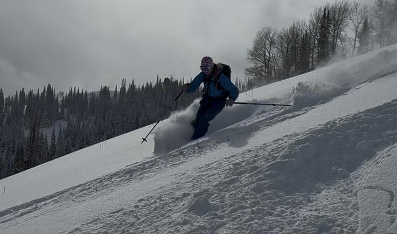
Photo below: Excellent powder conditions were had on Thursday - Kobernik

General Conditions: Periods of snow lingered through yesterday and last night, adding a few more inches. It's actually still lightly snowing in some locations this morning. Totals are 6 to 11 inches with the central and southern end of the Skyline being favored. Temperatures plummeted into the single digits overnight. Wind from the northwest increased in speed late Thursday and blew in the moderate speed range with stronger gusts. This was definitely enough to stir up the snow a bit. I expect to find drifts, slabs, and crusts from the wind in the exposed terrain today. Riding conditions were excellent on Thursday, given that there really isn't all that much snow on the ground. I expect conditions to be quite good today, especially out of wind-affected terrain.
Mountain Weather: The storm is attempting to clear, but it looks like some low-level moisture potentially could keep clouds around through the day. Temperatures will get into the teens. I think we are done with the strongest wind but it will remain moderate in speed from the northwest through the day. Things clear out Saturday and Sunday with temperatures rebounding. I hate to say it, but there are no storms in sight right now.
Avalanche Problem #1
Persistent Weak Layer
Type
Location
Likelihood
Size
Description

A Persistent Weak Layer of facets near the ground is present through the high terrain on the Skyline. The recent storm actually added enough weight to cause me concern. All the red flags are there:

  • Poor snowpack structure with facets near the ground
  • Cracking and collapsing over the last few days
  • A new layer of storm snow containing almost an inch of water in favored locations
  • Recent wind and fresh drifts

The problem is most pronounced above 9500' on NW, N, NE, and E facing steep terrain that received the most snow from the last storm. Wind-drifted snow will enhance this issue.

WATCH OUT IF YOU'RE GETTING INTO THE DESCRIBED TERRAIN.

General Announcements
This forecast is from the U.S.D.A. Forest Service, which is solely responsible for its content. This forecast describes general avalanche conditions and local variations always occur.