Join us for the 33rd Backcountry Benefit - Get Your Tickets Now!

Forecast for the Skyline Area Mountains

Brett Kobernik
Issued by Brett Kobernik on
Wednesday morning, January 7, 2026

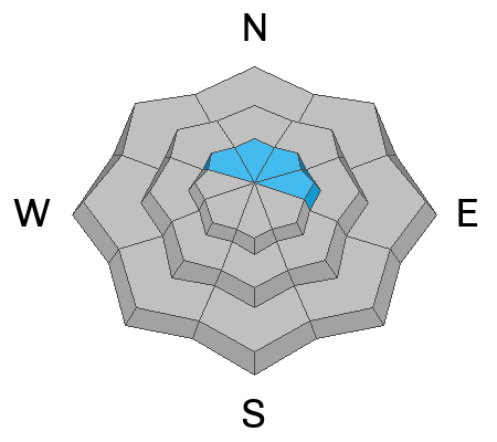
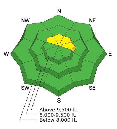
The majority of the terrain on the Manti Skyline has a LOW avalanche danger. There is a "pockety" MODERATE avalanche danger in the higher terrain that faces NW, N, NE, and E, where it is possible, although fairly unlikely, that a person could trigger an avalanche. Steep wind-loaded slopes with buried facets near the ground are where you could find trouble.
Low
Moderate
Considerable
High
Extreme
Learn how to read the forecast here
Weather and Snow
General Conditions: Clouds cleared out early on Tuesday, leaving us with a very nice day. Temperatures got up to near 30°F in the mid elevations. Most locations dropped to around 20°F overnight. Wind has been light from the southwest. The snowpack remains very shallow for this time of the year, especially in the low and mid elevations. Despite the lack of snow, riding conditions are pretty good.
Mountain Weather: We have a nice day in store with clear skies this morning and increasing clouds this afternoon. Temperatures will get up near 30°F. Wind will be light from the southwest. A storm starts moving in tonight and will linger through Thursday. It's a colder storm in a northwest flow. I think we're looking at about 4 to 6 inches of new snow by Thursday afternoon. Snow densities will be lower compared to the last couple of storms. Wind from the northwest could be a bit breezy late Thursday. Temperatures will drop into the single digits by Thursday night.
Avalanche Problem #1
Persistent Weak Layer
Type
Location
Likelihood
Size
Description

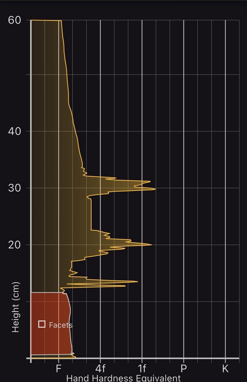
I hate to say it, but I believe the biggest threat out there right now is an avalanche involving weak, sugary, faceted snow near the ground. I continue to find more and more areas with buried facets near the ground. It is quite widespread across the higher terrain on the Skyline. During travel in Ephraim Canyon on Tuesday, I experienced numerous collapses and shooting cracks. This is a major red flag and is a sure sign of unstable snow.

Image below: Snow Scope snow profile in Ephraim Canyon where I was experiencing collapsing and shooting cracks.

The problem is most prominent above 9500 feet in elevation on slopes that face NW, N, NE and E. Slopes that have recent deposits of wind-drifted snow on top of the buried facets are the most suspect. Overall, the likelihood of triggering an avalanche isn't high yet because we don't have a large load on top of the buried facets. But it appears the writing is on the wall. When we start adding significant layers of snow to the existing snowpack, look out.

General Announcements
This forecast is from the U.S.D.A. Forest Service, which is solely responsible for its content. This forecast describes general avalanche conditions and local variations always occur.