UDOT PLANNED AVALANCHE CLOSURES!!

Forecast for the Skyline Area Mountains

Brett Kobernik
Issued by Brett Kobernik on
Friday morning, January 31, 2025
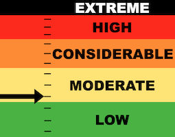
.
The avalanche danger on the Manti Skyline is MODERATE.
Overall, things are pretty quiet on the mountains but there are a few booby traps scattered around.
Recently formed drifts and wind slabs should still be avoided.
Low
Moderate
Considerable
High
Extreme
Learn how to read the forecast here
Special Announcements
FREE AVALANCHE AWARENESSS PRESENTATION:
I'll be giving a presentation on how to stay safe from avalanches in our local mountains. Topics will include:
  • Rescue gear
  • Avalanche terrain
  • Snowpack structure
  • Accident reviews and what we can learn
Friday, Jan 31, 2025, 7pm
Sevier county Search and Rescue building, 801 E 300 N, Richfield, UT
Weather and Snow
Current Conditions: We've had sunny skies with light to moderate wind from the west. The wind is almost calm this morning. Temperatures got into the upper 20s to low 30s on Thursday. There is a temperature inversion this morning with warmer temperatures along the higher terrain (around 30˚F) and colder temperatures down in the canyons (teens).
Mountain Weather: We'll have some sun this morning with clouds moving in mid day. Temperatures will again get into the mid 30s. Wind from the southwest starts out light then picks up a little speed this afternoon. A storm system moves through this weekend but mainly stays to our north. We might pick up a few inches of snow, mainly late Saturday into Sunday.
Ad
Avalanche Problem #1
Wind Drifted Snow
Type
Location
Likelihood
Size
Description
Avalanche conditions are fairly quiet right now. You still might pop out a wind drift or slab that formed over the last week. Most of these have been shallow and don't pose much threat.
The most likely place to trigger something is on very steep slopes in the higher terrain right around ridges and terrain features, especially on the more east facing slopes.
.
Avalanche Problem #2
Persistent Weak Layer
Type
Location
Likelihood
Size
Description
There is a lot of weak sugary snow around. There are layers deep in the snowpack and now there is loose sugary snow on the surface that formed over the last dry spell. For the most part, these layers are dormant and aren't posing much threat. Places where you might find trouble would be where the wind has deposited snow forming drifts and slabs.
The key for today is to simply avoid steep slopes where the wind has formed drifts, slabs and cornices.
General Announcements
This forecast is from the U.S.D.A. Forest Service, which is solely responsible for its content. This forecast describes general avalanche conditions and local variations always occur.