Forecast for the Skyline Area Mountains

Brett Kobernik
Issued by Brett Kobernik for
Friday, January 19, 2024
The overall avalanche danger on the Skyline is rated at CONSIDERABLE.
Large human triggered avalanches are likely today.
The snowpack remains very unstable.
Avoid being on or below any steep slopes.
Low
Moderate
Considerable
High
Extreme
Learn how to read the forecast here
Special Announcements
FREE AVALANCHE BEACON TRAINING
Saturday, 9am to 1pm
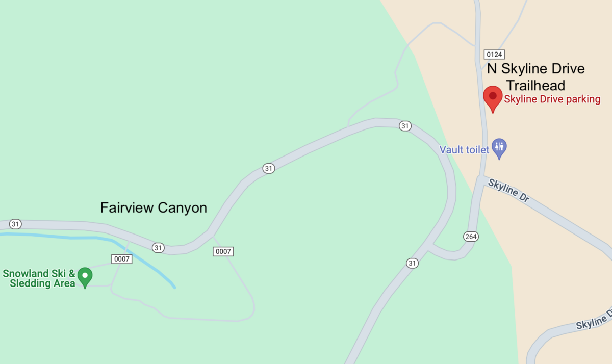
North Skyline Drive trailhead
Stop by anytime between 9am and 1pm and we'll take a half hour to an hour and teach you how to effectively use your avalanche gear. You will walk away being much more confident in using the gear.
LINK TO GOOGLE MAPS
Weather and Snow
Current Conditions: The wind has finally calmed down and is as slow as it's been in over a week from the west. Temperatures have been pretty steady staying in the mid 20s. Riding conditions are not bad. You'll find lots of areas with dense soft snow. You'll also find areas of stout wind crusts.
Mountain Weather: It's going to be pretty warm today with high temperatures getting into the mid 30s. Wind should remain fairly light from the west southwest. We'll see scattered high clouds. Unsettled weather starting Saturday night will bring periods of light snowfall over the next week. As of now it looks like snow on Saturday night, Sunday night and another chance about mid week. None of these impulses are going to produce much more than a few inches each.
Recent Avalanches
A tour of the canyons south of Miller Flat on Thursday revealed more large avalanches from the last cycle. It was really an impressive and unprecedented event and I'll have more avalanches documented today. One of the most notable slides was a monster in Rolfson Canyon that was triggered by snowmobilers from a distance. MORE DETAILS HERE
Ad
Avalanche Problem #1
Persistent Weak Layer
Type
Location
Likelihood
Size
Description
We have a weak snowpack structure across the entire Manti Skyline. The base consists of loose sugary facets from December. Numerous layers of new snow and strong wind overloaded the weak base and there was a significant avalanche cycle.
At this point, we are probably past the most sensitive period but the snowpack remains unstable. Our group experienced about 10 large collapses during our travels on Thursday. The type where you feel the snow drop underneath you. Riders in Ephraim Canyon reports numerous collapses as well. This is a HUGE red flag that definitivly demonstrates how unstable the snow remains. In simple terms, human triggered avalanches are still very likely.
All you can do is avoid the steep terrain until we see improvement in the snowpack stability. I'll be keeping you posted as to how this progresses.
General Announcements
This forecast is from the U.S.D.A. Forest Service, which is solely responsible for its content. This forecast describes general avalanche conditions and local variations always occur.