Join us at our 2nd Annual Blizzard Ball

Forecast for the Skyline Area Mountains

Brett Kobernik
Issued by Brett Kobernik on
Wednesday morning, January 15, 2025
.
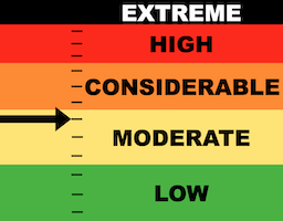
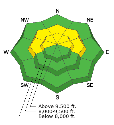
No big change in conditions. The danger remains at the upper end of MODERATE.
We are in a "low probability/high consequence" situation.
The best approach right now is to continue to avoid steep terrain until the buried weak layers gain more strength.
Low
Moderate
Considerable
High
Extreme
Learn how to read the forecast here
Weather and Snow
Current Conditions: Riding conditions are pretty decent right now with nice powder on the surface. You'll note that there are many places that remain "punchy" where you will sink through deep into sugary faceted snow. Temperatures have warmed slightly over the last 24 hours with most stations in the teens. Wind has been generally light from the northwest.
Mountain Weather: We'll be in a gradual warming trend for the next couple of days. We'll have mostly clear skies today with high temperatures into the 20s and continued light northwest wind. We'll have mild weather for the next couple of days then some clouds and a minor chance for light snow Saturday with no real accumulations expected.
Ad
Avalanche Problem #1
Persistent Weak Layer
Type
Location
Likelihood
Size
Description
We are in tricky times and will continue to be for a while it looks like. There is, no doubt, plenty of weak faceted snow buried at the base of the snowpack. As time slides by, it becomes less reactive. Chances for triggering something decrease. But the chance is still there and if something releases, it will break a couple of feet deep. Again, low probability/high conseqence.
Everything seems quiet but this is the nature of buried facets. They will trick you. Continue to use caution. Good luck.
.
General Announcements
This forecast is from the U.S.D.A. Forest Service, which is solely responsible for its content. This forecast describes general avalanche conditions and local variations always occur.