Donate to the 2024 Spring Campaign to help rebuild the UAC website.

Forecast for the Salt Lake Area Mountains

Nikki Champion
Issued by Nikki Champion for
Wednesday, April 6, 2022
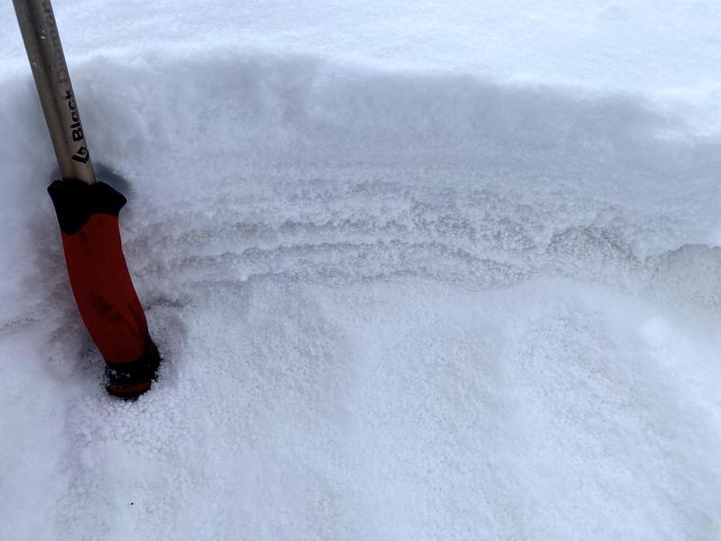
Today the avalanche danger is MODERATE at upper elevations where unstable soft slabs of wind drifted snow most likely exist. These wind slabs will be shallow. How dangerous they are will be determined by the terrain you're in.
The danger at mid and low elevations is LOW but there could be some fresh wind slabs at these elevations to look out for as well.
The high winds should help keep the snow from heating up too much, but once the sun comes out some wet loose avalanches could begin to happen on the southern end of the compass. Pay attention to changing conditions and avoid being on steep solar aspects if the snow has become wet and unsupportable.
Low
Moderate
Considerable
High
Extreme
Learn how to read the forecast here
Special Announcements
Snowbasin Ski Patrol is holding an avalanche dog fundraiser on Thursday, April 9th from 6-10pm at Mountain Luxury Real Estate, 3632 N Wolf Creek Drive in Eden, UT. The event costs $20 and includes dinner and a silent auction. Find more information HERE.
Weather and Snow
This morning skies are clear and mountain temperatures range in the low single digits to the upper teens F. At mid-elevations the northwest winds remain elevated, averaging 15-30 mph gusting to 30-45 mph. At the uppermost elevations, winds continue to be relentless, averaging 60-70 mph with gusts up to 90 mph. The mountains picked up 4-7" of new snow which has improved the riding conditions greatly in areas protected from the high winds.
Today skies will clear, the sun will come out and temperatures will climb into the mid 30s F. Strong northwest winds will continue through the early morning, and begin decreasing into the afternoon.
The rest of the week should be warm and dry with a ridge of high pressure dominating the weather. Things begin changing Saturday, and some snow may fall early next week but no major storms are in the long-range forecasts.
Recent Avalanches
Yesterday, there was one small point release observed from a distance in the Catchers Mitt off Kessler Peak.
Find all observations HERE.
Ad
Avalanche Problem #1
Wind Drifted Snow
Type
Location
Likelihood
Size
Description
Multiple days of relentless winds plus a few inches of new snow may have formed shallow soft slabs of wind drifted snow at upper elevations. You may find a few of these wind slabs at low and mid elevations where they likely bonded to the warm and wet snow surface.
If you're headed to high peaks and more extreme terrain today, these wind slabs may be small, but they can be a major threat because they can knock you off your feet and cause a fall. ​​​

Heads up - Many professional observers found notable graupel just below a few inches of new snow yesterday. In many areas, this graupel will be a non-issue and just make for fun 'surfy' riding - but in areas that could allow for both graupel pooling and some wind drifting to occur, I would be cautious of sensitive wind drifts sitting atop the pooled graupel. Today, I would give extra caution to any concavity, such as the aprons below steep chutes, the base of cliff bands, and directly below ridgeline and sub-ridges.
Photo of the graupel just below the few inches of new snow in Upper Days (B. Nalli)
Avalanche Problem #2
Wet Snow
Type
Location
Likelihood
Size
Description
The high winds should help keep the snow surface from heating up too much, but when the sun comes out this afternoon it wouldn't take much for the new snow to warm quickly, become wet, and begin producing wet loose avalanches on steep southwest to the south to southeast facing slopes today.
Signs that wet avalanches will start happening include; seeing snowballs or pinwheels roll downhill with increasing frequency, and seeing upper layers of snow become increasingly wet.
Timing is the name of the game. Avoid being on steep solar aspects if the snow has become wet and unsupportable.
General Announcements
Who's up for some free avalanche training? Get a refresher, become better prepared for an upcoming avalanche class, or just boost your skills. Go to https://learn.kbyg.org/ and scroll down to Step 2 for a series of interactive online avalanche courses produced by the UAC.
This information does not apply to developed ski areas or highways where avalanche control is normally done. This forecast is from the U.S.D.A. Forest Service, which is solely responsible for its content. This forecast describes general avalanche conditions and local variations always occur.