Forecast for the Salt Lake Area Mountains

Trent Meisenheimer
Issued by Trent Meisenheimer for
Sunday, April 21, 2019
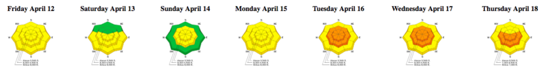
The avalanche danger is MODERATE at the upper elevation northeast through easterly facing terrain for shallow wind drifted snow. There is also a MODERATE danger for shallow, wet snow sluffs on all steep mid and upper elevation terrain. The rain snow line will stay between 8,000'-9,000' for the day.
Any period of strong sunshine can make the new snow unstable in a matter of minutes. Keep an eye on the new snow to see how wet and heavy it's becoming as it heats throughout the day.
Low
Moderate
Considerable
High
Extreme
Learn how to read the forecast here
Special Announcements
The last scheduled forecast will be Today, April 21st. We will issue intermittent updates with each snowfall or significant weather event through the rest of the month. We will continue posting observations - so please continue to send those in!

Closed resorts are now backcountry terrain - no avalanche mitigation is being done. Utah ski resorts are on a mix of private and public Forest Service land, and each resort has a different uphill policy - contact the individual resort for details.
Weather and Snow
Under partly cloudy skies the southerly winds are blowing at speeds of 10-20 mph gusting into 30's across the high elevation terrain. 10,000' temperatures are hovering just under 32 °F while the lower elevation trail heads are above freezing. Overnight we picked up 1-2" of new snow above about 9,500' containing 0.10" - 0.22" of water.
For today, the southerly winds will continue to blow at speeds of 10-20 mph with strong gusts at times. We will see snow showers with thunderstorms possible as this spring system moves through today and tomorrow. Expect a full range of weather today. Sun at times, turning to snow showers with heavy bands of snow with graupel likely. We can expect to pick up another 2-5" of new snow with up to 1" of water possible through Monday. The rain/snow line will be about 9,000' this morning and dropping to 8,000' by this evening.

The final Week in Review for the 2018/19 season is available. Thanks to Greg Gagne for putting compiling these valuable summaries each week
Recent Avalanches
No significant avalanche activity was reported from the backcountry yesterday.
Ad
Avalanche Problem #1
Wind Drifted Snow
Type
Location
Likelihood
Size
Description
Southerly winds along with 3-6" inches of new snow will likely create shallow drifts along the upper elevation leeward terrain. I would imagine these drifts will be touchy as the new snow may not bond very well to the slick underlying surface. Look for rounded pillowy snow along the upper elevation northwest through easterly facing terrain. Watch for any periods of heavy snow as that may spike the avalanche danger in your location.
Avalanche Problem #2
Wet Snow
Type
Location
Likelihood
Size
Description
Below about 9,000' its raining and it will continue to keep the surface wet, damp and soggy. As Mark said yesterday the snow is finally adjusting from a dry snowpack to a wet snowpack and wet avalanche activity is decreasing.
Above about 9,000' it's wet, heavy snow and push-a-lanches will be possible in the steep terrain. Shallow loose wet snow may slide faster than expected on the slick old snow surface. Keep an eye on your sluffs as you descend from the upper elevation dry snow into the damp, heavier snow at lower elevations. It's possible to trigger a dry snow avalanche at the upper elevations and as it moves downhill it becomes a wet snow slide.

Also, avoid being under any slope with a large glide crack. These are large cracks where the snow rest on a smooth ground surface and begins creeping/sliding downhill. At seemingly random times, these slopes can produce glide avalanches. Look for these large obvious cracks and just avoid hanging out beneath them.
Video: This is a good example of a shallow loose wet avalanche that I filmed the other day in the Uintas.
General Announcements
This information does not apply to developed ski areas or highways where avalanche control is normally done. This forecast is from the U.S.D.A. Forest Service, which is solely responsible for its content. This forecast describes general avalanche conditions and local variations always occur.