Researchers Ian McCammon and Sara Boilen are developing new tools for managing human factors for backcountry skiers and boarders. This survey asks about personal experiences with human factors and will take 7 - 8 minutes to fill out. Link is HERE
Storms!
This is shaping up to be a good one-two punch for us with 6"/0.8" (snow-water-equivalent) overnight and a roughly even LCC/BCC storm total of 12-16" (upwards of 2" of SWE). Storm totals along the PC ridgeline are about 8-12". The Ogden mountains have picked up about an inch of water while the Provo mountains have been drenched with 2-2.70" of liquid precipitation.
Temperatures are in the upper 20s to mid-30s with an estimated rain-snow line of 7500'. Winds are out of the southwest, blowing 20-30mph with gusts to 40, even in the mid-elevations.
A sharp cold front arrives before lunchtime and we'll see heavy snowfall, winds veering to the northwest, a decent chance of lightning, and snow on the daffodils in the valley. Winds are expected to blow moderate to strong from the northwest with periods of heavy snowfall through mid-afternoon. Light snowfall should continue - at least in the upper Cottonwoods through the overnight hours. A fair bet would be to see an additional 10-14" of snow from now through Friday morning. Temps drop to the low teens tonight and the low 20s tomorrow before we go high and dry over the weekend.
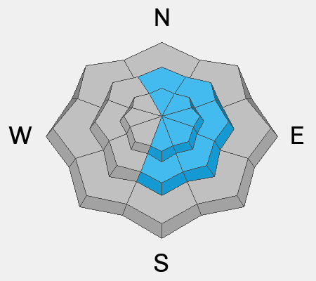
The Snow/Weather above was the good news. If you were out yesterday, you'll note that I glossed over the greenhousing in the early afternoon that kicked off a widespread cycle of wet loose avalanches on all aspects, leaving decent debris piles as the slow-running cement-like snow ran on the old melt-freeze crust. It was not our finest moment in the Wasatch, but with this winter, we'll take what we can get.
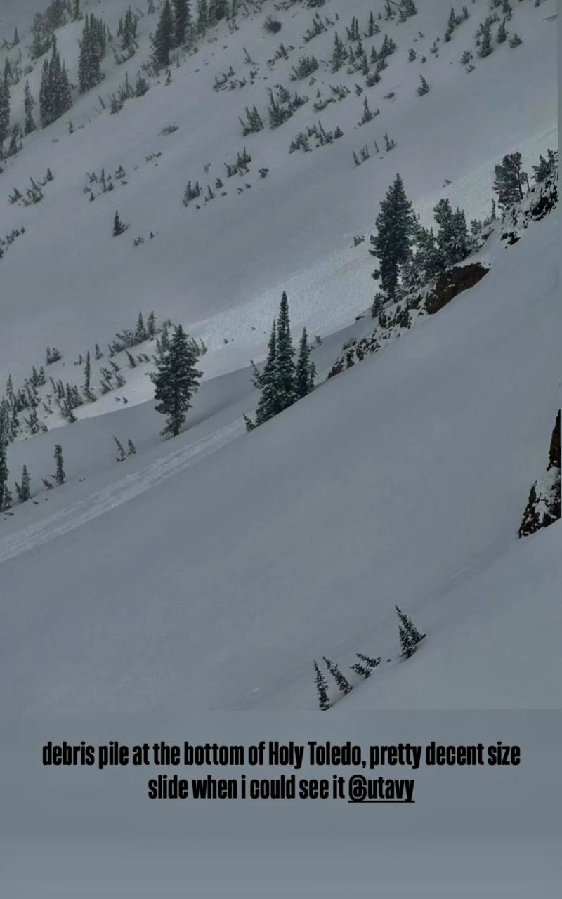
One of the many wet loose naturals yesterday, photo Mark White
You can view all recent observations HERE.