Join us at our 2nd Annual Blizzard Ball

Forecast for the Salt Lake Area Mountains

Greg Gagne
Issued by Greg Gagne on
Friday morning, April 16, 2021
The avalanche danger is LOW and avalanche conditions are generally safe, with sluffing in the top few inches of storm snow likely on steeper aspects the primary avalanche concern.
Be prepared to adjust plans with any sudden changes in the weather, including wet-loose avalanches if the sun appears or if the storm snow becomes reactive during any period of high precipitation intensity.
Low
Moderate
Considerable
High
Extreme
Learn how to read the forecast here
Special Announcements
Sunday, April 18th will be the 163rd avalanche forecast and the last one for the 2020/2021 season. For the rest of the month of April, we will provide updates on the snow and weather anytime it snows which is hopefully a lot. We will also continue to post observations.
Weather and Snow
Temperatures this morning range through the upper teens and winds are from the west/northwest and light, less than 10 mph, with gusts of 15 mph at 11,000'.
Another 1-2" of snow has fallen overnight, bringing snowfall totals since Wednesday of 1-2', with the highest amounts in upper Little Cottonwood Canyon. Settled snow is 12-18" in the upper reaches in the Cottonwoods.
For today, expect cloudy skies with temperatures in the 20's and low 30's F. Winds will be from the west/northwest and should remain light, with gusts in the teens. On and off snow showers may deliver another 2-4" during the day.

Our final Week in Review for the 2020/21 season - where we summarize significant weather and avalanche events for the prior week - has been published.
Recent Avalanches
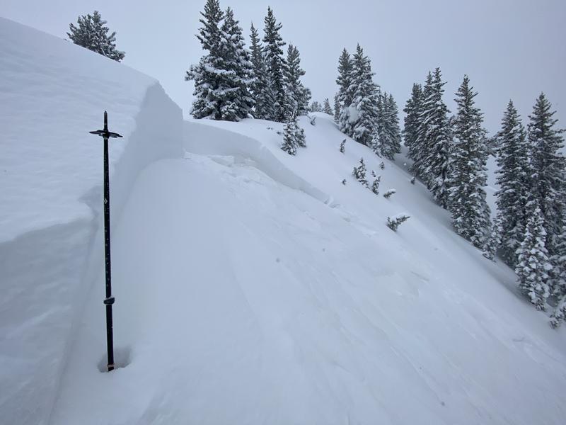
A 2' deep and 60' wide soft slab avalanche involving recent storm snow was intentionally triggered yesterday just above East Bowl Pass in Silver Fork (photo below). The only other reported avalanche activity was widespread sluffing in the top few inches of dense snow (with some graupel) on steeper slopes.

As always, find all of our observations and recent avalanches HERE.
Ad
Avalanche Problem #1
New Snow
Type
Location
Likelihood
Size
Description
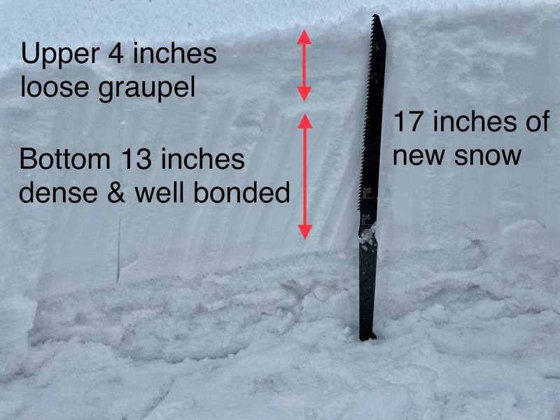
Instabilities within the storm snow have settled out, leaving a dense and cohesive slab 12-18" deep that is well-bonded to the old snow surface, with the top few inches of loose graupel (Mark Staples photo from Grizzly Gulch).
These are great conditions for April powder skiing, and although avalanche conditions are generally safe, you can expect sluffing in the storm snow on steeper aspects. In addition, here are a few other things to watch for today:
- if the sun comes out for any period of time, wet-loose avalanches will be possible;
- if the winds blow stronger than forecast, you may find sensitive wind drifts;
- during any period of high precipitation intensity the storm snow may become reactive.
Be willing to adjust plans in response to any sudden changes in the weather.
Additional Information
General Announcements
Please visit this website with information about Responsible Winter Recreation by the Utah Office of Outdoor Recreation.

This information does not apply to developed ski areas or highways where avalanche control is normally done. This forecast is from the U.S.D.A. Forest Service, which is solely responsible for its content. This forecast describes general avalanche conditions and local variations always occur.