Join us at our 2nd Annual Blizzard Ball

Forecast for the Salt Lake Area Mountains

Mark Staples
Issued by Mark Staples on
Thursday morning, April 15, 2021
Today, the avalanche danger is MODERATE at mid and upper elevations where it is possible to trigger a soft slab avalanche in the new snow. Despite generally light winds, there should be some slabs of wind drifted snow at upper elevations that could be triggered as well. At low elevations the danger is LOW.
The danger is generally trending down, but watch if there are any periods of intense snowfall that would cause the danger to rise. Also, evaluate every slope and don't take it for granted that seemingly stable conditions on one slope will mean that another slope is the same.
Low
Moderate
Considerable
High
Extreme
Learn how to read the forecast here
Special Announcements
Sunday, April 18th will be the 163rd avalanche forecast and the last one for the 2020/2021 season. For the rest of the month of April, we will provide updates on the snow and weather anytime it snows which is hopefully a lot. We will also continue to post observations.
Weather and Snow
What an impressive storm yesterday! Five inches of snow fell in one hour between 11 and 12 in upper Little Cottonwood Canyon. Overall yesterday, 9-14 inches of snow (0.8-1.26 inches of water) fell, with an additional 2-3 inches falling overnight.
This morning, light snow is falling under cloudy skies with an additional inch or two accumulating in upper LCC between 4 and 6 a.m. Temperatures range from the mid 20s to the upper teens F. Light winds 5-8 mph are blowing from the west southwest.
Today, expect similar weather as yesterday without the high snowfall rates. There will be light snow and light winds and temperatures that rise into the upper 20s to mid 30s F. As this storm system moves east today, winds will shift to the northwest and may increase a little by afternoon blowing 5-15 mph. 1-3 inches of snow should fall today with an additional 1-3 inches falling tonight and another 1-3 inches tomorrow.
A combination of temperatures just above freezing and brief moments of sunshine yesterday afternoon made the new snow a little damp, and there could be a thin crust under the snow that fell overnight. Despite that, I'd expect riding conditions to be quite good this morning. Cool temperatures (for this time of year) and clouds should keep the powder dry today, but any amount of sun and heat could change things quickly.
Recent Avalanches
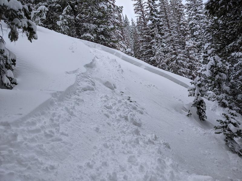
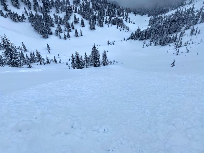
Yesterday after very high snowfall rates late morning, both human triggered and natural avalanches occurred. They were soft slabs of new snow generally 6-12 inches deep and 50-100 feet wide although there were a couple reported about 200 ft wide. One person was caught in a slide in Days Fork that was 16 inches deep and 50 feet wide. View all reported avalanches HERE.
Photo below of a slide in White Pine that was similar to many others (B. Miller)

As always, find all of our observations and recent avalanches HERE.
Ad
Avalanche Problem #1
New Snow
Type
Location
Likelihood
Size
Description
Following very high snowfall rates yesterday, many soft slab avalanches of new snow occurred. In most cases, a slab of higher density new snow failed on a layer of lower density snow that fell Tuesday night.
The new snow should have settled and become more stable since yesterday. The trouble is that different slopes stabilize at different rates, and there is still a possibility of triggering a soft slab in the new snow about a foot deep.
Use small test slopes at similar elevations and aspects of bigger slopes you hope to ride to evaluate the new snow. Consider choosing a slope to ride that has a clean runout (ie - no trees, rocks, gullys or cliffs) in case you trigger a slide.
Photo below of a slide in Days Fork that caught and carried a skier a short distance (LC).
Avalanche Problem #2
Wind Drifted Snow
Type
Location
Likelihood
Size
Description
Light winds have generally been blowing from the southwest, but there have been stronger gusts at elevations above 10,000 feet of 20-30 mph. With so much new snow, there should be some slabs of wind drifted snow at upper elevations that could be triggered today. As the new snow stabilizes at lower elevations, I would expect these wind slabs to remain unstable a little longer.
Additional Information
General Announcements
Please visit this website with information about Responsible Winter Recreation by the Utah Office of Outdoor Recreation.

This information does not apply to developed ski areas or highways where avalanche control is normally done. This forecast is from the U.S.D.A. Forest Service, which is solely responsible for its content. This forecast describes general avalanche conditions and local variations always occur.