Forecast for the Salt Lake Area Mountains

Evelyn Lees
Issued by Evelyn Lees for
Tuesday, April 16, 2019
Dangerous avalanche conditions.
Only those with excellent snowpack evaluation skills, cautious route finding and conservative decision-making should head into the backcountry today.
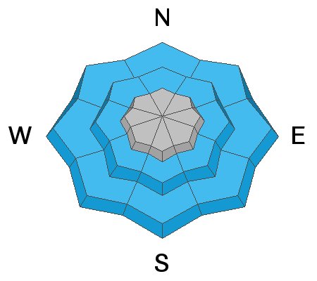
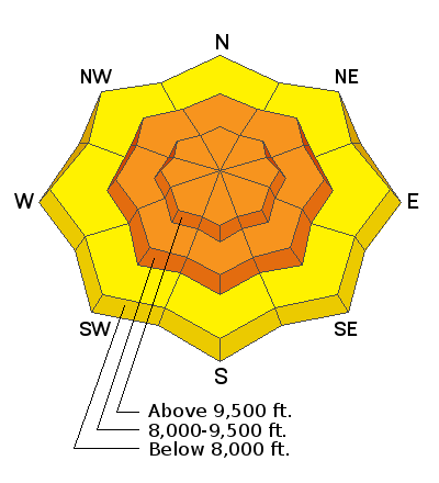
The avalanche danger is CONSIDERABLE on all steep, mid and upper elevation slopes - natural avalanches are possible and human triggered slides likely today. Any slide triggered today will rapidly become a wet snow slide as it moves down slope, resulting in large piles of cement like debris. The danger is MODERATE for triggering wet snow slides at the lower elevations and for avoiding runout zones, as natural avalanches from above could run long distances in isolated places.

I will update the Salt Lake City, Ogden and Provo forecast Wednesday morning (April 17th) by 7:30 am.
Low
Moderate
Considerable
High
Extreme
Learn how to read the forecast here
Special Announcements
Winter's not stopping, and neither are we! More snow = more forecasts through April 21st. We'll be doing early morning online forecasts for Ogden, Salt Lake and Provo most days this week, and definitely on Friday, Saturday, and Sunday of Easter weekend (April 19-21). Check the Bottom Line each day for the time of the next up date. We will continue posting observations every day this week.
There are backcountry closures in Little Cottonwood Canyon - click on the orange bar at the top of the page for details and updates.
Weather and Snow
It’s a warm spring storm, with the rain/snow line dancing around 8,500’ yesterday, and just starting to lower this morning. The upper Cottonwoods have a foot of dense snow at 9,500’, containing an inch and a half of water. Rain totals at the mid elevations are about 1/2” to 3/4” of water. Overnight, the southwesterly winds were steady and strong, averaging 25 to 35 mph along the 10,000’ ridge lines, with gusts in the 40s and 50s. Yesterday’s highs were in the 30s and 40s, and have slowly cooled overnight into the upper twenties and low 30s.
Today: the cool front is here, with another 4 to 8” of dense snow possible today above about 9,000’. The current strong southwesterly winds will slowly shift to the northwest behind the front and decrease, averaging 10 to 20 mph by evening, though gusts to 50 mph will occur throughout the day along the highest alpine ridges. Temperatures will slowly cool today, into the mid 20s at 10,000’, with the rain/snow line dropping to 7,500’.
Recent Avalanches
Yesterday, there were reports of easily triggered wet loose sluffs below about 9,000’ on all aspects in the rain soaked snow. Upper elevations had wind drifts release with explosives in the morning. In the afternoon, a natural avalanche cycle occurred in upper Little and Big Cottonwood, of new snow wet sluffs and wet slabs, many running on slick crusts. Even at upper elevations, the slides would entrain moist snow, resulting in large wet debris piles. There was also a skier triggered slide in Greaseball, on Kessler, of new snow only, but running fairly far in steep terrain.
Ad
Avalanche Problem #1
Wind Drifted Snow
Type
Location
Likelihood
Size
Description
The strong, southwesterly winds drifted snow much of the night, and the drifts will be most widespread on slopes facing the north 1/2 of the compass. These drifts could be one to three feet deep, along both mid and upper elevation ridge lines and off ridge lines, deposited mid slope. Watch for drifts cross loaded around terrain features such as mid slope break overs and sub ridges. Signs of wind drifts include cracking of the snow and looking for and avoiding smooth, rounded pillows of snow.
Any new cornices will be sensitive, breaking back further than expected and they may break from a distance. Stay well back from corniced edges when traveling on ridge lines and avoid travel beneath them.
Avalanche Problem #2
New Snow
Type
Location
Likelihood
Size
Description
With new snow depths of a foot, and the potential to reach 16 to 20” by storm's end, new snow slab avalanches and sluffs are likely, especially during periods of heavy snowfall. If there is brief, heavy snowfall where you are, the new snow could become reactive, and natural avalanches occur. Once moving, new snow slides may run on the old crusted surfaces, entraining snow all the way down the slide path. Debris piles would be much larger than expected.
Even at the upper elevations, there is moist snow from yesterday hidden beneath today’s dry snow. Once the dry snow gets moving, it will entrain the moist snow, and result in surprisingly large wet debris piles
Avalanche Problem #3
Wet Snow
Type
Location
Likelihood
Size
Description
The snow got a good soaking yesterday and overnight, with the rain/snow line over 8,500’ at times yesterday. Temperatures have been above freezing for 48 hours at the mid and lower elevations, and are just starting to cool. Wet snow avalanches will be easy to initiate in the soggy snow below about 9,000'. In steep terrain, both wet sluffs and the more dangerous wet slab avalanches are possible. Watch your slope angles at all times, avoiding steep slopes, including roll overs, creek beds and road banks. Avoid being in and below steep chutes and gullies even at the mid and lower elevations today - natural avalanches are possible, and could run long distances from above.

Glide cracks have been spotted in many of the classic places one could expect. These glide cracks are growing and at random the entire snowpack can come crashing down. If you're unfamiliar with Glide Avalanches please take the time to learn about them HERE. We have a few common drainages where we see these happen every year.
General Announcements
This information does not apply to developed ski areas or highways where avalanche control is normally done. This forecast is from the U.S.D.A. Forest Service, which is solely responsible for its content. This forecast describes general avalanche conditions and local variations always occur.