Forecast for the Salt Lake Area Mountains

Drew Hardesty
Issued by Drew Hardesty for
Monday, March 6, 2023
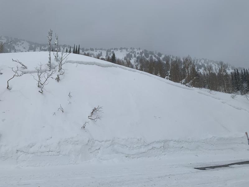
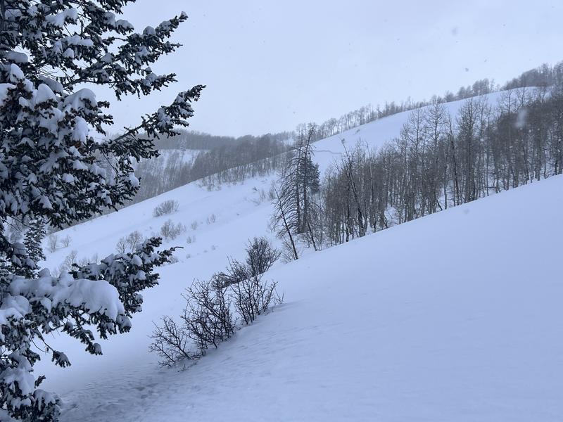
A CONSIDERABLE avalanche danger exists on all aspects of the mid and upper elevations. Human triggered avalanches are likely. Soft slabs and sluffs in the new snow are to be expected and not limited to usual starting zones...
***Cautious route finding and conservative decision making today is essential.***
Low
Moderate
Considerable
High
Extreme
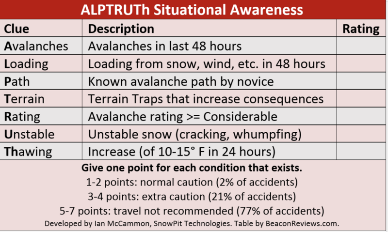
Learn how to read the forecast here
Special Announcements
To help you safely enjoy the backcountry, the UAC team is constantly evaluating and implementing new programs and technologies. Donate to the Spring Campaign to help our team implement innovative tools and better provide you with the information you rely on.
Thank You!
Weather and Snow
Come, let's go
Snow-viewing
Til we're buried.
--- Matsuo Bashō (1644-1694)

We are still living in a snow globe.
Overnight snow totals in the upper Cottonwoods are 14-16" and just shy of 1.0" snow water equivalent. The Park City ridgeline picked up 8-12" overnight.
Storm totals:
  • LCC: 43"/2.75" Snow water equivalent
  • BCC: 35"/2.30" SWE
  • PC: 26"/2.50" SWE
And counting...
Mountain temperatures are in the single digits. Winds, mercifully, are generally light from the west. Along the highest ridgelines, they are blowing 15mph with gusts to 20.

For today, we'll see light snowfall that may add up to another 3-6" of fairy dust. Temperatures will be in the single digits to low teens. Winds will remain light from the west.

We (the intermountain west) are buried beneath a long wave trough that will continue to keep at least light snowfall going off and on through Wednesday evening. We stay relatively cool with generally light to moderate wind. The next series of storms fire up on Friday. The image below - you can see we're nested in the cradle of storms.
Recent Avalanches
Last night!: snow cats reported seeing some natural avalanches in the overnight hours.

Yesterday: Avalanche control work in LCC brought numerous long running and destructive avalanches down across the road (photo) and avalanche crowns up to 2' deep were even noted on steep road-cuts down low (photo). Ski area control teams triggered numerous soft slab and dry loose new snow avalanches with ski cuts and explosives. Greg Gagne (report) noted numerous shallow new snow natural avalanches in Neff's; another long time observer triggered two avalanches in the lower Meadow Chutes of Silver Fork on steep east facing slopes.

Check recent observations from the backcountry in the menu bar above.
Ad
Avalanche Problem #1
New Snow
Type
Location
Likelihood
Size
Description
You will be able to trigger new snow avalanches big enough to kill you in steep terrain today. Both soft slab avalanches and loose snow sluffs are likely on a variety of aspects and elevations.
In our travels yesterday, we found weak snow interfaces one and two feet down within the storm snow and at the old snow interface. We've added another 12-16" of new snow overnight.
I would approach any steep terrain with caution today. Ski cuts on test slopes and cornice drops should give some information on stability. Shooting cracks indicate instability as well.
Note that avalanches will release well off the ridgelines and not in usual starting zones (as in this one in the lower Meadow Chutes of Silver Fork yesterday)
Avalanche Problem #2
Wind Drifted Snow
Type
Location
Likelihood
Size
Description
Yesterday we noted southwest and westerly winds blowing and drifting snow in the mid and upper elevations. These drifts will be buried by the overnight snow, but overnight fresh soft slabs of wind drifted snow may be found primarily along the higher elevations today. These will be sensitive to human weight.
Additional Information
Forecaster's Corner:
Local Wasatch resident Ian McCammon holds a PhD in robotics but can tell us a lot about human behavior. His research into avalanche accidents led him to an algorithm called ALPTRUTH.

The TAKE HOME here is that you already have three checked boxes before you even leave the house.
The terrain choice is yours.
General Announcements
This information does not apply to developed ski areas or highways where avalanche control is normally done. This forecast is from the U.S.D.A. Forest Service, which is solely responsible for its content. This forecast describes general avalanche conditions and local variations always occur.