We need your help. In an effort to increase awareness and prevent future fatalities we need to reach more people with our daily avalanche forecasts, expand the Know Before You Go program, and increase the number of on-snow avalanche courses. Please consider a donation to the UAC to help us raise $25,000 by April 8.
Help your support of the UAC by making a donation HERE. Thank you for your support!
Couple of new interesting things to
read and
listen to: (1) The latest blog by Drew "
Roping the Wind (Slab)", and (2) UAC
podcast featuring Lynne Wolfe - guide, avalanche educator, editor of The Avalanche Review, mentor, role model. This is a can't-miss episode!
Snow: An inch or two of snow fell overnight. Total snow since Thursday night is 18-23 inches in the Cottonwoods (1.4-1.8 inches of water) and about 12-14 inches along the Park City Ridgeline (1.1 inches of water)
Temperatures: This morning temperatures are mostly in the teens F.
Winds: Yesterday winds averaged 15-20 mph from the west with gusts of 30 mph. This morning winds shifted to the northeast and were blowing 2-5 mph even at 11,000 ft.
Today: Scattered snow showers will produce a trace to an inch of snow. Winds will remain mostly calm. Temperatures will climb into the low 30's F. There will be a mix of sun and clouds but it's hard to say exactly how much sunshine we'll see.
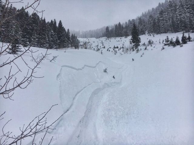
The new snow should have settled some overnight and I'd expect great "surfy" riding conditions this morning before the snow warms up too much.Avalanches in the backcountry and at ski resorts were mostly slabs of wind drifted snow about a 10-20 inches deep. Photo below of the layering in a small wind slab near
Summit Park (Brackelsberg).
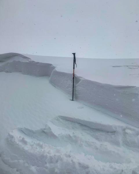
A few soft slabs 5-10 inches deep in the new snow produced avalanches like the one below in
Argenta on Kessler Peak, but these instabilities on non-wind loaded slopes should have stabilized this morning.