A new version the UAC's mobile app has been released with many new features and performance improvements. Download our app today, available on iPhone and Android. Learn more HERE.
Join Caroline Miller, UAC Executive Director, tomorrow, March 25th at 6pm in exploring a life-altering accident in the mountains. Broken Neck, Broken Systems is a deeper dive into decision-making in the mountains. Learn more HERE.
Skies are clear. Overnight lows are in the upper 30s to mid-40s. A weak storm passing to the north has elevated the winds and hourly averages are 15-20 mph from the west-northwest and about twice that along the highest peaks and ridgelines.
For today, we'll have partly cloudy skies, moderate winds from the west-northwest and daytime highs again reaching into upper 40s and 50s. A dry cold front crashes through for a brief reprieve on Thursday, but temps rebound for the weekend. There are hints of a more active pattern for next week, but we've heard that sales pitch before.

Call it mid-March madness. Here are the temps from the Mill D North snotel site in mid-BCC at roughly 9000'. You can see the cold front last Saturday March 14th with the sharp dip in temps, but we're seeing extreme temperatures more akin to late May or early June.

This station had 14" of snow-water-equivalent on the morning of March 17th, but in the past week, the water draining out of the snowpack had dropped that amount to about half that (7.4" SWE).
I am amazed to note that two winter extremes have occurred within just a few years, with Winter 22/23 boasting almost 1000" of snowfall in upper LCC.
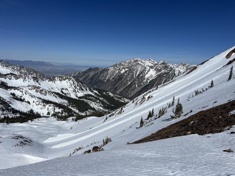
There were a few significant wet avalanches reported over this weekend:
- High Ivory in Cardiff Fork - a glide avalanche over 3 feet deep and several hundred feet wide, running on rock slabs (photo below)
- Long John Silver in White Pine - a long-running wet loose avalanche (photo by Logan Cookler)
- Control work at resorts using explosives triggered large wet slab avalanches that ran on facets above crusts that formed over the holidays (the CERC layer).
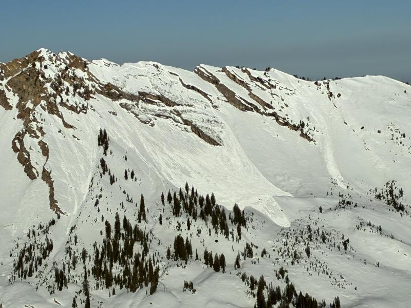
Glide avalanche on High Ivory (photo Andrew Hamlin)