Forecast for the Salt Lake Area Mountains

Issued by Trent Meisenheimer on
Sunday morning, March 2, 2025
Sunday morning, March 2, 2025
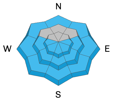
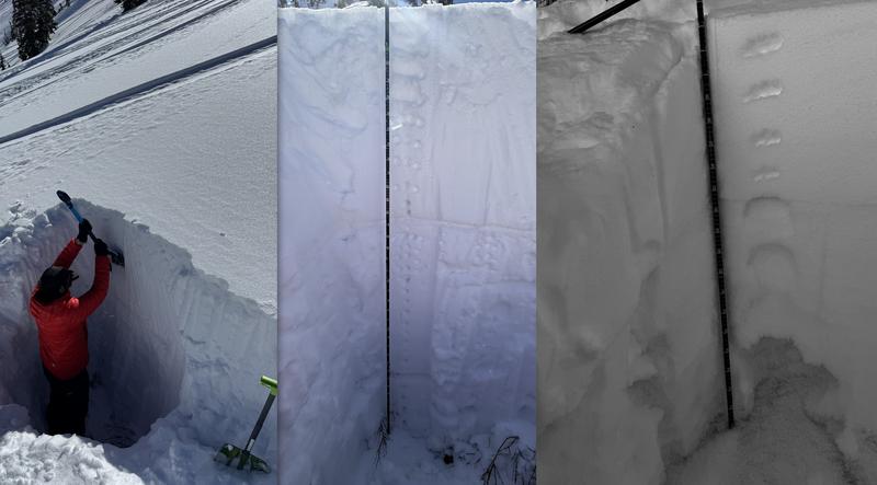
The avalanche danger is MODERATE on all aspects and elevations. On mid and upper-elevation slopes facing northwest through east - including some upper-elevation slopes facing west and southeast - it remains possible to trigger an avalanche 2-4 feet deep failing on a persistent weak layer.
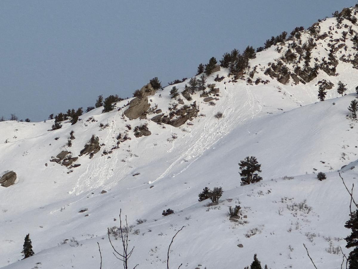
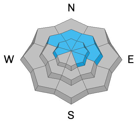
With daytime heating, we could see wet snow on aspects facing east, south, and west - including low-elevation northerly slopes. Watch for glide avalanches in Broads Fork, Mill B South, and Stairs Gulch of Big Cottonwood Canyon.

Low
Moderate
Considerable
High
Extreme
Learn how to read the forecast here