Observation Date
2/28/2025
Observer Name
Kelly
Region
Salt Lake » Cottonwood Canyons
Location Name or Route
Michigan City-Silver Fork- Willow Knob
Comments
I went looking for the worst just below treeline northerly facing snow I could find today, and did I ever find it. This was a 3' deep snowpit and the bottom 2' was made up of developed dry facets. The snow closest to the ground (photo 2) shows advanced depth hoar. My guess is this was a repeater slope and that is why it was such a thin snowpack. This is one of the bulls eye slopes for triggered a persistent weak layer avalanche failing near the ground once we get more snow and wind.
I have spent some time in Southwest Colorado and Montana, both places that can harbor weak faceted snow (persistent weak layers) till late in the season and this year in the Wasatch we are looking more like one of these locations. Based on this snowpit I would say we are not done dealing with the persistent weak layer quite yet. We are moving into the low end of Moderate and the high end of Low danger for most of the region, but Low Danger with a buried PWL is still something that gets my attention and makes me second guess my slope angles and terrain choices.
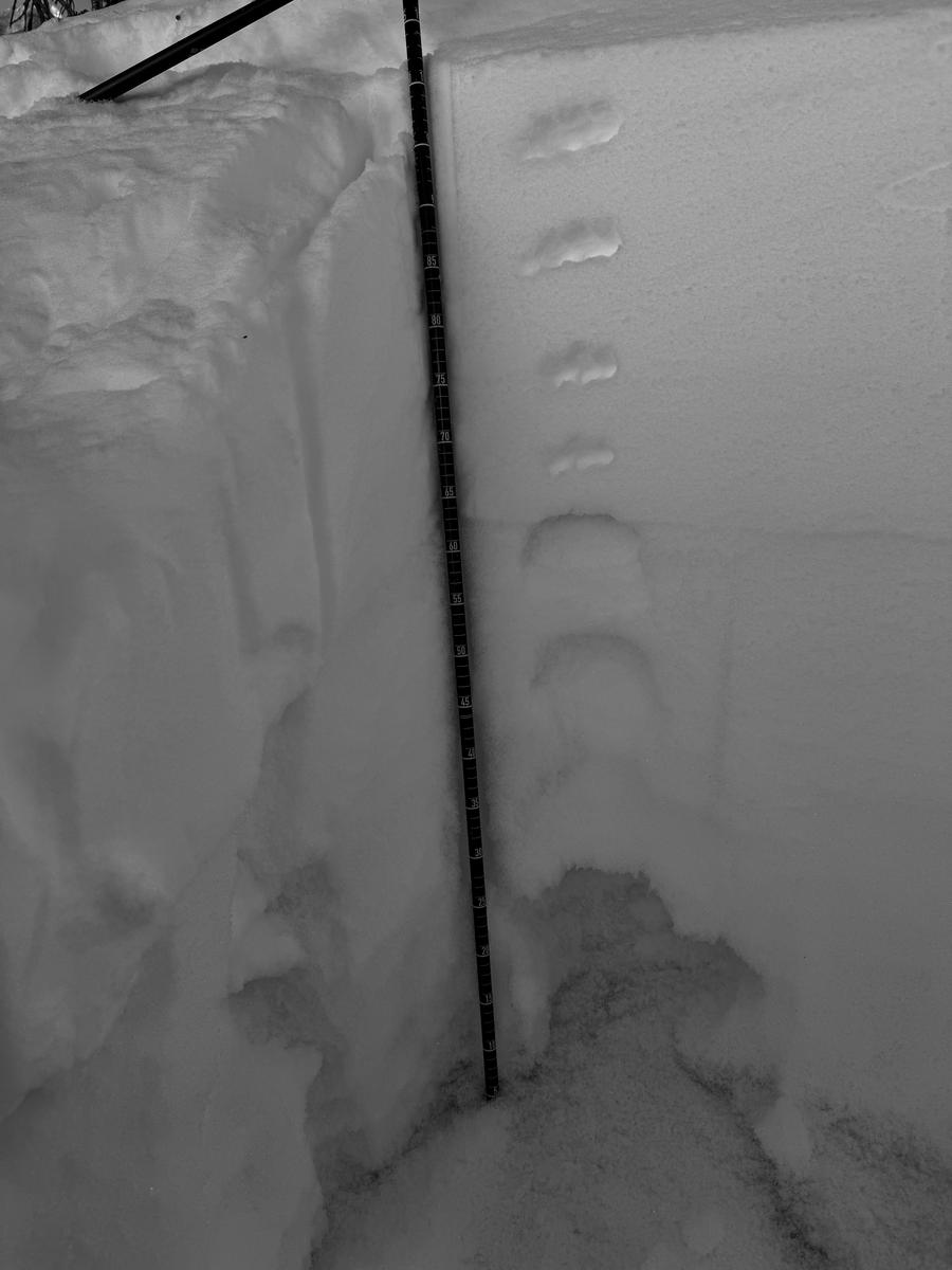
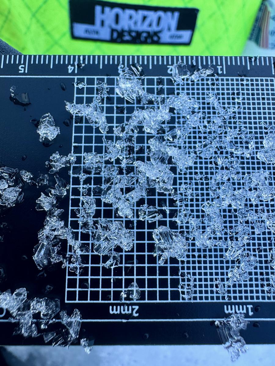
Large grained 4-6mm depth hoar near the ground.
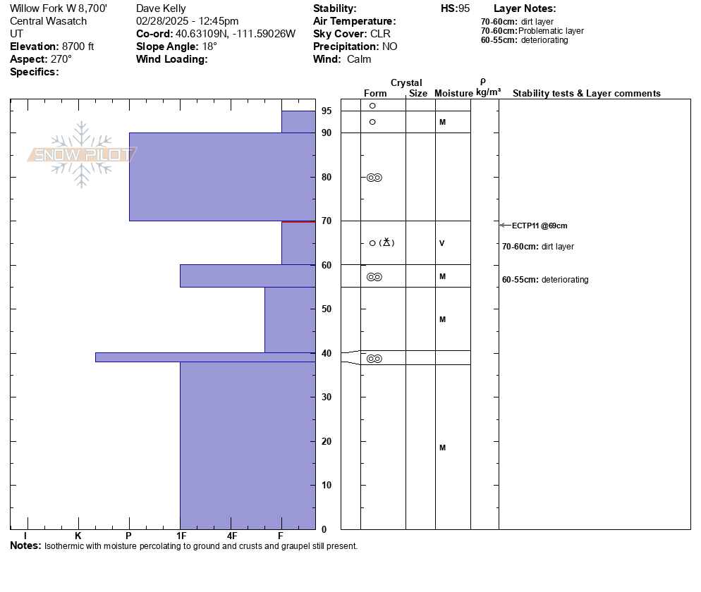
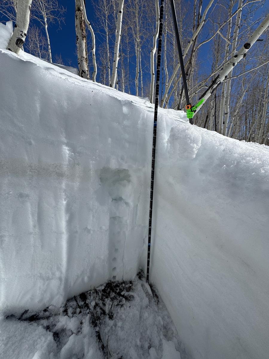
I was also looking for west facing slopes at mid elevation and at 8,700' in Willow Fork I found 3' of snow that was moist and saturated. When I traveled on this slope it was supportable, while at 8,200' in elevation I was sinking to the ground when I stepped out of my skis. The graupel layer in this snowpit was still intact (dirty graupel layer) but showing signs of rounding and was very saturated (more so than the other layers), it felt like wringing a sponge out. I was able to get propagation with an extended column test on this layer, but think that in order to find a wet slab avalanche you would need steeper terrain and perhaps a smaller isolated slope, such as a gully feature. On steeper south and west facing slopes with rock underneath you could hear water running.
Today, where I traveled the avalanche danger was on low end of MODERATE and working the terrain, sun angle, temperatures how I chose to travel. There are places in the forecast region where it is LOW danger, but those areas are variable and not everywhere. It doesn't feel like a green light LOW danger style of snowpack right now.
Today's Observed Danger Rating
Moderate
Tomorrows Estimated Danger Rating
None
Coordinates


