Forecast for the Salt Lake Area Mountains

Issued by Nikki Champion on
Sunday morning, March 14, 2021
Sunday morning, March 14, 2021
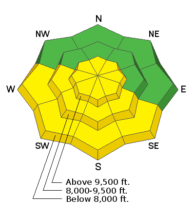
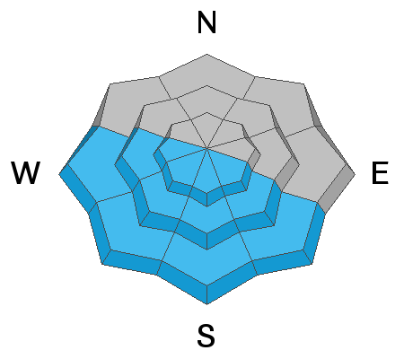
As the strong March sun heats the cold snow surface, the avalanche danger will quickly rise to MODERATE on all steep southerly aspects. Pay attention to changing conditions - rollerballs are the first sign that the snow is becoming unstable.
Areas of MODERATE danger exist also at all upper elevations for triggering a fresh slab of wind drifted snow. These wind slabs will be generally shallow and isolated to terrain features that allow for drifting snow to accumulate. In cold wind-sheltered zones, the new snow could still lead to shallow soft slab avalanches or minor sluffing on the steepest slopes today.
Remember that even a small avalanche can be problematic in very steep and complicated terrain. Think about the terrain you are traveling above today.

Low
Moderate
Considerable
High
Extreme
Learn how to read the forecast here


