We are filled with grief to report four avalanche fatalities yesterday in the Wilson Glade of upper Mill Creek Canyon. The avalanche involved two separate parties. Our deepest condolences go out to the friends and families involved. Our deepest gratitude to the many members of SL County SAR, Wasatch Backcountry Rescue, and Utah Dept of Public Safety. The avalanche path is on north facing terrain at 9800'. The avalanche is estimated to be 2-3' deep and at least 250' wide. Our
preliminary report will be continually updated over the next several days.
PLEASE AVOID THIS TERRAIN TODAY AND MONDAY TO ENSURE A SAFE ENVIRONMENT FOR THE CONTINUING OPERATIONS.
photo courtesy of Wasatch Backcountry Rescue
This avalanche brings us to six avalanche fatalities in Utah for the 2020/2021 winter.
Since February 1, there have been thirteen avalanche fatalities in the US. Yesterday's four fatalities marks the largest avalanche accident in Utah since the February 1992 tragedy that killed four in the La Sal mountain range east of Moab.
Skies are clear.
Mountain temperatures are in the low to mid 20s.
West to northwest winds remain unabated and continue with hourly averages of 25-30mph with gusts to 45. The highest elevations have been gusting into the 80s and 90s.
We'll have sunny skies, continued moderate to strong west northwest winds and mountain temperatures warming to the mid-20s up high, the mid-30s down low.
A high amplitude ridge of high pressure to the west will keep us under a cool and breezy northwest flow through Tuesday when a weak system undercuts the ridge and ripples through from the west. Some of the weather models hint at another series of storms arriving late in the week and beyond.
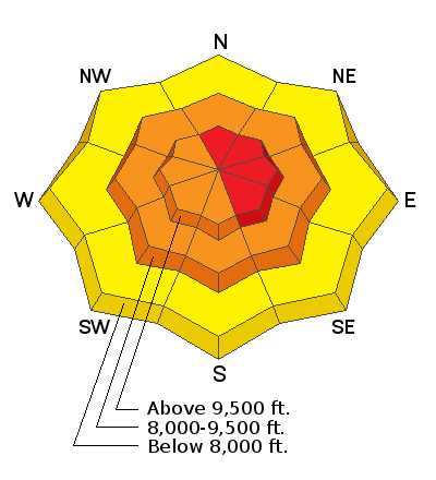
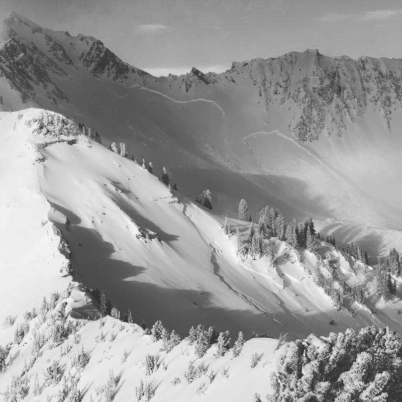
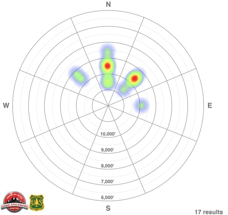
Friday/Friday night's storm led to an extensive and widespread natural avalanche cycle in the Salt Lake and Provo area mountains. (1st photo - large natural avalanche in Cardiac Bowl of Cardiff Fork) Many large natural and destructive avalanches ran naturally with many avalanches reportedly breaking 5-7' deep with some propagating over 1000' wide. Some of these snapped trees and include downed timber in debris piles. Most of the avalanches were 2-3' deep and 250' wide. Most of these avalanches ran on steep northwest to east facing slopes above about 9000' (see heatmap below).
pc: Mountain Guide and avalanche educator Colby Stetson
The Wilson Glade fatalities were not the only avalanche involvements yesterday.
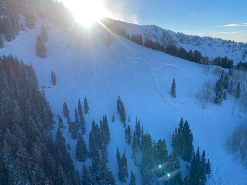
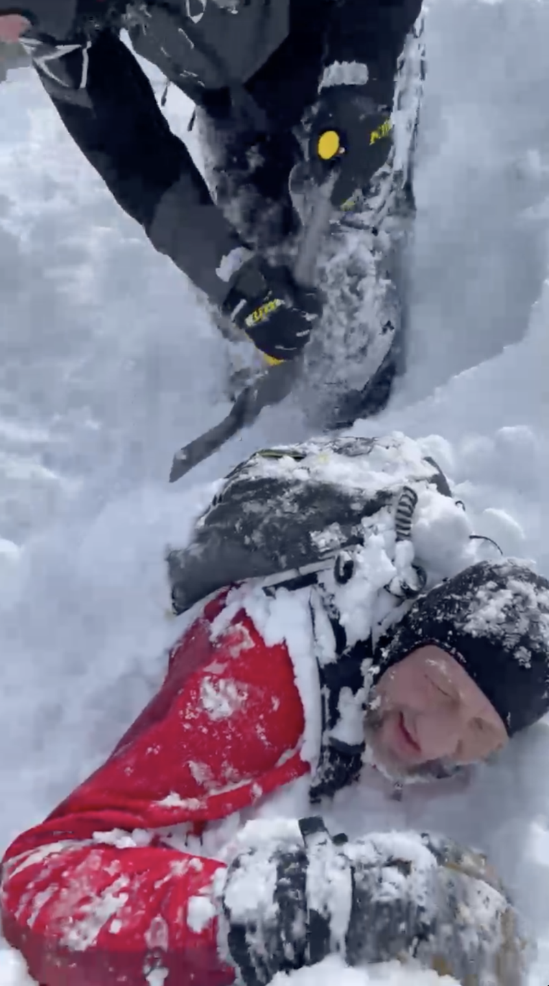
- In upper Mary Ellen drainage of upper American Fork, a snowmobiler was caught, carried, and almost fully buried (photo below) in a large avalanche on a steep east-northeast facing slope at 10,000'.
- In the upper Lackawaxen area off the backside of Clayton Peak in the Brighton periphery, a skier was caught and carried in an avalanche, temporarily losing gear but was ok.
In the Uintas near Moffit Peak yesterday, snowmobilers experienced a very close call with a very large avalanche. Terrifying video
HERE, courtesy of backcountry_sledders.