Donate to the 2024 Spring Campaign to help rebuild the UAC website.

Forecast for the Salt Lake Area Mountains

Drew Hardesty
Issued by Drew Hardesty for
Thursday, February 7, 2019
Areas of CONSIDERABLE danger exist on many slopes in the mid and upper elevations with a MODERATE danger down low. Some avalanches may be triggered at a distance or from below. Avoid being on or beneath the heavily corniced ridgelines.
Low
Moderate
Considerable
High
Extreme
Learn how to read the forecast here
Special Announcements
An AVALANCHE WARNING continues for the Western Uintas and the Manti-Skyline Plateau. If you're headed that way or know someone who is, please spread the word and have them check in with that area's forecast.

Backcountry Closures are in place today in Little Cottonwood:
All terrain north of Little Cottonwood Creek from Gate B to Grizzly Gulch. Extends 100 feet over Twin Lakes Pass, and 1000 meters into Big Cottonwood. Estimated opening: 8am
Coalpit #1, 2, 3, and 4 and Perla's Ridge along with the terrain above and on the Great White Icicle from the road to the ridgeline. Estimated opening: 4pm
Weather and Snow
Along a cool west-northwest flow, most areas picked up another 2-3" of 4% cold smoke overnight, pushing storm totals since Saturday night to 60"/5.75" in LCC, 70"/6.8" in BCC, and 45"/4.5" along the south end of the PC ridgeline. West-northwest winds are generally 15mph with gusts to 25. The highest, most exposed anemometers are averaging 35-40mph with gusts near 60. Temps are in the low single digits on either side of zero.
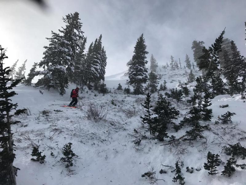
Snow depths are 120-130" in the upper Cottonwoods and 70-80" along the PC ridge. Skiing and riding conditions are out of this world. People lives are changed by conditions like these.

Overcast skies and light flurries should fade away by the afternoon toward partial clearing. Mountain temps will be in the single digits up high, the low teens at other elevations. Winds will be west-northwesterly blowing 15mph. I do have some concern that the winds will remain gusty along the highest peaks and ridgelines through early afternoon.

A weak system should produce another 2-4" Saturday/Saturday night with another storm Sunday night into early Tuesday. Perhaps another 5-10"? Another possibly going south for Valentine's Day...and perhaps another after that?...Stay tuned -
Recent Avalanches
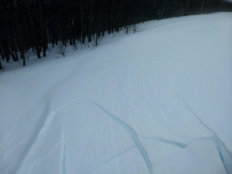
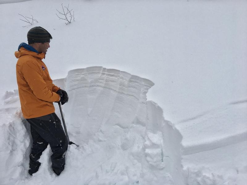
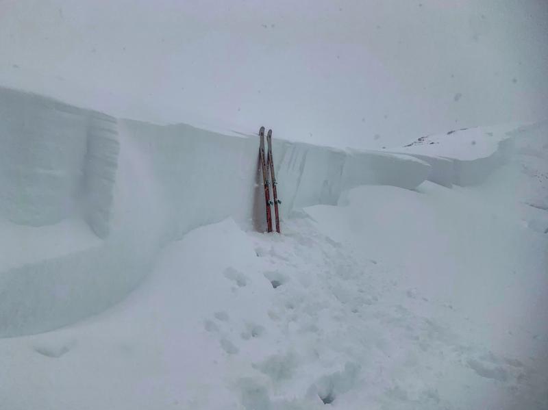
A natural avalanche cycle occurred yesterday morning in upper Little Cottonwood and by the afternoon, tons of debris washed over the road with full avalanche control work. Ski areas control teams triggered numerous small and medium size avalanches with the largest noted along the southern end of the PC ridgeline on a northeast facing slope at 9700'. This avalanche looked to be 3-6' deep, stepping to the ground in some places.
Ad
Avalanche Problem #1
Wind Drifted Snow
Type
Location
Likelihood
Size
Description
Yesterday's winds found their way into the mid-elevations with observers noting shooting cracks on steep rollovers. With continued moderate west to northwest winds at the mid-elevations and strong gusts up high, wind slabs will continue to be cause for concern. They'll be more prominent on steep north to east to south facing slopes up high and crossloaded into gullies and to the lee of other terrain features. Cracking like below are signs to choose alternate terrain. Noted the scalloping and rounded nature of the wind drifts in the pic. (pc:Stefankowski)
Avalanche Problem #2
Persistent Weak Layer
Type
Location
Likelihood
Size
Description
There are two persistent weak layers of concern.
  1. Weak surface snow and patches of surface hoar buried Saturday night. This layering has likely been the culprit in at least four avalanches from Murdock Peak east to 10,420' along upper Mill Creek to BCC. These have been 1-3' deep on wind drifted north to northeast facing slopes with elevations from 8800' to 10,200'. Some of these have run naturally, some of been triggered at a distance. Cracking/collapsing are key indicators here; snow pit tests should also be reliable indicators for intended terrain - look for the 'thin grey line' a couple feet down in the snowpack (pic below). Caution should be observed as these may be triggered on approach or from below.
2. Enough snow and wind have tipped the balance in some areas to produce avalanches down near the ground 3-6' deep. These will be much more prominent in terrain that has avalanched previously this winter and may require more of a significant trigger to snap the rubber band. The large slides along the Park City ridgeline on Tuesday, and the Little Water Peak slide on Monday (observation) highlight this problem. These slides were triggered from cornice falls and were on steep, wind-loaded slopes facing northeast. Tuesday's natural from South Monitor highlights how large these avalanches can be. (pc: Mark White). In contrast to the more shallowly buried weak layers, cracking and collapsing are unlikely to be present and snow tests may be highly variable. These are lower-probability high consequence.

It's a touch outdated, but looking at the Avalanche Problem Toolbox will also provide good details and travel advice on these two types of avalanches (previously Persistent Slab and Deep Slab) .
Avalanche Problem #3
New Snow
Type
Location
Likelihood
Size
Description
Lower density cold smoke will sluff with provocation and perhaps naturally on the steepest terrain of all aspects. While more predictable in nature, loose snow avalanches can pack quite the punch and entrain lots of snow in steep, sustained and enclosed terrain (couloirs and gullies). Ski cuts are effective but it's key to continue from area of safety to area of safety, moving across the slope. Snowshoers should not attempt this technique.
Additional Information
Mark Staples has a nice piece on the importance of quick snow pits in Backcountry magazine. INFO.
The Wisdom of the Crowds applies directly to you and other backcountry skiers and riders, from the novice to the expert.
General Announcements
This information does not apply to developed ski areas or highways where avalanche control is normally done. This forecast is from the U.S.D.A. Forest Service, which is solely responsible for its content. This forecast describes general avalanche conditions and local variations always occur.