Forecast for the Salt Lake Area Mountains

Dave Kelly
Issued by Dave Kelly for
Tuesday, February 28, 2023
The avalanche danger is HIGH on upper-elevation slopes for new and wind-drifted snow avalanches. Humans are very likely to trigger an avalanche that could be 1-3' deep and up to 200' wide. The avalanche danger is CONSIDERABLE in mid and lower elevation terrain where human triggered avalanches are likely.
Today is a day to avoid traveling on or underneath avalanche terrain. There are low-angle slopes where you are sure to find surfy graupel turns and those are the places I would be seeking out today.
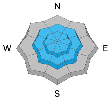
Low
Moderate
Considerable
High
Extreme
Learn how to read the forecast here
Weather and Snow
Under obscured skies it is currently snowing in the mountains. Trailhead temperatures are in the teens °F while ridgetop temperatures are in the single digits ˚F. Winds are just now shifting from the southwest to the northwest and are currently blowing 20 gusting to the 30's MPH at the 9,000' ridgelines and 40 gusting to the 70's MPH at the 11,000' ridgelines.

There are some density changes from changing snow and precipitation rates during the storm that at times brought up to 3" snow/.20" water an hour which is one of the red flags for avalanche activity.

Today, we can expect 2-4" of new snow, and westerly winds decreasing this afternoon 25 gusting to 35 MPH at the 9,000' ridgelines and 45 gusting to 70 MPH at the 11,000' ridgelines. Temperatures will be 16-20 ˚F.

Storm Totals (Inches of Snow/Water)
  • Park City Ridgeline 15-22" snow/ .95-1.05" water
  • Upper Cottonwoods 16-35" snow/ 1-2.5" water
  • Provo Area Mountains 23-32" snow/ 2-2.95" water (updated storm snow/water 11:00)
  • Ogden Area Mountains 20-28" snow/ 2-2.45" water

A series of storms continues to affect Northern Utah. The National Weather Service has issued a Winter Storm Warning effective until 5:00 pm on Wednesday. These storms will bring 30-40" of new snow and up to 3" of water to the mountains.
Recent Avalanches
Over the last few days people have been out and about checking out current conditions to see how things were looking before this storm hit. Check out the updated observation and avalanche page for more information.
Ad
Avalanche Problem #1
New Snow
Type
Location
Likelihood
Size
Description
We had a lot of new snow and water weight overnight. Give this new snow some time to settle and seek soft turns on slopes less than 30 degrees.

I would expect to see soft slab avalanches within the new snow. Anywhere there has been any wind will increase the avalanche hazard. There was a softer layer of snow from last week's old/new snow interface now buried 2-3' down. Mark went to White Pine yesterday and describes in this video how he assesses weak layers.
Avalanche Problem #2
Wind Drifted Snow
Type
Location
Likelihood
Size
Description
Higher elevations with more wind= more avalanche danger. A run of southwest winds has loaded north-east slopes with thick drifts of snow. These areas of wind-drifted snow will be sensitive and I would not be surprised to hear of natural activity in steep high elevation terrain.
Additional Information
The lowest elevation band has some tricky conditions as we've seen avalanches in the foothills as low as 6,200'. There is more than enough snow in the lower elevation foothills that there is good riding to be had close to home. These three avalanches stand out in that they all occurred in low elevation easy to access terrain that you can see from highways and neighborhoods. Check out Craig's video discussing a low elevation avalanche in Browns Canyon HERE, Drew's video discussing an avalanche in the Salt Lake Foothills HERE, and JB's report from the Ogden Foothills HERE. These are the types of slides that can impact people with little knowledge of avalanche terrain. Please share this information with your friends who may not regularly read the avalanche report.
General Announcements
This information does not apply to developed ski areas or highways where avalanche control is normally done. This forecast is from the U.S.D.A. Forest Service, which is solely responsible for its content. This forecast describes general avalanche conditions and local variations always occur.