Forecast for the Salt Lake Area Mountains

Nikki Champion
Issued by Nikki Champion for
Tuesday, February 14, 2023
The avalanche danger is generally LOW, but areas of MODERATE avalanche danger exist at all upper elevations where sensitive slabs of wind-drifted snow will continue to form throughout the day.
These wind slabs will be generally shallow and small in size. How dangerous they are will be determined by the type of terrain you're in, and above today.
Low
Moderate
Considerable
High
Extreme
Learn how to read the forecast here
Weather and Snow
This morning, under overcast skies, it is lightly snowing in the mountains, Accumulation as of 5 AM is between 2-5", favoring upper Little Cottonwood. Mountain temperatures range from the single digits to the low teens °F. Winds have picked up significantly overnight, and are blowing from the west-northwest at speeds of 20-30 mph with gusts between 40-60 mph at mid-elevations, and the upper elevation winds are gusting up to 80 mph.
Today, we can expect continued light snowfall, cold temperatures, and elevated winds. Temperatures will climb into the low to mid-teens °F. At mid-elevations winds will continue to blow from the west-northwest at speeds of 15-25 mph, with gusts up to 45 mph. At upper elevations, the winds will blow 35-45 mph with gusts up to 65 mph. We could see another 2-4" of new snow by 5 PM.
Overnight, winds will switch to the northeast and moisture should begin to shut off during the early morning hours Wednesday. Final snow totals should be around 4-8".

The wind and sun have taken their toll on the snow surface. On southerlies, you will likely find a sun crust under a few inches of fresh snow. On the Northerlies, you can expect a stiff wind board on many upper-elevation slopes. The good news is that soft settled powder still existed in the sheltered terrain before this storm.
Recent Avalanches
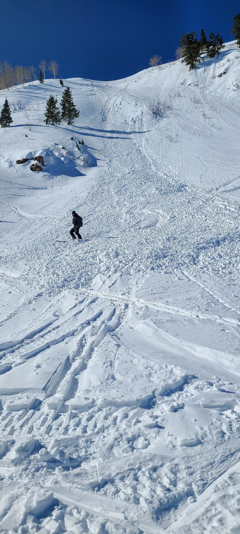
Yesterday, one wet-loose avalanche was reported from the Ant Knolls area of the Wasatch Back. This occurred on an east aspect near 9500'. This avalanche failed 4" deep, and approx 20' wide.
Small wet-loose from Ant Knolls, good reminder that even a small avalanche is enough to knock you off your feet. (K. Waller)
Find all the recent observations HERE.
Ad
Avalanche Problem #1
Wind Drifted Snow
Type
Location
Likelihood
Size
Description
The huge bump in overnight winds plus a few inches of new snow may have formed shallow soft slabs of wind-drifted snow at upper elevations. You may find a few of these wind slabs at mid elevations where they likely bonded well to the warm and wet snow surface. With the winds slated to remain elevated, these shallow soft slabs will only continue to grow throughout the day. Look for slopes with any signs of wind-drifted snow, such as cracking, hollow noises, and pillow-shaped snow, and avoid those slopes.
If you're headed to high peaks and more extreme terrain today, these wind slabs may be small, but they can be a major threat because they can knock you off your feet and cause a fall. ​​​
Additional Information
Just wanted to share a fun brain nugget to discuss on the drive or skin track. Did you know that when the avalanche danger rating is at EXTREME that at that danger level, it only accounts for 1% of avalanche fatalities and that the LOW danger rating accounts for 7% of avalanche fatalities? Why do you think this is the case?
General Announcements
This information does not apply to developed ski areas or highways where avalanche control is normally done. This forecast is from the U.S.D.A. Forest Service, which is solely responsible for its content. This forecast describes general avalanche conditions and local variations always occur.