Join us at our 2nd Annual Blizzard Ball

Forecast for the Salt Lake Area Mountains

Nikki Champion
Issued by Nikki Champion on
Tuesday morning, February 11, 2020
Today, a MODERATE avalanche danger exists on upper elevation slopes with wind drifted snow. Human triggered avalanches remain possible in steep terrain.
Cornices along the ridgelines should also be approached with great caution.
A LOW avalanche danger exists at mid and low elevations, where generally safe avalanche conditions exist.

Remember a primarily low avalanche danger, doesn’t mean “no avalanche danger”. Continue to evaluate snow and terrain carefully.
Low
Moderate
Considerable
High
Extreme
Learn how to read the forecast here
Special Announcements
Discounted lift tickets - Thanks to the generous support of our Utah ski resorts and Ski Utah, all proceeds from these ticket sales go towards paying for avalanche forecasting and education! Get your tickets here.
Looking to improve your avalanche skills? We are offering a Backcountry 101: Introduction to Avalanches class at Powder Mountain February 14-15.

Forecaster Trent Meisenheimer will be giving a talk on the "State of The Wasatch Snowpack" at the Black Diamond Retail Store in Millcreek - Feburary 13th, from 7:00-8:30 pm.
Weather and Snow
Yesterday afternoon, the mountains got up to 2 inches of snow.
This morning, mountain temperatures are in the single digits at trailheads and hovering near zero F at the ridgelines. Skies are currently clear and winds are light and Northerly, averaging 5- 10 mph with gusts up to 25 mph at the uppermost ridgetops.
Today, skies will be mostly sunny with some high clouds moving through the area in the afternoon. Temperatures should begin to increase this morning, reaching temperatures in the mid to upper 20s F by the afternoon. Winds will continue to be Northerly, averaging 5 - 10 mph with a few gusts up to 35 mph at the upper-most elevations, near 11,000 feet.

The backcountry currently hosts a variety of supportable crusts, making travel and riding fast and efficient. This morning Southerly aspects will have a new solar crust after a few hours of sun yesterday.

Recent Avalanches
No new recent avalanches reported in the backcountry.
In resorts, only reports of explosive triggered avalanches on upper elevation terrain, above 10,500, which had experienced significant avalanching during the last storm, and produced minimal results yesterday.

We are starting to see more evidence of last week's avalanche cycle, extending from Provo north to the Bountiful Sessions mountains. These appear to be running on last weekend's snow surfaces or within the storm snow and hundreds of feet wide at the mid and upper elevations of all aspects. A full avalanche cycle report will come out later this week, stay tuned.
Ad
Avalanche Problem #1
Wind Drifted Snow
Type
Location
Likelihood
Size
Description
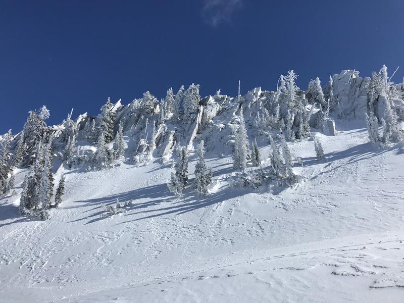
Shallow slabs of wind drifted snow may be found at the upper elevations and will be most widespread near and on ridgelines. Isolated areas of wind drifted snow could also exist on the upper end of mid-elevation ridgetops, such as Reynolds Peak. With gusts up to 35 mph today, the wind will continue drifting the remaining snow that is still available for transport.
Today continue to look for slopes with any signs of wind drifted snow, such as cracking, hollow noises, and pillow-shaped snow and avoiding those slopes.
You can see signs of wind drifted snow in the photo below from Maybird Gulch. (Photo. Graves)

Cornices: Additionally, this past weekend storm added heft to the existing cornices, and I noticed some very large ones when traveling on the Park City Ridgeline yesterday. As the temperatures begin to climb, remember that these cornices often break much further back than expected, so give them a wide berth whenever traveling near ridgelines.
Additional Information
Over the next few days keep an eye on this structure, and watch for the development of weak faceted snow beneath the crust which could pose a problem for our snowpack in the future.
Areas of the Ogden mountains suffered more greatly with the rime/freezing rain crust. Travel conditions are greatly diminished, particularly on the east side of the Eden valley. Avalanche conditions are currently LOW there, they may prove to be interesting up there in the coming weeks.
General Announcements
This information does not apply to developed ski areas or highways where avalanche control is normally done. This forecast is from the U.S.D.A. Forest Service, which is solely responsible for its content. This forecast describes general avalanche conditions and local variations always occur.