Join us at our 2nd Annual Blizzard Ball

Forecast for the Salt Lake Area Mountains

Drew Hardesty
Issued by Drew Hardesty on
Monday morning, February 10, 2020
We are trending toward LOW danger but we are not there yet. Areas of MODERATE danger still exist on many slopes at the mid and upper elevations. Human triggered avalanches remain possible.
Continue to evaluate snow and terrain carefully.
Low
Moderate
Considerable
High
Extreme
Learn how to read the forecast here
Special Announcements
Discounted lift tickets - Thanks to the generous support of our Utah ski resorts and Ski Utah, all proceeds from these ticket sales go towards paying for avalanche forecasting and education! Get your tickets here.
Looking to improve your avalanche skills? We are offering a Backcountry 101: Introduction to Avalanches class at Powder Mountain February 14-15.

Forecaster Trent Meisenheimer will be giving a talk on the "State of The Wasatch Snowpack" at the Black Diamond Retail Store in Millcreek - Feburary 13th, from 7:00-8:30 pm.
Weather and Snow
Skies are clear.
Winds increased around midnight and are blowing 10-15mph from the west northwest. The highest anemometers are spinning 30mph with gusts to 35.
Mountain temps are in the single digits up high and at the trailheads and in the mountain basins. Spruces in mid-BCC is a lonely 1°F.
For today, we'll see something of a dry cold front, ushering in cooler temps and some cloud cover but that's about it. The next storm arrives on Valentine's Day but it hints at falling apart; we'll see.

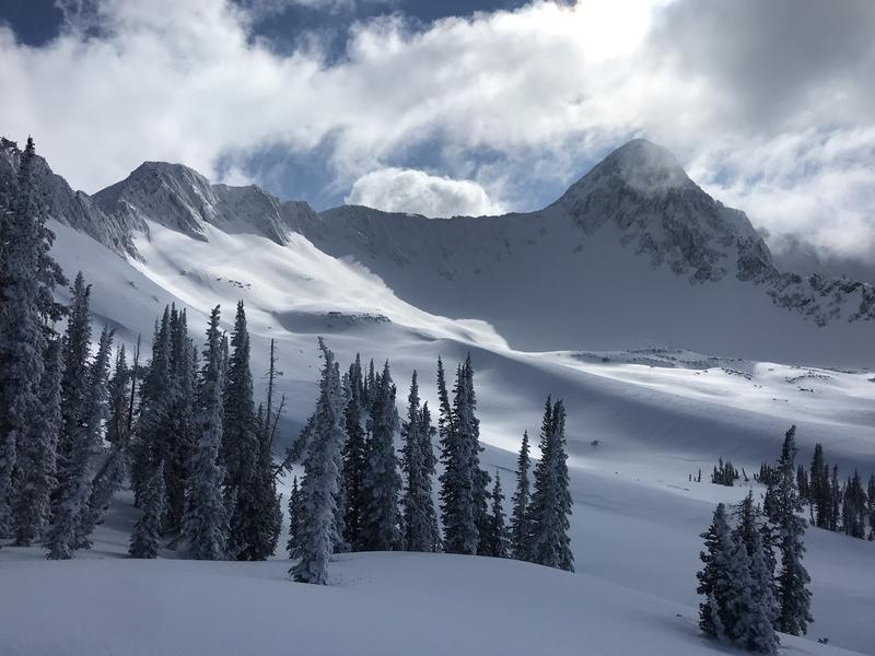
Skiing and riding conditions are good with fast and easy travel in the backcountry, although some southerly aspects will be crusted this morning. Yesterday it was nice to have some blue in the sky with - as observer Quinn Graves described it - everything "candy coated" in rime - the peaks, the trees, etc.
Graves, Torrey, others finding beauty in upper Maybird of LCC
Recent Avalanches
We are starting to see more evidence of last week's avalanche cycle, extending from Provo north to the Bountiful Sessions mountains. These appear to be running on last weekend's snow surfaces or within the storm snow and hundreds of feet wide at the mid and upper elevations of all aspects. I'll start to put a photo gallery together today.
We only heard about one human triggered avalanche yesterday. This 4-6' deep and 300' wide hard slab released at a distance from an airblast (explosive suspended above the snow, usually on a piece of bamboo). This was on a steep, but unsupported southeast facing slope at Snowbird at 10,600'. (photo below).
Other avalanche teams reported plenty of explosive testing - even in rarely skiied terrain - with no results.
Ad
Avalanche Problem #1
New Snow
Type
Location
Likelihood
Size
Description
Avalanches may still be triggered on all aspects and elevations generally 1-3' deep. It may take a more significant trigger (cornice fall, skier or snowmobile launching off a jump, etc), but avalanches may still run at last weekend's interface or within the storm snow. Note that these avalanches may be more pronounced along the Park City ridgeline and along the periphery of the Cottonwoods and/or at the mid elevations. John Mletschnig and an avalanche class found recent avalanches from the cycle in semi-unusual locations in lower East Silver Fork and near the Spire in White Pine of LCC. Find them in the Observations tab above.
TREND: Decreasing danger
Avalanche Problem #2
Wind Drifted Snow
Type
Location
Likelihood
Size
Description
Old...and perhaps developing shallow wind drifts may be found off the ridgelines at the mid and upper elevations. More wind transported snow may be expected with gusty winds associated with the passing of the weak weather system today. The winds are expected to veer to the northeast by the afternoon...with east canyons winds possible in the overnight hours.
Additional Information
Areas of the Ogden mountains suffered more greatly with the rime/freezing rain crust. Travel conditions are greatly diminished, particularly on the east side of the Eden valley. Avalanche conditions may prove to be interesting up there in the coming weeks.
General Announcements
This information does not apply to developed ski areas or highways where avalanche control is normally done. This forecast is from the U.S.D.A. Forest Service, which is solely responsible for its content. This forecast describes general avalanche conditions and local variations always occur.