Join us at our 2nd Annual Blizzard Ball

Forecast for the Salt Lake Area Mountains

Nikki Champion
Issued by Nikki Champion on
Wednesday morning, December 27, 2023
Overall, the avalanche danger is generally LOW, and normal caution exists. You may encounter isolated pockets of fresh wind-drifted snow in exposed terrain at the upper elevations. In the more wind-protected terrain, you may be able to trigger shallow loose sluffs that will be enough to catch and carry a skier or rider down the slope.
Continue to maintain safe travel habits; this means exposing one person at a time to avalanche terrain, having someone watch them from a safe location, and not traveling above or below other parties.
Low
Moderate
Considerable
High
Extreme
Learn how to read the forecast here
Special Announcements
To fulfill our mission, the UAC relies on our amazing backcountry community. Your support helps pay for the daily avalanche forecast, free awareness presentations across the state, and new tools like the new Avalanche and Observation Explorer. As the end of the year approaches, please consider donating to the UAC.
Weather and Snow
This morning, under partly cloudy skies, there is an inversion in the mountains. Temperatures are in the upper 20s F along ridgelines and in the single digits at trailheads. Winds are primarily from the west-northwest, gusting in the teens along mid-elevation ridges with gusts in the mid-20s along the highest peaks.
Today, skies remain partly cloudy, temperatures will rise into the upper 20s and low 30s F, and the northwesterly winds will remain generally light, gusting into the mid-20s mph along the highest peaks.
General Outlook: The weather models depict a few weak disturbances down the road that seem to lack much aim or direction. We’ll see. In the meantime, travel is easy, and skiing and riding conditions are pretty good in sun and wind-sheltered terrain without old tracks. As the surface continues to weaken, the riding will continue to improve a bit in protected areas. Read, loud pow. While this could be an issue down the line once we add an additional load to the now weak surface, we can enjoy some soft turns for now.
Recent Avalanches
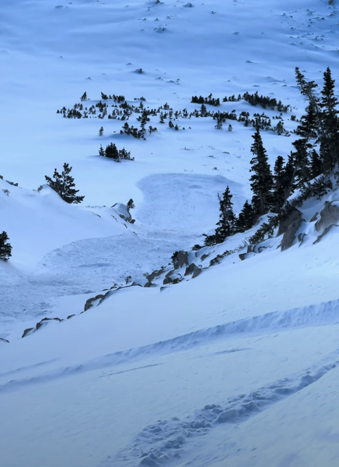
Skiers and riders continue to initiate slow but long-running sluffs of loose, dry snow in steep terrain. (pc: Z. Little).
Ad
Avalanche Problem #1
Normal Caution
Type
Location
Likelihood
Size
Description
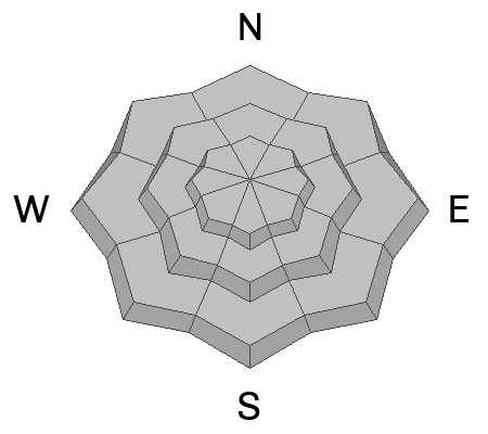
Overall, the avalanche danger is LOW, and normal caution exists. Although avalanches are unlikely, they are not impossible. In isolated areas, you may encounter:
  • Shallow, soft, and hard slabs of wind-drifted snow along the highest ridgelines and mid-elevation terrain features that allow for snow to drift. These slabs will be most prevalent on north, east, and southwest-facing slopes. With soft slabs, you’ll often see shooting cracks. They’re generally sensitive to provocation. Hard slabs are smooth and round and may not release until you’re well onto the lens of snow.
  • Long running, loose, dry avalanches, and sluffing out of the wind zone. The snow surface continues to weaken in many areas; as this happens, we will continue to see small sluffs in steep, wind-protected terrain. These avalanches will not be very big, but enough to knock riders off their feet and sweep them through consequential landscape.
  • A larger avalanche breaking down into faceted snow in steep, thin, rocky terrain on aspects facing northwest through east, and even southeast at the mid and upper elevations.

Remember that low danger is not the same as no danger.
Additional Information
What happened to the Persistent Weak Layer (PWL) problem? The PWL problem first appeared in the December 1 forecast and was removed from the forecast on Wednesday, December 20. On Thursday, December 21, forecasters Nikki Champion and Greg Gagne talked about the PWL problem over a Zoom call and their 5-minute discussion. Be sure to watch the video.
General Announcements
This information does not apply to developed ski areas or highways where avalanche control is normally done. This forecast is from the U.S.D.A. Forest Service, which is solely responsible for its content. This forecast describes general avalanche conditions and local variations always occur.