Join us at our 2nd Annual Blizzard Ball

Forecast for the Salt Lake Area Mountains

Drew Hardesty
Issued by Drew Hardesty on
Tuesday morning, December 26, 2023
Most terrain has a LOW avalanche danger.
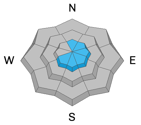
If you're looking for MODERATE danger, you'll find pockets of hard and soft slabs of wind drifted snow along the higher ridgelines. These slabs will be most prevalent on north to east to southwest facing slopes. In the more wind protected terrain, you'll be able to trigger shallow loose sluffs that will be enough to catch and carry a skier or rider down the slope.
Low
Moderate
Considerable
High
Extreme
Learn how to read the forecast here
Special Announcements
To fulfill our mission, the UAC relies on our amazing backcountry community. Your support helps pay for the daily avalanche forecast, free awareness presentations across the state, and new tools like the new Avalanche and Observation Explorer. As the end of the year approaches, please consider donating to the UAC.
Weather and Snow
Under the cold moon, skies are clear (ain't it a shame).
Mountain temperatures are in the teens and have bottomed out to near 0°F in the valleys and basins.
Winds remain from the northwest, blowing 15-20mph. The highest anemometers are spinning 30mph with gusts to 45.

Mid and high level clouds will accompany the weakest of warm fronts today. Winds will blow 20-25mph from the northwest. Mountain temperatures will be in the mid to upper 20s. I don't expect to see much -if any- precipitation, though a touch of rime wouldn't be out of the question.
The Outlook: Winds finally start to lose steam tonight with a warming trend on tap through the rest of the week. The weather models depict a few weak disturbances down the road that seem to lack much aim or direction. We'll see.
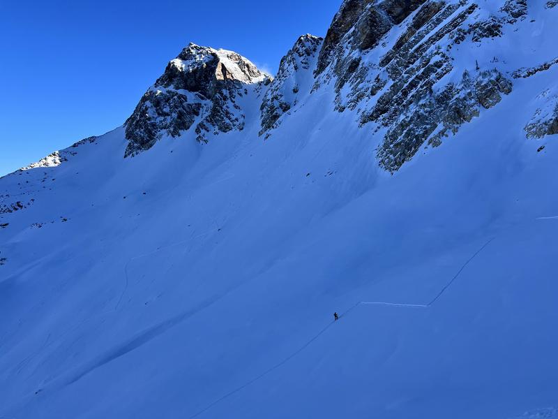
In the meantime, travel is easy, and skiing and riding conditions are quite good in sun and wind sheltered terrain. In 1976, Dave Hanscom and Alexis Kelner published the first edition of their guidebook Wasatch Tours. They describe something back then called a SuperTour.
pc: C. Jiricko

Recent Avalanches
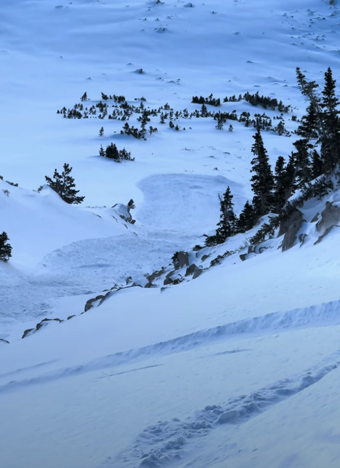
Backcountry travelers reported triggering shallow soft slabs of wind drifted snow, but noted that these were confined to the highest elevation starting zones. Out of the wind, skiers were able to initiate slow but long running sluffs of loose dry snow in steep terrain. (pc: Z. Little). Avalanche control work along the south end of the Park City ridgeline resulted in a 12" deep and 35' wide soft slab that failed on weak faceted snow.
Ad
Avalanche Problem #1
Wind Drifted Snow
Type
Location
Likelihood
Size
Description
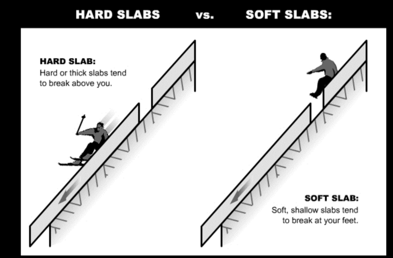
The relentless north to northwest winds continue to transport snow, primarily along the highest elevation ridgelines. Soft and hard slabs can be found to the lee of ridgelines and other terrain features and will range from sensitive to stubborn. With soft slabs, you'll often see shooting cracks. They're generally sensitive to provocation. Hard slabs are smooth and round and may not release until you're well onto the lens of snow.
Additional Information
What happened to the Persistent Weak Layer (PWL) problem? The PWL problem first appeared in the December 1 forecast and was removed from the forecast on Wednesday, December 20. On Thursday, December 21, forecasters Nikki Champion and Greg Gagne talked about the PWL problem over a Zoom call and their 5-minute discussion. Be sure to watch the video.
General Announcements
This information does not apply to developed ski areas or highways where avalanche control is normally done. This forecast is from the U.S.D.A. Forest Service, which is solely responsible for its content. This forecast describes general avalanche conditions and local variations always occur.