Check out our Holiday Auction - Sign Up for the Utah Snow and Avalanche Workshop (USAW)

Forecast for the Salt Lake Area Mountains

Nikki Champion
Issued by Nikki Champion on
Thursday morning, November 28, 2024
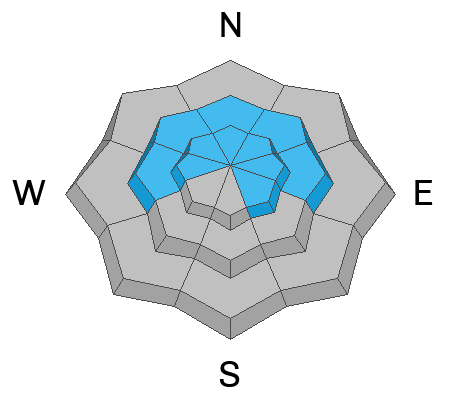
Avalanche danger is MODERATE on steep, westerly, northerly, and easterly aspects at mid-elevations and on all aspects at upper elevations, which have received the highest snow totals and strongest winds, in combination with weak, faceted snow near the ground.
Human-triggered avalanches 1–3 feet deep are possible today. Avalanches may fail within the wind-drifted snow or step down more deeply into the persistent weak layer. Be mindful of cracking and collapsing, as these are clear signs of instability.
Outside the wind zone, the new snow may still be reactive, with small avalanches capable of moving quickly and traveling farther than expected. Today, it’s very important to identify features of concern and evaluate both terrain and snow carefully. It's still early season with a shallow snowpack, and even a small avalanche may not bury you but could sweep you through consequential terrain.
Low
Moderate
Considerable
High
Extreme
Learn how to read the forecast here
Special Announcements
The 17th Annual Utah Snow and Avalanche Workshop (USAW) is scheduled for Saturday December 7th - Information and tickets available here.
Weather and Snow
This morning, skies are clear with a temperature inversion in place. Cold air has settled into the trailheads and valleys, leaving temperatures in the single digits down low and the low teens up high. Winds remain westerly but have decreased since yesterday. Overnight, gusts reached 40 mph along the highest ridgelines, while most other elevations saw winds averaging 10-15 mph.
Snowfall wrapped up mid-day yesterday, bringing final storm totals to:
  • LCC: 14-18.5" of snow (1.20-1.36" SWE)
  • BCC: 7.5-22" of snow (0.61-1.59" SWE)
  • Park City Ridgeline: 15-17" of snow (0.71-0.89" SWE)
This storm particularly favored upper Big Cottonwood Canyon, the Wasatch Back, and areas along the Park City Ridgeline.
Today will be a gorgeous Thanksgiving day in the mountains. Northern Utah will remain on the cooler, dry side of a strengthening ridge over the Western Great Basin, with terrain-driven winds sticking around. Expect clear, sunny skies and gradually decreasing winds throughout the day. High temperatures will reach the low to mid-20s °F. Northwest winds will persist, with gusts near 30-35 mph at higher elevations.
Looking ahead, the ridge will settle over the region Monday and remain through at least Wednesday or Thursday, keeping conditions dry and sunny. Temperatures will steadily warm, and inversions will strengthen, likely peaking midweek. There’s a slim 10-15% chance of a weak system grazing northern Utah late next week, but it doesn’t appear to bring much moisture. If it does, the main impact would be mixing out the inversions.
Recent Avalanches
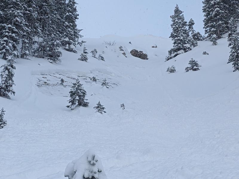
A skier-triggered soft slab avalanche occurred on a north-facing slope at 9,900' on Davenport Hill in Silver Fork, BCC. The 12" deep, 15' wide avalanche failed on a persistent weak layer of facets at the snow-rock interface. This slope had previously avalanched two weeks ago. See photo below.
Ski areas reported recent avalanche activity, including natural activity up to D2 during periods of heavy snowfall. Long-running avalanches were triggered by control work on soft wind slabs, with collapsing and cracking observed in unskied terrain.
Davenport Hill Avalanche - JC
You can find the most recent observations HERE.
Ad
Avalanche Problem #1
Wind Drifted Snow
Type
Location
Likelihood
Size
Description
With multiple days of elevated winds and fresh snow available for transport, expect sensitive slabs of wind-drifted snow on upper-elevation slopes and mid-elevation terrain features prone to drifting. These slabs will be most pronounced on leeward (easterly) slopes, but high winds can load any aspect due to swirling and shifting directions, a phenomenon known as cross-loading.
Look for signs of wind-drifted snow, such as pillow-shaped deposits, and avoid those slopes. Any avalanche that fails within the wind-drifted snow on the northern end of the compass has the potential to step down and fail within the old snowpack—a mix of weak, sugary facets and crusts.
The best riding conditions will be in sheltered, lower-angle terrain out of the wind.
Outside the wind zone, the new snow may still be reactive, with potential instabilities at the interface with the old snow surface or within storm or wind-blown layers. While these avalanches are likely to be small, they could move fast and travel farther than expected.
Avalanche Problem #2
Persistent Weak Layer
Type
Location
Likelihood
Size
Description
We currently have a snowpack structure primed for avalanches—a classic strong-over-weak setup. It’s a delicate balance, just waiting for enough new snow and wind to tip the scales. The key questions are whether the storm delivered enough load and if avalanches will be triggered.
At the moment, it seems the scales haven’t been tipped, though if they have and have gone unreported, it’s likely in areas that received the most snow and wind—such as upper Big Cottonwood, the Park City Ridgeline, and parts of the Wasatch Back that already had snow on the ground before this storm. That said, the soft snow is there and ready to be transported, and it doesn’t take much wind to continue building a slab, adding load, and getting closer to that tipping point. Keep an eye out for areas that received a bit more snow and wind, especially at higher elevations or favored spots. There’s potential to trigger 1–3' deep soft slab avalanches on slopes facing west to east at mid and upper elevations. Any avalanche initially triggered within the wind-drifted snow could step down into the weak faceted snow.
Listen for whumphs or collapses, test small slopes to gauge reactivity, and look for shooting cracks. Extended Column Tests can also provide valuable insights into snowpack stability. Proceed carefully, as this unstable setup isn’t going anywhere anytime soon.
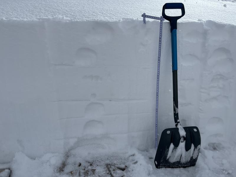
See UAC Employee Talty's photo below representing the strong over weak nature of our current snowpack structure. See full observation from Park City Ridgeline here.
General Announcements
This information does not apply to developed ski areas or highways where avalanche control is normally done. This forecast is from the U.S.D.A. Forest Service, which is solely responsible for its content. This forecast describes general avalanche conditions and local variations always occur.