Forecast for the Salt Lake Area Mountains

Nikki Champion
Issued by Nikki Champion on
Tuesday morning, November 18, 2025

Welcome to the start of the 2025–2026 winter season.

The Utah Avalanche Center is back in full swing, and the staff is ready for another season in the mountains. For now, we’re waiting on more snow. In the meantime, it’s a great opportunity to dig out your gear. Beacon, shovel, and probe remain the three essentials. Take a few minutes to put your pack together, check batteries, and get your skis, board, or machine tuned and ready to go.

There’s no shortage of avalanche information online, and early season is the perfect time to refresh your knowledge. A quick review can go a long way once the snow starts to stack up. You can find a ton of classes and events in the Menu tab above.

As you begin to get out and about, be sure to check the uphill travel policies at each resort. We’ll keep you posted as storms line up and the season starts to take shape.

We'll update this as conditions warrant.

Low
Moderate
Considerable
High
Extreme
Learn how to read the forecast here
Special Announcements

SAVE THE DATES!

Saturday, December 6 - 18th Annual Utah Snow and Avalanche Workshop (USAW). This session will be held in-person at the Wasatch Jr High School Auditorium. 3750 S 3100 E, Salt Lake City, UT 84109. Information and tickets are available here.

Weather and Snow

As expected with all the uncertainty, the storms didn’t produce as much as the higher numbers were calling for. Across the Wasatch, we saw a mix of rain and snow with final totals coming in at:

Little Cottonwood: 1.5 to 4 inches of snow (0.15 to 0.45 inches H2O)

Big Cottonwood: Trace to 4 inches of snow (0.10 to 0.31 inches H2O)

Park City Ridgeline: Trace to 2 inches of snow (0.0 to 0.24 inches H2O)

A weak southerly system is spinning well to our south, so the Wasatch could see light, on and off mountain snow starting this afternoon and continuing through Friday. Nothing big, just passing showers with modest accumulations at upper elevations if we get lucky. The unsettled pattern could continue into early next week, though uncertainty is still high.

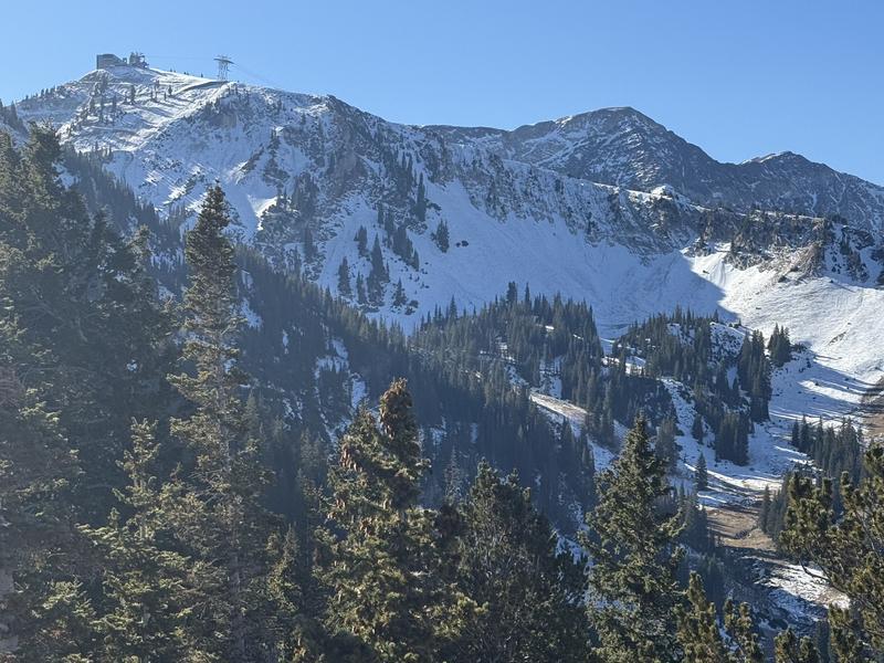
Snow conditions remain pretty grim. Before this storm, the highest elevation northerly slopes were the only places holding any snow. There was about 4 to 10 inches on the ground, and in many spots, it was textured or not well-connected. Everything else was bare ground. As Drew said, it is worth noting where the dirt is because it might be the safest place to ride once storms really start rolling for us. Slopes with old snow will be guilty until proven innocent.

Observations have been quiet overall, but Trent Meisenheimer and Dave Kelly poked around upper Little Cottonwood last week, and their observation is linked here. Mark White and Jenna Malone were out on the Cottonwood ridgeline and the Park City ridgeline, and I’ve stitched together a short video you can find here.

Coverage Prior to the storm in Upper Little Cottonwood - Kelly/Meisenheimer

Recent Avalanches
None.
Additional Information

It's never too early to start thinking about avalanches. Here are a few things to consider doing:

  • Learn online. We have over 5 hours of free online learning at the Know Before You Go website
  • Check out the upcoming in-person Know Before You Go events HERE
  • Sign up for an on-snow class
  • Check out the UAC's education progression HERE
  • Get your avalanche rescue gear ready for winter. Put fresh batteries in your transceiver and update the firmware. Inspect your shovel and probe. Get your airbag backpack ready by possibly doing a test deployment and updating the firmware if it is an electric version or getting your canister refilled if it's not electronic.
General Announcements

This information does not apply to developed ski areas or highways where avalanche control is normally done. This forecast is from the U.S.D.A. Forest Service, which is solely responsible for its content. This forecast describes general avalanche conditions and local variations always occur.