Forecast for the Salt Lake Area Mountains

Dave Kelly
Issued by Dave Kelly on
Monday morning, November 18, 2024
This most recent storm added just enough new snow and water to start to tip the scales in isolated terrain and with the addition of blowing winds it may be possible to trigger shallow soft slabs 10"-18" deep and up to 50' wide in upper elevation northerly facing terrain.
While these avalanches may not be enough to fully bury a rider, they are more than enough to rake someone through rocks and stumps.

Updates will follow as conditions warrant. This update is from 0700 on Tuesday November, 19, 2024.
Low
Moderate
Considerable
High
Extreme
Learn how to read the forecast here
Special Announcements
Weather and Snow
Over the weekend and into Monday we had another 8"-14" of new snow and 0.60"-1.00" of water with winds blowing from a westerly direction in the low teens gusting to the high 20's MPH at the highest ridgelines.
As this storm moves out we can look for clearing skies and warming temperatures as high pressure build for the remainder of the week before another storm heads our way into the weekend. Read the most updated forecast discussion from our partners at the National Weather Service HERE.

There have been lots of great observations from the backcountry giving us an idea of what our early season snow structure looks like. Forecaster Greg Gagne dives deeper into what a faceted snowpack may mean for the future in his write up from the Catherine's area.
Recent Avalanches
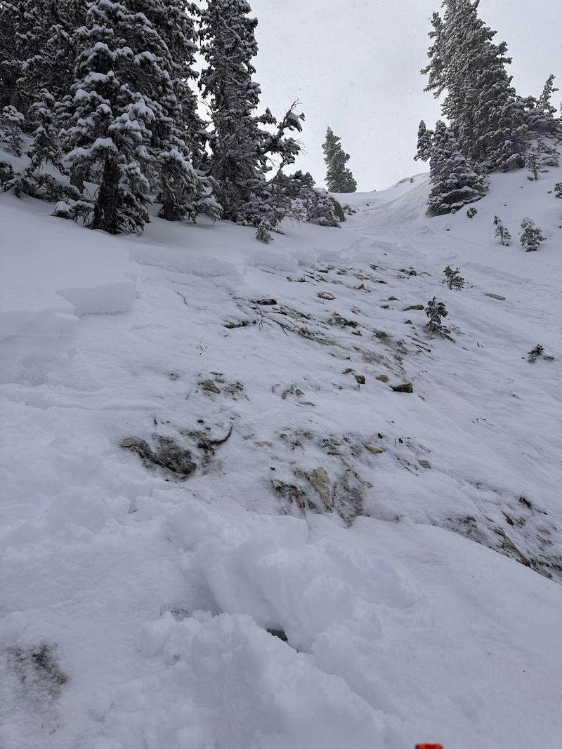
Over the weekend we got reports of skier triggered avalanches failing on facets. While none of these avalanches were deep enough to bury a person, they would have been more than enough to cause injury had someone been caught in rocky terrain or washed over a cliff band.
The Tri-Chutes avalanche that was on a northwest aspect at 10,100' got my attention because of the collapses the party observed before they remotely triggered the avalanche (photo below). Another rider triggered an avalanche that failed on weak faceted snow on a north facing slope in Upper Silver Fork Canyon. Mark White also reported signs of natural activity from late last week in upper Mineral Fork.
Above photo showing the fracture line from Silver Fork (photo credit: Chris D).
Check out all recent observations and avalanches HERE.
Ad
Avalanche Problem #1
Normal Caution
Type
Location
Likelihood
Size
Description
Continued incremental loading (wind, snow, and water) has started to sneak up on us and the places that are holding the most snow (upper elevation northerly facing aspects) are the places that are most suspect right now. Dig down on any slope you intend to travel on to see if there is a slab of new or wind loaded snow with soft weak snow underneath before committing to ascend or descend a slope over 30° degrees. I still think the biggest concern is the summer surface and I am still sticking to lower angle ridges and slopes where I can't get enough speed to hit a rock or stump just under the surface. Some avalanche problems you may want to keep on your radar:
  • New Snow - The new snow may not bond well to the different crusts and weak faceted snow in our shallow snowpack. There will be a potential for sluffing and even shallow soft slabs of storm snow, especially during any period of higher precipitation
  • Wind-Drifted Snow - Blowing winds will cause snow to drift at the upper elevations. Watch for signs such as cracking in fresh wind slabs. Although these drifts should be small, you will want to avoid getting caught in one in steep, consequential terrain
Additional Information
Before traveling within one of the ski resort boundaries, check out Resort Uphill Policies.