We have a lot of upcoming education and events -
- The 14th Annual Utah Snow and Avalanche Workshop is virtual again this year and will be held Nov 5th (professional session) and Nov 9th, 10th, 11th evenings from 6-9pm. More info and speaker lineup on our Events page HERE.
- Check all the upcoming education HERE.
If you're seeing anything we should know about, submit your observations
HERE.The Current Picture:
A closed upper level low pressure system moved through overnight, drenching the valleys and laying down a fairly even 6-8" of 10% density snow. Ogden and Provo have received 4-8" with one snowstake at Powder Mountain showing 10" overnight. It's still snowing. Winds were moderate to strong from the southeast yesterday and have rotated around to the northwest where they're blowing 15mph with gusts to 25. Temps are in the mid-20s. We should continue to see "wrap-around" precipitation through about midday with another 3-6" possible.
The Outlook:
It's been a pretty good run so far this October. Since the 9th, a series of storms have produced 20-40" of snow in the Wasatch, with the lion's share in upper LCC and BCC. We'll see a few more inches this morning before the storm barrels off to the east. Mid-week looks warm and sunny with mountain temperatures rising back into the low to mid-40s. A weak system is on tap for Saturday with what looks to be an atmospheric river event for late weekend into early week. These typically are wet, warm, and windy events. We'll see.
History:
This active October weather reminds me of October 2004 where upper LCC received 122" between October 17th and Halloween. The Alta snow stake sat at a cool 81" on November 1st. But it was not all good news that year - the winter of 04/05 was our most tragic year for avalanche fatalities with eight.
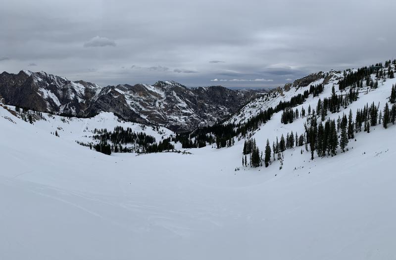
(Monday's photo of snow coverage from Alta looking north to the Cottonwood ridgeline)
Trent and I each have been out and about the last couple of days and have found generally 1-2' of snow on the ground with a generally strong and stable snowpack. My observation from the closed Alta ski area is
HERE. Prior to last night's storm, the only semblance of dry settled powder existed on true north above about 10,000'. All other aspects had either burned off to the ground (south), had thermal crusts (northerlies below 9500-10k), or solar melt freeze crusts (everything else).
The current snowfall of medium density should dramatically improve riding conditions.