UDOT PLANNED AVALANCHE CLOSURES!!

Forecast for the Salt Lake Area Mountains

Trent Meisenheimer
Issued by Trent Meisenheimer on
Sunday morning, January 5, 2020
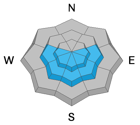
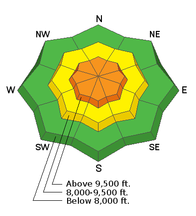
Today the avalanche danger is CONSIDERABLE at all upper elevations where slabs of Wind Drifted Snow are the main problem to look for and avoid. We also have a CONSIDERABLE danger for triggering a slab avalanche on steep slopes that face east, southeast, south, southwest and west at the upper elevations failing on a persistent weak layer of snow found near a crust. Regardless, of which one you trigger, both types of avalanches could be large enough to catch, carry and bury a person.
The problem should be less severe at mid-elevations where the danger is MODERATE. Heightened avalanche conditions on specific terrain features and human triggered avalalnches are possible.
The danger is LOW at low elevations where avalanche conditions are generally safe.
Low
Moderate
Considerable
High
Extreme
Learn how to read the forecast here
Special Announcements
Get discount lift tickets HERE. Thanks for this generous support from Utah Ski Resorts and Ski Utah. All proceeds go directly to supporting the UAC.
New to the backcountry or in need of a refresher? Consider taking a companion rescue course offered at Woodward Park City, January 14, 5:30-9 p.m.
Weather and Snow
Under mostly clear skies this morning "the weather is a changin." The winds have already backed to the west southwest and are currently blowing 10-20 mph gusting into the 20's and 30's at the upper elevations. Mountain temperatures are in the mid teens to low 20's °F across the board. Clouds will quickly usher in this morning and into the afternoon where a trace to an inch of new snow is possible. Around the dinner hour the first trough will slice through northern Utah veering the winds to the northwest once again and bring additional snowfall. By tomorrow morning we could see 5-10" of new snow in favored areas.
Winds have relentless and taken their toll on the snow surface. The last remnants of powder will be found in sun and wind sheltered terrain at the mid elevations. Upper elevations exposed terring is scoured and wind board is the main theme. South and west facing terrain was kissed by the sun yesterday leaving behind an annoying zipper crust.
Recent Avalanches
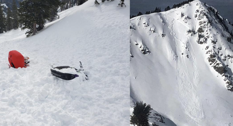
Yesterday, there were eight new avalanches reported to the Utah Avalanche Center with two of them catching and carrying the backcountry riders. Luckily nobody was fully buried or injured in these slides. The odd news, is that five out of the eight new avalanches were on southerly aspects. These avalanches were all roughly 1-2' deep and up to 100' wide. Make sure to check out the many new observations posted HERE.
Photos: Left - catch and carry on south facing Sunset Peak. Right - catch and carry on southeast facing Tuscarora.
Ad
Avalanche Problem #1
Wind Drifted Snow
Type
Location
Likelihood
Size
Description
Northerly winds continued to transport snow yesterday at almost all aspects and elevations. For today the winds have backed to the west and southwest and are currently blowing 10-20 mph at the upper elevations and this will keep the Wind Drifted Snow active once again today.
Because the winds have been out of every direction and winds often swirl around in canyons - be on the lookout for Wind Drifted Snow on a variety of terrain features. Cross loaded gullies, mid slope break-overs, open bowls, and of course leeward slopes right off the ridgelines. Shooting cracks and collapsing is a huge red flag.
Wind Drifted Snow can be easy to spot - it often looks rounded and pillowy. Sometimes it's hollow like a drum. It can be hard or soft under your skis, board or sled. The key is to look for and avoid any Wind Drifted Snow. Some drifts will be welded in place while others may be sensitive to the weight of a rider. Approach each new drift with caution.

Travel Advice: Avoid the wind and avoid the problem. Mid elevation, sun and wind sheltered terrain offers the best and safest riding conditions.
Avalanche Problem #2
Persistent Weak Layer
Type
Location
Likelihood
Size
Description
HEADS UP - WE HAVE A NEW PERSISTENT WEAK LAYER. Over the past several days we have seen many avalanches on southerly aspects. It all started in the overnight hours on Thursday (January 2nd at 4:20am) a very large natural avalanche came barreling down Tanner's slide path. Also, another avalanche happened naturally in the White Pine Cutes in mid Little Cottonwood Canyon. Thursday morning (January 2nd) with control work in upper Little Cottonwood Canyon, produced large avalanches with explosives on southerly aspects with three of the avalalnches crossing the road. Yesterday, we had five human triggered slides with two catch and carries on southerly facing slopes. It's been very active!
The avalanche that caught my attention was a remote trigger on a south facing slope in White Pine. This avalanche was triggered from over 150' feet away. This to me is a sign of faceted snow. Other observers reported from the field finding this weak layer of snow just above a crust on southerly facing slopes. This weak layer is now buried 12-18" deep and most pronounced on southeast, south and southwest facing slopes at the mid and upper elevations. Below is a list of observations where this layer has been found.
Cardiff Peak observation
10420 SE facing observation
Snake Creek S facing observation
Travel advice: Avoid any steep southerly facing terrain (anything greater than 30° in steepness) or, get your shovel out and dig! do your homework before committing to any steep southerly facing slope.
  • The Persistent Weak Layer found on northerly facing slopes where faceted snow at the ground exists is now dormant. There are much greater issues to pay attention to.
Additional Information
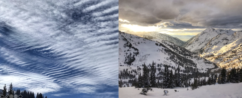
Did you see these clouds yesterday? Like me, are you wondering how they formed? if so, check out Jim Steenburgh's blog HERE. The clouds also made a spectacular sunset. (Photo: Meisenheimer)
General Announcements
This information does not apply to developed ski areas or highways where avalanche control is normally done. This forecast is from the U.S.D.A. Forest Service, which is solely responsible for its content. This forecast describes general avalanche conditions and local variations always occur.