Join us for the 17th Annual Professional Snow and Avalanche Workshop (PROSAW) on November 4 - Purchase tickets here!

Forecast for the Salt Lake Area Mountains

Drew Hardesty
Issued by Drew Hardesty on
Friday morning, January 28, 2022
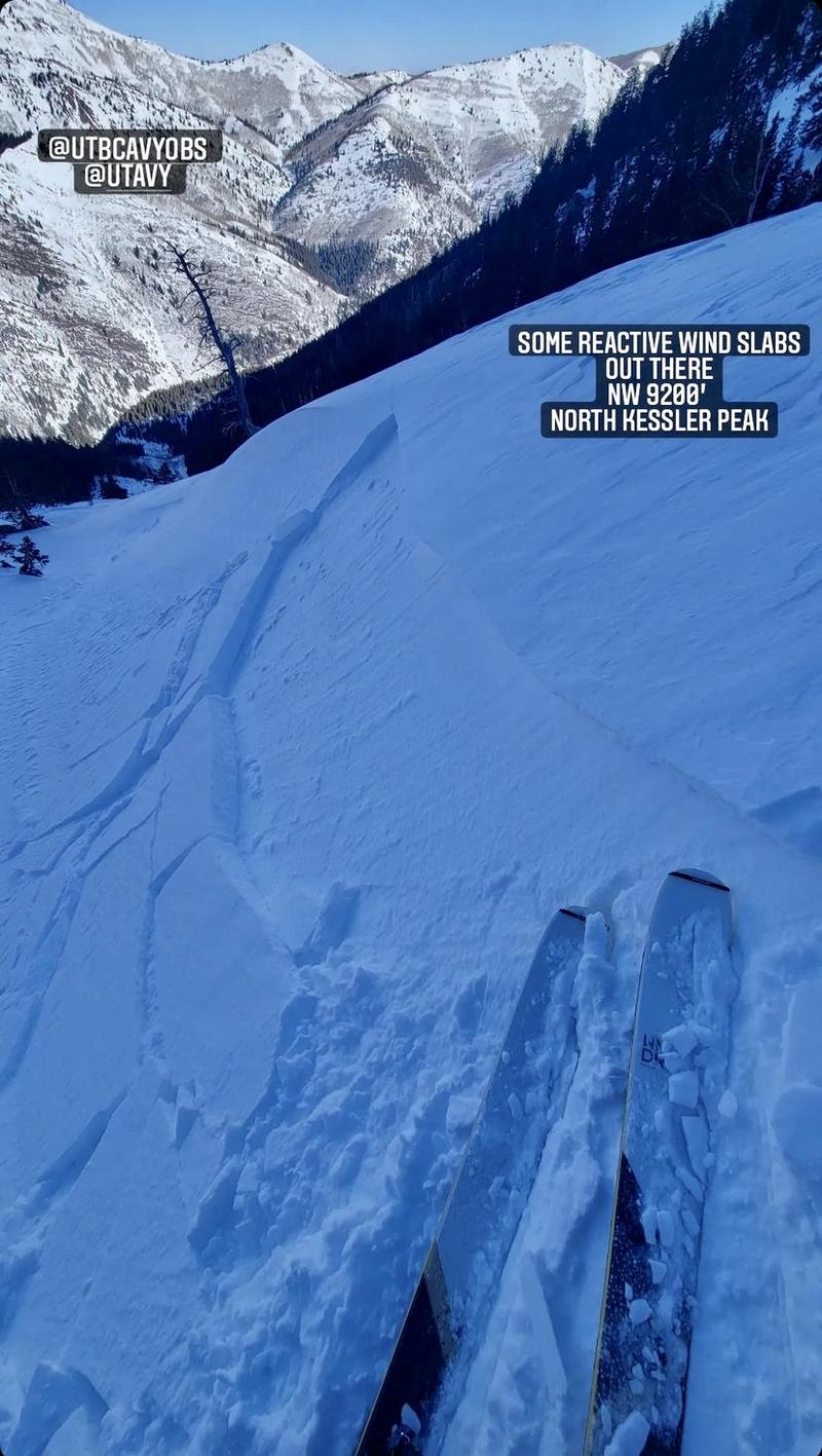
A LOW avalanche danger exists. Anticipate shallow pockets of wind drifted snow and dry loose sluffing in steep terrain.
You control your own RISK by choosing where, when, and how you travel.
Low
Moderate
Considerable
High
Extreme
Learn how to read the forecast here
Special Announcements
Thanks to the generous support of our local resorts and Ski Utah, discount lift tickets are now available. Support the UAC while you ski at the resorts this season. Tickets are available here.
Weather and Snow
Skies are clear. Northerly winds are blowing 15-20mph. Mountain temperatures are in the upper teens.
Riding conditions remain quite good in the wind and sun protected terrain.

We'll have sunny skies through the weekend, with temps warming again into the upper 20s to mid-30s. Winds should be backing to the northwest and decreasing as the day wears on.
The weather models have long hinted at a pattern change as we move into February...but the first storm for early/mid-week looks a bit threadbare and moth-eaten.
Our Week in Review has been published. You can find it HERE>
Recent Avalanches
Old news: Yesterday we reported of a large slide in upper White Pine of LCC. This slide was confirmed to have run during our early January avalanche cycle.

Pockets of shallow wind slab (photo Joey Manship) and loose snow sluffing continued to be the only game in town yesterday.
You can find all observations HERE.
Ad
Avalanche Problem #1
Normal Caution
Type
Location
Likelihood
Size
Description
Normal Caution: It is used by forecasters when the avalanche conditions are generally safe, and there is no predominate avalanche problem. Any avalanche type is possible, but the most common would be windslab, loose wet, and dry loose avalanches, and they are expected to be small.
In isolated areas you may find:
- Pockets of fresh wind drifted snow at the mid and upper elevations. Although drifts will be shallow (up to 6") and not very wide, wind drifts may be sensitive if they have formed on top of weaker snow underneath.
- Sluffing of dry snow on steep northerly aspects. Although these sluffs won't entrain much snow, getting caught in one could be serious in consequential terrain.
- Wet loose sluffs on the sunny aspects. Watch for rollerballs and pinwheels as precursors to any wet loose sluffing with direct sun and daytime heating.
Additional Information
It's times like these that I think of Dave Hanscom and Alexis Kelner. They were some of the early pioneers in backcountry skiing in the Wasatch. Count yourself lucky if you own any of their Wasatch Tours guidebooks and even luckier if you have met them. During periods of Low avalanche danger and easy travel, they always recommended what they called SuperTours - long point to point outings in the Wasatch where you could really see the range and experience what the mountains have to offer.
photo Andrew McLean
General Announcements
Who's up for some free avalanche training? Get a refresher, become better prepared for an upcoming avalanche class, or just boost your skills. Go to https://learn.kbyg.org/ and scroll down to Step 2 for a series of interactive online avalanche courses produced by the UAC.
This information does not apply to developed ski areas or highways where avalanche control is normally done. This forecast is from the U.S.D.A. Forest Service, which is solely responsible for its content. This forecast describes general avalanche conditions and local variations always occur.