Donate to the 2024 Spring Campaign to help rebuild the UAC website.

Forecast for the Salt Lake Area Mountains

Trent Meisenheimer
Issued by Trent Meisenheimer for
Saturday, January 21, 2023
The avalanche danger is MODERATE on all steep slopes at the upper elevations where it's possible to find pockets of sensitive wind-drifted snow. Here avalanches can be 1-2' deep and up to 50' wide.
Avoid traveling underneath or along the edge of corniced ridgelines, as large cornices may easily break off. Long-running dry loose avalanches (sluffs) are also possible in steep, sustained terrain.
Low
Moderate
Considerable
High
Extreme
Learn how to read the forecast here
Weather and Snow
Under mostly clear skies, the mountain temperatures range from 0-10 °F with wind chills in the negative digits. Winds are currently blowing from the northwest at speeds of 5-15 mph with gusts into the upper 20s across some of the upper elevation ridgelines.
Today we will see partly to mostly cloudy skies by late afternoon, with mountain temperatures only climbing into the low 20s °F. Winds will remain from the northwest at speeds of 5-15 mph. The riding and turning conditions are epic, with powder on almost all aspects and elevations.
On Sunday, we will see another storm that quickly slices through the state as it overachieves and heads south for Mexico. As the storm approaches, we will see increasing clouds and northerly winds after sundown today. Hopefully, by Monday the storm will deliver 2-6" of new snow.
Recent Avalanches
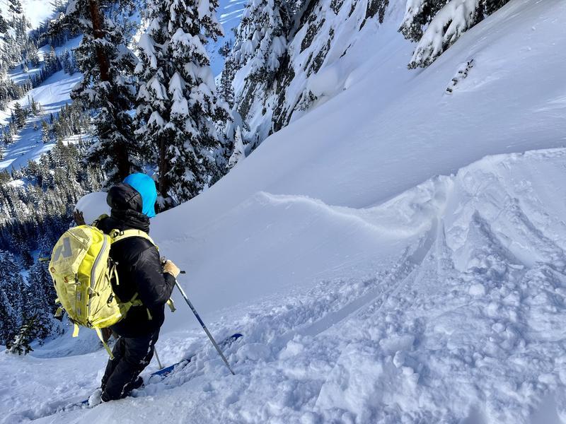
Yesterday, backcountry riders found wind slabs dotted around the upper-elevation terrain. Most of these wind slabs were soft slabs and roughly 12-24 inches deep and up to 50 feet wide. We had a report of a close call on the Dresden Face in Hogum Fork, where a rider triggered a wind slab that almost took the skier out. The avalanche ran fast and over multiple cliff bands.
Another wind slab avalanche was reported from the Maybird/Hogum ridgeline in Little Cottonwood on an east-facing slope at 10,500'. This wind slab was 18 inches deep and 30 feet wide and triggered with a slope cut.
Photo: Grainger/Young showing another wind slab avalanche in Neffs Canyon.
Ad
Avalanche Problem #1
Wind Drifted Snow
Type
Location
Likelihood
Size
Description
In the past 24-48 hours, the winds have been just strong enough to drift snow into shallow soft slabs of wind-drifted snow. Many backcountry riders reported triggering these wind slabs on steep upper-elevation terrain yesterday. Most of the wind slabs reported were 12-24 inches deep and up to 50 feet wide.
Today, it will remain possible to trigger shallow soft slabs of wind-drifted snow once again. When it comes to small avalanches, the terrain dictates how dangerous they are. If you end up caught in a wind slab avalanche in steep committing terrain, where will you end up? Cliffs, rocks, terrain traps, and trees all make a ride in a small avalanche much more dangerous.
Also, on steep slopes, you can expect dry loose avalanches (sluffs) to be an issue, and sluff management will be essential. Cornices have grown massive, and I would avoid being on or below these massive school bus chunks of snow. Give yourself some extra space between you and the edge when walking on ridges.
Additional Information
  • What happened to the persistent weak layer problem? Nikki Champion and Dave Kelly discuss the team's decision to drop the Persistent Weak Layer as a listed problem.
  • Be in the Know - follow our partners @UDOTavy for backcountry and road closure information on Twitter and Instagram.
General Announcements
This information does not apply to developed ski areas or highways where avalanche control is normally done. This forecast is from the U.S.D.A. Forest Service, which is solely responsible for its content. This forecast describes general avalanche conditions and local variations always occur.