Join us for the 17th Annual Professional Snow and Avalanche Workshop (PROSAW) on November 4 - Purchase tickets here!

Forecast for the Salt Lake Area Mountains

Drew Hardesty
Issued by Drew Hardesty on
Thursday morning, January 20, 2022
The avalanche danger is LOW on all aspects at all elevations. Natural and human-triggered avalanches are unlikely, but not impossible, and could occur in isolated terrain.

Continue to use safe travel protocol practices when in avalanche terrain - keep a close eye on your partners and expose only one person at a time on a slope.
Low
Moderate
Considerable
High
Extreme
Learn how to read the forecast here
Special Announcements
Thanks to the generous support of our local resorts and Ski Utah, discount lift tickets are now available. Support the UAC while you ski at the resorts this season. Tickets are available here.
Weather and Snow
Skies are partly cloudy.
Winds are from the northwest and generally less than 15mph.
Temperatures are in the single digits and low teens.

Most areas picked up a trace of new yesterday, along with some additional rime and surface hoar deposition. Today's snow surface may be tomorrow's weak layer. We'll see.
Look for increasing clouds in the early afternoon hours ahead of tonight's "storm". Temps today will be in the upper teens to mid-20s with slowly increasing winds from the northwest. Snowfall kicks in before midnight and we may see 3-6" by morning, with another inch or two in the mid-morning hours. The flow veers northerly and then northeasterly tomorrow, generally shutting off orographic support except for the southern end of the Park City ridgeline. Even though this looks like a "non-event" by Wasatch standards, we need the moisture and it'll be a nice little refresher for the riding conditions.

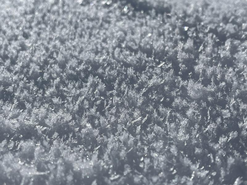
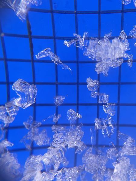
A couple photos of the snow surface conditions from yesterday -
rimed surface hoar, Chris Brown
recrystallized snow at and near the snow surface, Mark Staples
Recent Avalanches
No backcountry avalanches were reported yesterday.
Backcountry observers
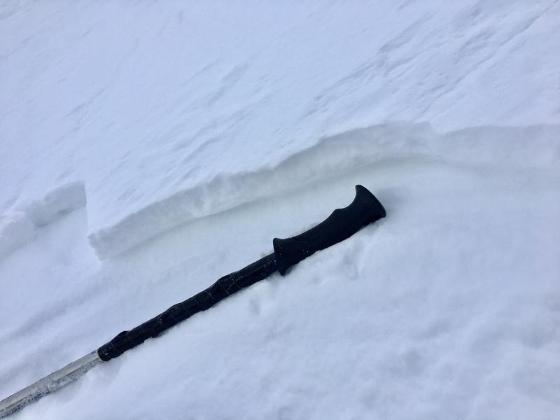
 Nat Grainger and Zack Little have each found areas where new wind drifts sit above the weak recrystallized surface snow that has developed over the recent couple of weeks. Perhaps a portent of things to come?
wind drift over weak recrystallized surface snow, Nat Grainger
Ad
Avalanche Problem #1
Normal Caution
Type
Location
Likelihood
Size
Description
Normal caution is used when the avalanche danger is LOW and there is no predominant type of avalanche problem. Although avalanches are unlikely, they are not impossible and they could occur in isolated terrains, such as;
  • small isolated areas of wind drifted snow in upper elevation terrain features that allow for drifting, such as gullies, sub ridges and directly below ridgelines;
  • a larger avalanche breaking down into faceted snow in steep, thin rocky terrain on aspects facing northwest through east at the mid and upper elevations.

Although I am unsure if the small avalanche in Broads Fork is a glide avalanche or not, there is a deep snowpack in drainages where glide avalanches occur, such as Broads Fork and Stairs Gulch. Glide avalanches are notoriously difficult to forecast, but when they do occur they will release the entire season's snowpack down to the ground.
Additional Information
What happened to the Persistent Weak Layer problem? The PWL problem first appeared in the December 12 forecast, and since that time numerous large natural and human-triggered avalanches have occurred, failing on the layer of faceted snow down near the ground on mid and upper elevation aspects facing west, north, and east. This PWL formed from snowfall in October and early November that weakened during the prolonged dry spell through November and early December. Heavy snowfall in December and early January snowfall placed a 3-5' deep slab of strong/dense snow on top of this layer (as shown in this photo by Meredith Johnson) and it is now unlikely a skier or rider could affect this deeply-buried layer. Although we may not have any remaining issues with this PWL this season, for now we are saying the PWL problem has become dormant as it may again become reactive with future storms.
Observer Niko Milo has a nice couple of photos from his outing in the Willows of BCC showing the old weak snow at the bottom of the snowpack and the new weak snow at the top of the snowpack.
General Announcements
Who's up for some free avalanche training? Get a refresher, become better prepared for an upcoming avalanche class, or just boost your skills. Go to https://learn.kbyg.org/ and scroll down to Step 2 for a series of interactive online avalanche courses produced by the UAC.
This information does not apply to developed ski areas or highways where avalanche control is normally done. This forecast is from the U.S.D.A. Forest Service, which is solely responsible for its content. This forecast describes general avalanche conditions and local variations always occur.