Seemingly and hopefully the November persistent weak layer is now bridged/rounding and out of play.
It is excellent to be able to feel reasonably comfortable on North aspects of all elevations again and to look at what conditions are before the next weather changes.
Currently in locations like this (above ~9000' NW-E facing) there are 3 surface conditions of note in light of the possibility of ≤10" snow starting Friday:
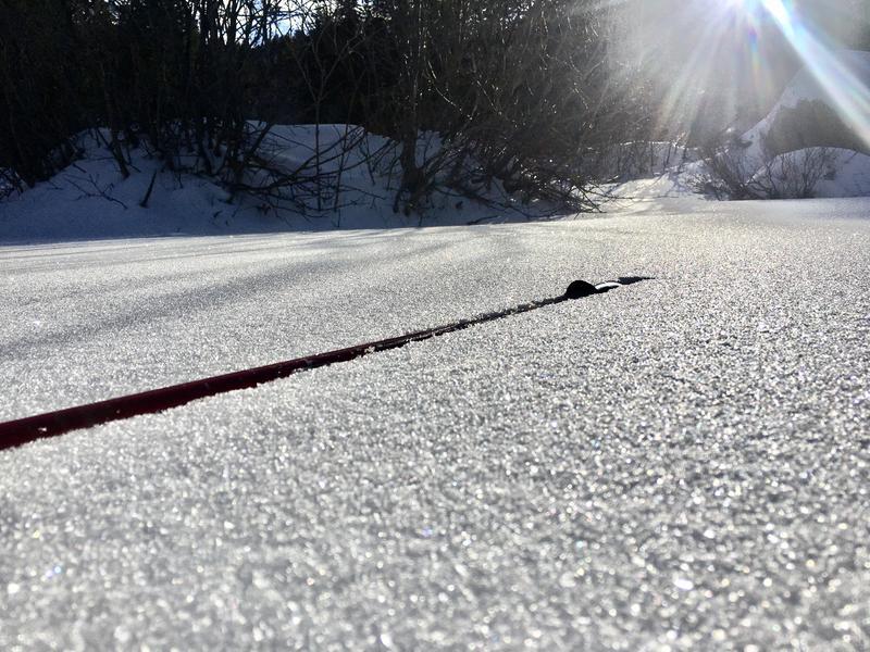
Pic 1- Beautiful but troublesome loose faceted snow, 2-6 cms in most places. These crystals continue to weaken with the current temperature gradient and generally lie on a 4F+-to -P crust underneath. This will be a smooth bed surface and weak layer for any new snow slab.
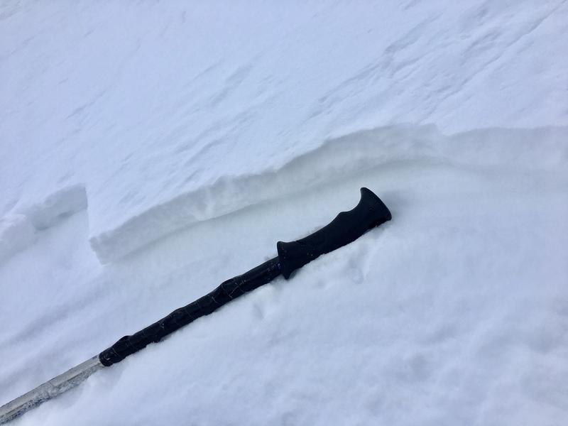
Pic 2- In alpine wind-affected terrain there is a 1-3 cm wind slab that caps the remaining near-surface facets. This cap may accentuate the facet problem once we get a load on top, failing under more weight and with wider propagation.
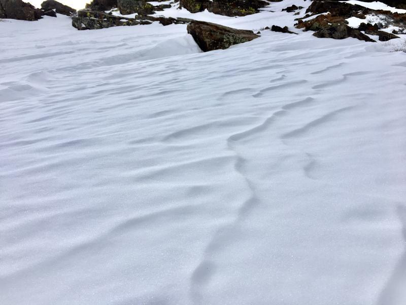
Pic 3- Alpine wind-affected slopes also have areas of stout, sastrugi-ed wind board. The texture on this surface may be a positive, helping to interface with new snow that comes Friday.
The current faceting of the surfaces will be the determining factor for the near future. Many solar aspects and lower elevations have less to worry about but any preserved NSF will be the next issue depending on what snow we receive.


