Forecast for the Salt Lake Area Mountains

Drew Hardesty
Issued by Drew Hardesty for
Tuesday, January 16, 2024
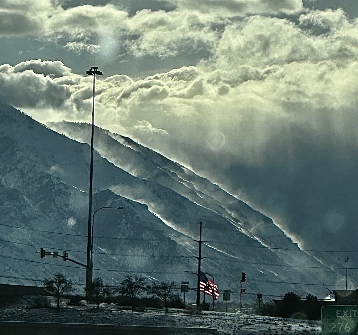
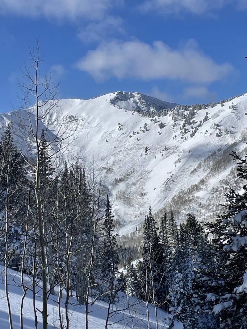
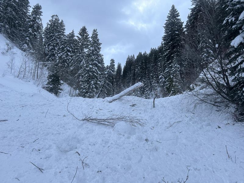
A HIGH DANGER exists on many slopes.
Today has avalanche accident written all over it.
Large avalanches may be triggered in many areas. Travel in or underneath avalanche terrain is not recommended. Remember that avalanches can be triggered at a distance or from the flats well below a slope. Stepping out of bounds at a ski area is stepping into HIGH DANGER.
Low
Moderate
Considerable
High
Extreme
Learn how to read the forecast here
Special Avalanche Bulletin
A Special Avalanche Bulletin is in effect from 6am MST this morning to 6am MST Wednesday for all the mountains of northern, central and southern Utah, to include southeastern Idaho and the Bear River Range.
Dangerous avalanche conditions exist on many slopes of all elevations. Avalanche accidents often occur under these conditions. Please stay off of and out from underneath slopes steeper than 30 degrees
Weather and Snow
Skies are clear.
Mountain temperatures are in the single digits. Winds are from the west northwest, blowing 20-30mph with gusts to 40. Along the highest elevations, anemometers are humming 45mph with gusts to 55.
Winds from the northwest continued to punish the mountains yesterday at all elevations. The 11,000' level gusts crested 100mph many times.
photo: Doug Wewer

Storm totals: (snow/snow-water-equivalent)
  • LCC: 85"/6.83" SWE
  • BCC: 66"/5.45" SWE
  • PC: 50-60"/4.4-5.42" SWE
  • Ogden: 50-70"/4.5-5.5" SWE
  • Provo: 60"/5.69" SWE
For today, we'll have mostly clear skies with high cirrus moving in overhead, portending the next storm. Temps will rise to the upper teens to low 20s. Winds will blow from the west northwest, then from the west southwest. A wet but warmer storm arrives tonight through tomorrow that should offer 6-12" of snow. Initial rain/snow line looks to be around 6500-7000'. Another quick break Friday before another storm lines up for Saturday through early week. Gusty winds persist all the while.
With this last storm, we are back on track - most areas are at or above "median" snow-water for the year.
Recent Avalanches
War Zone.
Clearing yesterday allowed for excellent viewing of Sunday's Extreme avalanche conditions. More avalanches than I can count. Many broke at least 4' deep at the December PWL of facets; some have stepped down to the ground. We received reports of avalanches on Gobblers Knob in Butler Basin stretching 2500'+ wide (pic 1). An avalanche with similar dimensions is in the Meadow Chutes of Silver Fork. Ski area control teams triggered numerous avalanches with some reported to be 6-12' deep. Most were on north to southeast facing slopes at the mid and upper elevations. But not all. A couple natural avalanches roared down by 1000 Springs, leaving a huge pile of debris littered with timber on the upper groomed Mill Creek Canyon path, a couple miles above the closed gate. None of the old-timers I spoke to remember an avalanche of that magnitude into MCC.(pic 2)
photo: Forecaster Nikki Champion
photo: JW Hall
Since Friday, we have heard about two full avalanche burials (Main Porter, American Fork) with rumors of a third; all recovered by partners or bystanders. We've also heard of many more skiers and riders being caught and carried; again with a good outcome. Tragically, a skier was killed in an avalanche in Wyoming Sunday (Details).
Be sure to check all the avalanche activity HERE.
Ad
Avalanche Problem #1
Persistent Weak Layer
Type
Location
Likelihood
Size
Description
These are very dangerous avalanche accident conditions.
The "peak" of the instability was on Sunday. Avalanches are not as hair-trigger. Cracking and collapsing is not as constant and continuous as it has been.
And yet, here we are on a blue-bird day with good skiing and riding conditions with the best coverage of the year. It will be easy to convince yourself that conditions are much improved and safe enough. This is why we have issued a press release, issued a Special Avalanche Bulletin and why I am writing to you now that these are the days of accidents.
Here's what I know:
  • Although most avalanches have been on north to southeast facing aspects, all aspects are suspect.
  • Large destructive avalanches have occurred even in the low elevation bands.
  • These soft and hard slab avalanches may be more stubborn but they can still be triggered at a distance.
  • If you are caught in one of these monsters, it will probably be unsurvivable.
Avalanche Problem #2
Wind Drifted Snow
Type
Location
Likelihood
Size
Description
Continued winds have drifted the snow into soft and hard slabs on predominantly north to east to south facing slopes. Terrain channeling and very strong wind speeds, however, will have deposited these slabs onto many aspects and well down the slope. Any wind slab may step down into our PWL layers, making a much more dangerous avalanche.
General Announcements
This information does not apply to developed ski areas or highways where avalanche control is normally done. This forecast is from the U.S.D.A. Forest Service, which is solely responsible for its content. This forecast describes general avalanche conditions and local variations always occur.