Join us for the 17th Annual Professional Snow and Avalanche Workshop (PROSAW) on November 4 - Purchase tickets here!

Forecast for the Salt Lake Area Mountains

Mark Staples
Issued by Mark Staples on
Sunday morning, January 16, 2022
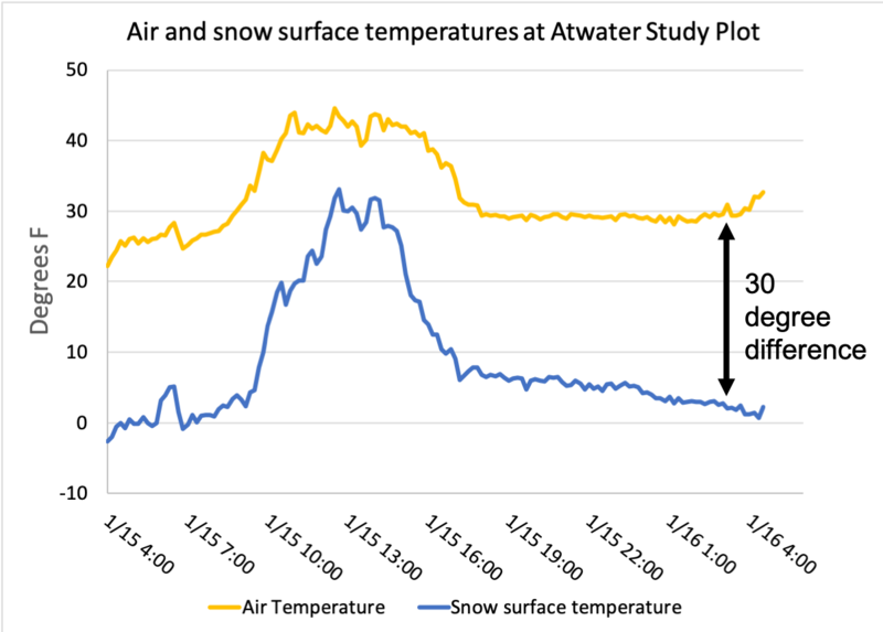
Today the avalanche danger is LOW on all aspects and elevations. Watch out for snow becoming wet on south-facing slopes especially in terrain with a lot of exposed rocks. In these isolated areas, there could be some loose wet avalanches.
Avalanches are unlikely today and conditions are generally safe, but low danger DOES NOT mean avalanches are impossible. There could be unstable snow in isolated areas.

Maintain normal safe travel protocols of only exposing one person at a time to avalanche terrain. If you were to trigger a slide, your only hope of surviving will be having partners watching you from a safe location.
Low
Moderate
Considerable
High
Extreme
Learn how to read the forecast here
Weather and Snow
This morning temperatures are in the upper 20s and low 30s F above 9000 ft while temperatures are in the low to mid teens at many trail head elevations. Winds from the west are blowing 10-15 mph at ridgelines gusting to 20 mph.
Today will be a repeat of yesterday with sunshine, warm temperatures in the upper 30s to low 40s F, and light winds.
Looking ahead, no major storms are in the long term forecasts; however, cooler air should arrive on Tues/Wed with maybe a trace of snow.

Soft snow can still be found mostly in wind and sun-sheltered slopes. Clear skies make a huge difference in keeping the snow from heating up much. Yesterday at the Atwater Study Plot in upper Little Cottonwood Canyon, a temperature sensor of the snow surface showed the snow reaching 32 degrees for only about an hour around 2 p.m. before quickly cooling down to 1 degree F by 4 a.m. this morning. The graph of these temperatures below shows a huge difference between air temperature and snow surface temperature.
Snow on south facing slopes has undergone several melting and refreezing cycles and should have a stout ice crust this morning that should slowly soften and melt as things warm up.
Recent Avalanches
The most recent avalanche activity was some wet loose avalanches in south facing terrain five days ago. The last reported dry, hard slab avalanches were nine days ago on January 7th.
Our Week in Review can be found HERE>
Ad
Avalanche Problem #1
Persistent Weak Layer
Type
Location
Likelihood
Size
Description
It seems that the persistent weak layer of facets that caused so many avalanches in December and the first week of January is now dormant.
  • The hand hardness of this layer has noticable increased and there is a corresponding increase in strength.
  • It is buried deeply, 3-10 feet, and hard to impact by the weight of a skier or rider.
  • The last reported avalanche on this layer was nine days ago on Jan 7th.
  • Most stability test like the ECT are either not breaking or requiring very hard force to break on this layer. There are some exceptions like this observation (video) from Big Cottonwood yesterday.
For these reasons, large, hard slab avalanches breaking on this persistent weak layer are unlikely. Not impossible, but unlikely.
Avalanche Problem #2
Wet Snow
Type
Location
Likelihood
Size
Description
Places where the snow will heat up and become wet will be south-facing chutes, couloirs, and gullies where the snow is surrounded by rocks that absorb strong sunshine and transmit that heat into the snow. Watch for the snow becoming wet in these isolated areas where wet loose avalanches may occur if you see pinwheels and snowballs rolling downhill with increasing frequency.
As seen in the graph of air temperature and snow surface temperature above, clear skies keep the snow cool even when the air temperatures warm up a lot. Snow loses a tremendous amount of heat by emitting long wave radiation into clear skies. This cooling will keep the snow from becoming very wet on many slopes.
General Announcements
Who's up for some free avalanche training? Get a refresher, become better prepared for an upcoming avalanche class, or just boost your skills. Go to https://learn.kbyg.org/ and scroll down to Step 2 for a series of interactive online avalanche courses produced by the UAC.
This information does not apply to developed ski areas or highways where avalanche control is normally done. This forecast is from the U.S.D.A. Forest Service, which is solely responsible for its content. This forecast describes general avalanche conditions and local variations always occur.