Forecast for the Salt Lake Area Mountains

Evelyn Lees
Issued by Evelyn Lees for
Tuesday, January 15, 2019
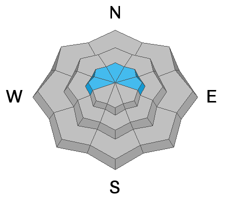
Today, there is a pockety MODERATE danger for triggering a small wind drift, most likely on an on upper elevation slope facing the north 1/2 of the compass. But watch for the hard, cracky drifts to be scattered on other aspects and even a few mid elevation slopes. There remains an isolated chance for triggering an avalanche that breaks 1-3' deep into faceted snow at the mid and upper elevations, most likely in steep, wind loaded, unsupported terrain, that faces northwest through east. Approach wind drifted slopes with caution, and consider the consequences of getting caught in any slide.
Low
Moderate
Considerable
High
Extreme
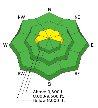
Learn how to read the forecast here
Special Announcements
Check out the improved weather links, road conditions, and weather links for each forecast region on the new UAC IOS App. Do you use the NOAA point forecast? If so, now you can bookmark your favorite weather locations in "My Weather" in the App.
Weather and Snow
Under partly cloudy skies, temperatures are in the teens to low 20s this morning. Winds were from the southeast yesterday, occasionally in the 25 to 30 mph range, gusting in the high 30s. Winds are varying from southeast to southwest this morning, 15 to 20 mph averages, gusts to 30 mph, and speeds are expected to increase again along the high ridge lines today. Skies will remain cloudy and a trace to 2” of snow is possible late in the day. Temperatures will warm into the mid 20s to mid 30s.
A more organized system tonight into Wednesday could bring 3 to 6” of snow by tomorrow night. There is a more potent system (snow and wind) is still expected for the latter portion of the week - Thursday and Friday.
Recent Avalanches
The only avalanche reported was perhaps a small natural wind drift in Mongo No, in Mineral Fork, timing uncertain.
Although it has been relatively quiet in the Salt Lake mountains, there were two close calls on Saturday to our south and north, in the Skyline and in the Logan area mountains. Both occurred on wind-loaded slopes that had previous tracks, failing in weaker faceted snow. On Sunday, there was a skier triggered slide in American Fork, again on a slope with tracks and failing on facets.
Ad
Avalanche Problem #1
Wind Drifted Snow
Type
Location
Likelihood
Size
Description
There was just enough wind yesterday that I expect there are pockety, erratic wind drifts that could be triggered by a person, mostly at the upper elevations. In addition to small plumes of snow along the ridge lines, the wind was moving snow at the mid elevations, too. Think “wind plates,” layers of stiff snow deposited by the wind. These plates or drifts are sitting on weak, faceted snow, which may make them easier to “pop out” with the weight of a person.
Below: Visual of yesterday's wind affected snow, eroded and deposited, even in a protected gully feature. Grainger photo.
Avalanche Problem #2
Persistent Weak Layer
Type
Location
Likelihood
Size
Description
The various faceted layers in our snowpack are mostly dormant and are adjusting to the load of snow and wind from early last week. However, as evidenced by the skier-triggered wind slab avalanche in American Fork Canyon on Sunday, avalanches remain possible. The areas of biggest concern are wind-loaded slopes at the mid and upper elevations that face northwest through east where the wind slabs are sitting on top of weak, faceted snow. Shallower snowpack areas also remain suspect.
How have some of these persistent weak layers formed? Check out this new Blog by Greg Gagne that includes an explanation of near surface faceting. Photo below of square, angular, near surface facets.
Additional Information
The Wasatch range has a complex weak snow surface for the incoming storms to land on - near surface facets, surface hoar and a variety of weak crusts and hard old wind slabs with facets above and below. If you’re out and about, keep looking at the variety of snow surfaces.
If you’re heading further afield, here’s a great observation from the Oquirrhs.
General Announcements
This information does not apply to developed ski areas or highways where avalanche control is normally done. This forecast is from the U.S.D.A. Forest Service, which is solely responsible for its content. This forecast describes general avalanche conditions and local variations always occur.