
Greg Gagne
Forecaster
Overview: A significant storm system dropped nearly 3 feet of snow in the Cottonwoods from December 21 through December 31. From Tuesday January 1, through Friday January 4, cold clear weather prevailed, allowing the surface of the snowpack to weaken, producing a widepsread layer of near-surface facets. Southwest winds began to increase on Friday January 4, and into the day on Saturday January 5. These winds deposited fresh wind drifts onto these weak facets, conditions which allowed several human-triggered avalanches to occur during the day on Saturday January 5. Although several avalanches statewide have failed on this layer of near-surface facets that formed during the same period, we are only focusing on the Salt Lake mountains as that is closest to where the data was collected.
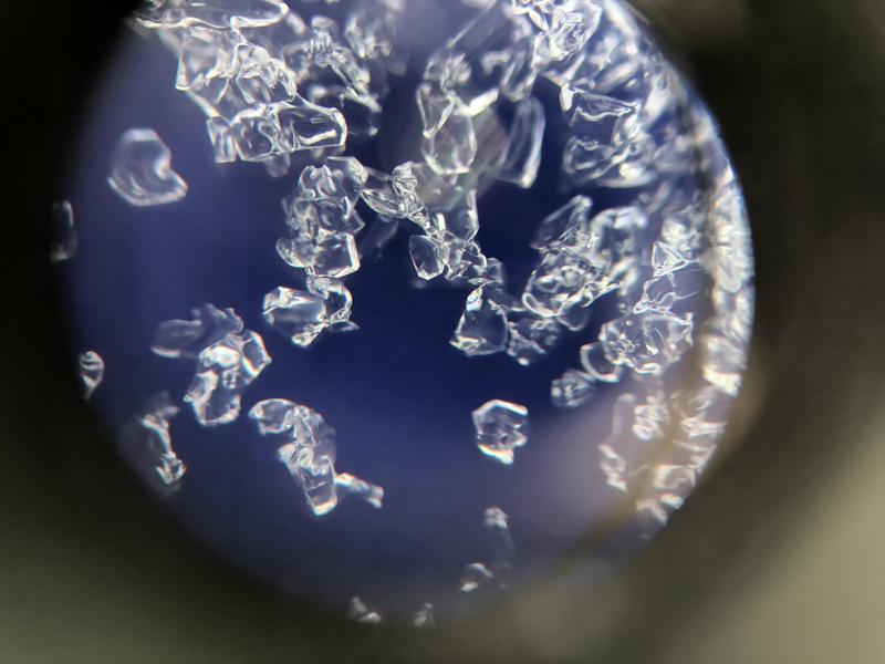
Near Surface Faceting: "Facets" are weak, angular-looking snow crystals that form whenever there is a substantial temperature gradient (or difference) in the snowpack. Typically, the required gradient for faceting to occur is 1 degree C over 10 vertical cms of snow, or 10 degrees C over 1 meter of snow (see footnote below.) The photo below shows 1-2 mm facets, highlighting their angular structure.
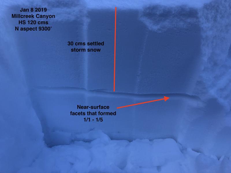
When buried by new snow or wind-driven snow, facets create a persistent weak layer, allowing avalanching to occur on this layer for days or even weeks (hence the term "persistent"). The photo below illustrates the location of the near-surface faceted layer that was buried by subsequent storm snow:
On Tuesday January 1, UAC staff deployed a pair of iButton thermochrons at 8800' in Big Cottonwood Canyon. An iButton thermochron is a temperature sensor and data logger. These thermochrons were placed 2 cms apart, with the top iButton 1 cm below the snow surface, and the lower iButton 3 cms below the surface. The iButtons then recorded and logged temperature measurements every 10 minutes, until they were retrieved early in the morning on Saturday January 5, where the results were evaluated.
Results: The graph below illustrates the recorded temperature gradient during this period. The graph is normalized to display the gradient over a meter of snow.
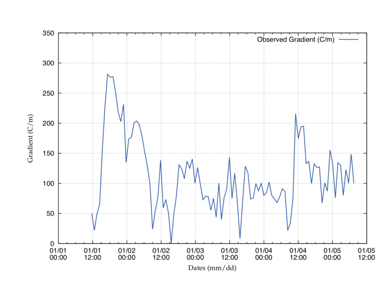
Recall, the required gradient is 10 C over 1 meter of snow. This graph illustrates gradients routinely in excess of 50 C (or 5 times the required gradient), with some gradients even reaching 275 C!
The recorded temperatures are even more interesting to observe:
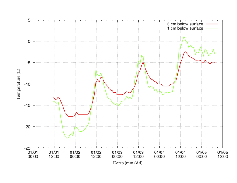
The green line is the temperature of the snow 1 cm below the surface, and the red line is the temperature 3 cms below the surface. Notice how the two lines fluctuate. During the day the snow surface warms (a relative term as it is routinely about -5 C). In particular, notice the spike at 12:00 noon on 1/2, 1/3, and 1/4. However, over the long winter night the snow surface cools and radiates its heat back to the clear sky, with snow surface temperatures in excess of -15 C (notice the dips around 00:00 (midnight)).
The red line (3 cms below the surface) changes less dramatically as it is insulated somewhat, but that also allows it to retain some of its heat during the cold, long winter night. The flipping between the surface being warmer during the day, and colder at night, is known as diurnal fluctation, and it explains why facets can quickly develop on the snow surface.
Implications: During this 4-day period, a widespread layer of near-surface facets developed, and winds later on Friday January 4, and Saturday January 5, deposited fresh wind drifts on this weak layer. On Saturday January 5, there were 8 human-triggered avalanches recorded in the backcountry of the Salt Lake mountains. These avalanches were sensitive fresh wind drifts, failing on the buried layer of near surface facets.
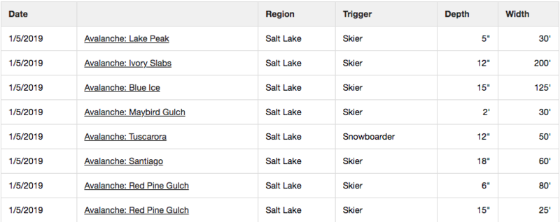
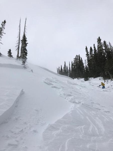
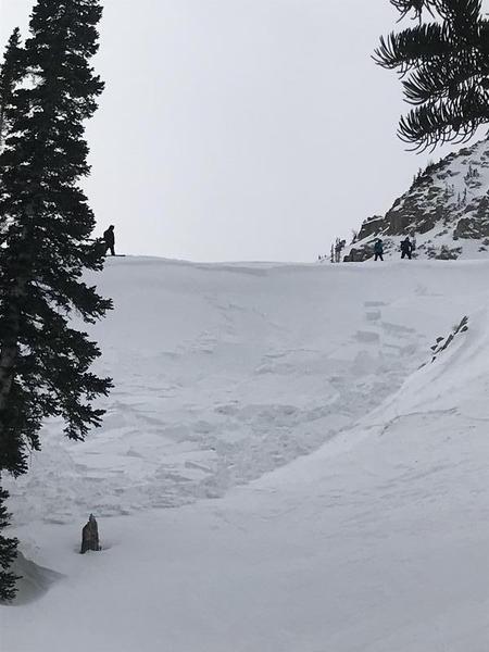
Photos of some of the avalanche activity include:
The take-home point is that during periods of cold, clear weather, the snow surface will weaken, creating a layer of faceted snow near and at the surface of the snowpack. If the faceted layer is preserved underneath subsequent snowfall or wind-blown snow, avalanche activity can be expected, with failures occurring at the layer of facets on the old snow surface.
Footnote: The rule of thumb for the required gradient is 10 C/100 cm. However, when the mean temperature is colder, the required gradient becomes greater than 10 C/100 cms. The recorded gradients were routinely in excess of, 50 C/100 cms, greater than the required gradient for the mean temperature of the snow.
This is great information. Thanks for the education.
Bill Brandt (not verified)
Tue, 1/15/2019
This is just excellent! I love the application of the neardy realm to recent events in our snowpack. Makes it easier and more motivating to learn.
I think blogs like this really helps with the education of the UAC user. Please keep these detailed descriptions comming.
Chester (not verified)
Tue, 1/15/2019
Thanks Greg, very succinct. Couple questions:
When facets are transported by wind what occurs structurally to the crystals to create wind slab?
What is the correlation between wind speed and the structural change in the crystals?
Thanks,
Matt
Matt Steward (not verified)
Tue, 1/15/2019
Great question Matt! In fact we actually want the wind to blow the faceted crystals at the snow surface as this disrupts the weak layer, and generally prevents it from becoming a problem once we get an additional load of new and/or windblown snow. Usually this is the case .... we get a weak layer on the existing snow surface, such as facets or surface hoar, but then warmth and wind essentially destroy the weaknesses at the surface, and the new snow bonds well to the existing surface.
What had happened on Jan 4/5 was that the wind deposited snow *on top of* the weak facets, and kept the faceted layer intact (you can see the stripe in the photo of the snowpack). The wind-blown snow was a dense, hard wind slab (yes, consisting of some faceted snow, but that the wind compacted it into a hard slab) that was sitting on top of the facets. You then had the perfect combination for avalanching - strong snow (hard wind slab) over weak snow (loose facets). The avalanching that took place on that Saturday really surprised many of us at the UAC, as well as other snow professionals, mostly because we thought the wind and warmth had disrupted the snow surface enough. But it was a good reminder of just how sensitive a layer of facets can be with a new load of snow.
Hope this helps!
Greg
Tue, 1/15/2019
Got it, classic "bridging." Sounds like wind transported surface facets aren't a significant factor in the wind slab but rather new snow accompanied by wind falling on non-transported facets. I was curious what the wind does to the crystalline structure of the snow to cause it to make such a hard slab? From crystals that bond poorly to crystals that bond strongly?
Thanks in advance!
Matt (not verified)
Tue, 1/15/2019
The issue is a strong slab on top of weak facets. I'll be honest and admit to not knowing how different crystals form wind slabs. And we really don't know what crystals composed the wind slabs, but rather that weaker facets were underneath the wind slabs. If the wind is blowing, and there is snow available for transport, wind slabs will form.
Greg
Tue, 1/15/2019
I used to live in Layton but have been in Pennsylvania for decades now. My wife and I travel to Utah annually in March. We find the UAC incredibly helpful and this additional information is invaluable! We do buy resort tickets every year that support the UAC and thank you all very much for the service you provide!!
Dave Case (not verified)
Wed, 1/16/2019


