Forecast for the Salt Lake Area Mountains

Trent Meisenheimer
Issued by Trent Meisenheimer for
Sunday, January 13, 2019
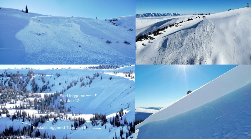
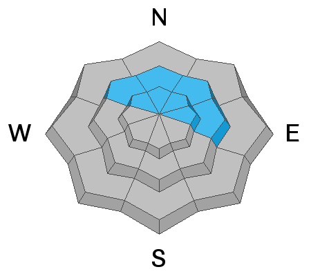
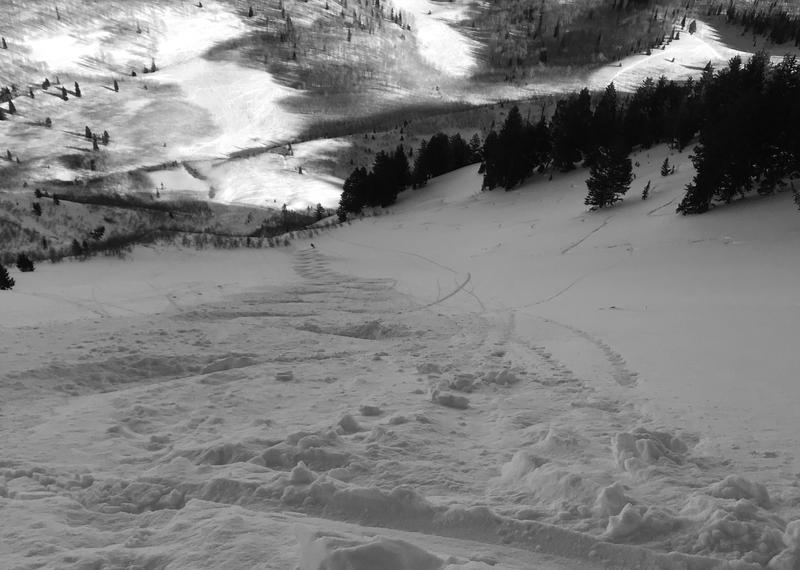
Today the avalanche danger is LOW. However, there remains the isolated chance for triggering an avalanche that breaks 1-3' deep into faceted snow at the mid and upper elevations. The most likely place to trigger an avalanche would be in steep, wind loaded, unsupported terrain, that faces northwest through east. Continue to approach recent wind drifted slopes with caution. Don't overstay your welcome on steep sunny aspects with daytime warming.

Safe travel protocol is key: make a plan, communicate, one-at-a-time, keep eyes on your partner.
Low
Moderate
Considerable
High
Extreme
Learn how to read the forecast here
Weather and Snow
It will be another beautiful day, with plenty of sunshine and clear weather. 10,000' Temperatures this morning are in the mid teens while lower trail heads sit in the single digits °F. Winds picked up around 7:00 pm yesterday and are currently blowing from the east/southeast with speeds in the 10-20 mph range across the high elevation ridge lines.
The snow surface is getting old and worn out, and there are many tracks in the backcountry. Lots of wind effected snow exists, however soft enough to put a smile on your face. The best and softest snow is found at mid elevation shady sheltered slopes. The sunny slopes will have a crust this morning that should soften later in the afternoon with day time heating.

Greg Gagne's Most Excellent Week in Review is hot off the presses. Look for it in the Blog menu above or simply click HERE.
Recent Avalanches
Ski resorts were able to release a few wind slabs with explosives off upper elevation, steep NE facing slopes yesterday. These avalanches were in steep, wind loaded terrain and large enough to bury, injure or kill a person. There were no avalanches reported from the backcountry yesterday. List of all observations found HERE.

To our north and south avalanches continue to be triggered. There was a close call in the Skyline yesterday as a rider triggered a large slab avalanche that was on a heavily wind loaded slope. Another close call was in the Logan area where a rider triggered an avalanche on a heavily wind loaded slope. In both cases there were many tracks adjacent to and on the slope. While the SLC mountains haven't seen this activity it's a good reminder it may exist in certain terrain throughout the range.
Photo: Slab avalanches from the Skyline and Logan area. Left side is Skyline and Right is Logan.
Ad
Avalanche Problem #1
Persistent Weak Layer
Type
Location
Likelihood
Size
Description
Right now our faceted layers are mostly dormant and starting to adjust to their recent load of snow from the past weekend. However, yesterday on my tour in the Timpanogos massif, I discussed with another forecaster that we wouldn't feel comfortable walking in steep open bowls that have been effected by the wind. Our biggest concern, was slopes where the wind deposited a slab on top of the weak December faceted snow. This layer is easy to find - simply dig in a safe location 2-3' deep and you'll see the small stripe of faceted snow. Again, my concern is where this layer is now buried and stressed by a larger amount of snow, that was deposited by the wind.

Most of the terrain has a LOW avalanche hazard. However, if you're planning on going big today - it doesn't mean we can simply turn our brain off. Look for and avoid upper elevation, steep unsupported slopes that have been effected by the wind, especially on the north half of the compass. This is exactly the terrain where there is an isolated chance for triggering a slab avalanche. Yesterday, I rode the steepest line of the year for myself. We did our homework, we communicated, we identified features of concern and entered the slope where it wasn't wind effected. We rode one at a time and broke the slope into 2 pitches keeping an eye on each other at all times in case we were wrong.
Photo: UDOT forecaster, John Woodruff taking the lead in the Provo area mountains.
General Announcements
This information does not apply to developed ski areas or highways where avalanche control is normally done. This forecast is from the U.S.D.A. Forest Service, which is solely responsible for its content. This forecast describes general avalanche conditions and local variations always occur.