Join us for the 33rd Backcountry Benefit - Get Your Tickets Now!

Forecast for the Salt Lake Area Mountains

Brooke Maushund
Issued by Brooke Maushund on
Sunday morning, January 11, 2026

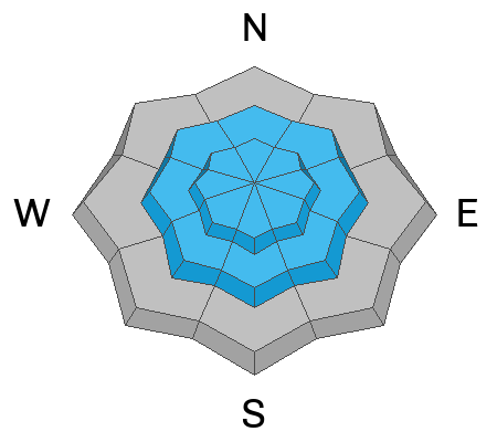
MODERATE avalanche danger exists on all upper and mid-elevation slopes where you're likely to trigger sensitive soft WIND SLABS. As the day warms up, expect the potential for WET LOOSE avalanches to rise on slopes that face the sun. If you're noticing surface snow becoming wet and easier to make a snowball with, then these slides are on the menu.

Upper and mid-elevation slopes facing W-N-E are still harboring a persistent weak layer that can release slides more than 5 feet deep.

Remember SAFE TRAVEL PROTOCOLS: ride one at a time, keep an eye on each other, and have a plan.

Low
Moderate
Considerable
High
Extreme
Learn how to read the forecast here
Special Announcements

Be mindful of avalanche workers and SAR personnel - IF YOU TRIGGER an avalanche near a ski area, please report it to the ski patrol dispatch or Alta Central (801-742-2033). Rescue personnel don’t want to be subjected to dangerous conditions if the scene is clear. More on this in Backcountry Emergency Protocols

Reminder from PC Patrol to BCC touring parties- Now that Jupiter is open, Pinecone Ridge off Puke Hill is in-bounds closed terrain.

Weather and Snow

Yesterday was another bright blue stunner of a Wasatch powder day. Early morning single-digit F temps jumped into the mid to high 20s F by late afternoon. Mostly northerly but shifting winds blew stronger than forecast, reaching into the 20s mph with gusts into the 40s recorded on Hidden Peak.

This morning, temps are hovering just below freezing in many locations—a stark contrast to the negatives yesterday morning. Winds are variable, blowing in the 20s mph after continuing to shift overnight.

Today, expect temps to reach just above freezing into the mid 30s F, with additional solar input from mostly sunny skies. The wind forecast continues to say light, but I'd bet we see moderate, shifting winds similar to yesterday that can easily transport snow.

SPECIAL CONSIDERATIONS: Not to beat a dead horse, but a final reminder for some safe travel protocols out there today. This weekend is likely the most busy weekend in the backcountry of the season. Be aware of who’s above and below you, pick the uptrack with the least exposure, transition in safe zones (not in avalanche run outs), cross slopes one at a time, and keep an eye on your partners. Let’s make it through the weekend with stories and stoke for next week.

Recent Avalanches

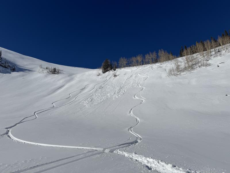
Most avalanches reported in the backcountry yesterday were small, human-triggered wind slabs running less than a foot deep and 50 feet wide.

Red Rock Chutes - Scott triggered a 12" deep wind slab on a NE-facing slope near 9,600'. It broke 20' wide.

Radar Love - Garrett's party triggered a 7" deep, 20' wide soft slab running on a density change in the new snow on a SE-facing slope near 9600' on a convex roll. While small, these are exactly the slides that can catch you off guard and knock you off your feet above consequential, exposed terrain.
Ski areas in upper LCC reported explosive results with wind slabs up to 6' feet deep.

Read all backcountry observations here.

Avalanche Problem #1
Wind Drifted Snow
Type
Location
Likelihood
Size
Description

Winds blew in the 20s mph yesterday, shifting and changing directions as multiple observers noted transport of fresh snow at ridgeline. These slabs of wind-drifted snow may be surprisingly sensitive or loaded into areas skied in previous days...Similar to the wind slab triggered by a party traversing the Mt. Superior ridgeline yesterday, which has seen more skier traffic than the eyes could count since Friday. While these may be small, they can knock you off your feet quite easily….be mindful of what you’re skiing over.

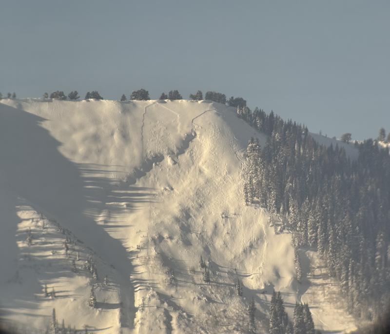
These can run potentially run fast and far if you find a pocket of buried near surface facets or the isolated buried surface hoar from before our most recent storm, like the skier-triggered slide on Square Top.

A group of skiers triggered a second avalanche (climber's right) on Square Top (9600', NE). Photo by Deutschlander

Avalanche Problem #2
Wet Snow
Type
Location
Likelihood
Size
Description

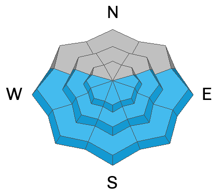
Over two feet of our newest snow has seen two days of full sun (in some areas) and warming temperatures. Today, temps continue to climb above freezing with another day of sun. Expect the new snow to warm throughout the day on slopes that face the sun, with the chance of wet snow avalanches increasing into the afternoon.

Watch the surface snow throughout the day. If you're noticing its becoming more wet and saturated—easier to make a snowball with—then these slides are on the menu. Wet, loose avalanches are most likely on steep slopes close to rocky outcroppings—like a snowboarder on the SE face of Davenport saw yesterday afternoon. Roller balls and pin wheels are warning signs to change aspects or head back to the truck.

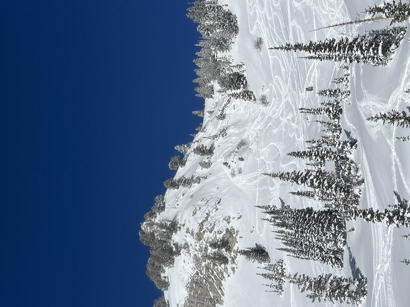
A snowboarder triggered a small wet loose slide in the afternoon yesterday on a rocky, SE-facing slope on Davenport Hill 8" deep and 30' wide. They were carried a short distance before riding away.

Avalanche Problem #3
Persistent Weak Layer
Type
Location
Likelihood
Size
Description

The story has two chapters: first, we have weak, old snow at the base of the snowpack on upper and mid-elevation W-N-E facing slopes. We are also seeing layers of weak snow adjacent to the Christmas Eve Rain Crust (CERC). Think they're old news? These layers resulted in a full burial (minus a hand) on Monday on First Cornice, as well as an avalanche large enough to bury a person that ran to the ground in Upper Days on Tuesday (Oingo Boingo). We've added over two feet of snow since.

The issue here is spatial variability. The supportability of the CERC, as well as the development of the facets adjacent to it, vary widely from slope to slope. Steep, rocky, higher W-N-E facing terrain that has been wind-loaded is most suspect.

Additional Information

Ian McCammon and Kelly McNeil's 2024 paper Six Tips That Could Save Your Life (Recent updates to Safety Messaging) is worth a re-read. It could save your life.

General Announcements

This information does not apply to developed ski areas or highways where avalanche control is normally done. This forecast is from the U.S.D.A. Forest Service, which is solely responsible for its content. This forecast describes general avalanche conditions and local variations always occur.