Forecast for the Provo Area Mountains

Evelyn Lees
Issued by Evelyn Lees for
Wednesday, April 3, 2019
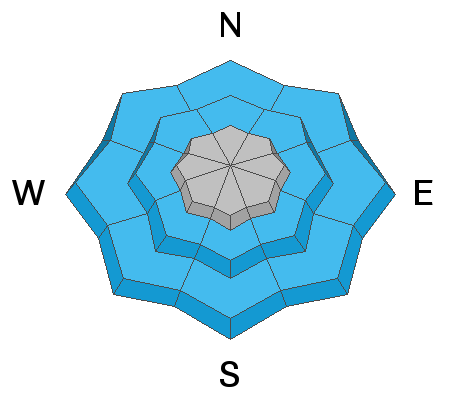
Today’s avalanche problems elevation dependent - the avalanche danger is MODERATE on steep, upper elevation slopes for triggering a dense New Snow slide where the snow has bonded poorly to the old snow surfaces or a new drift of wind blown snow along the higher ridge lines. The avalanche danger is MODERATE today on mid and lower elevations slopes for easily triggered Wet Snow sluffs. These could be largest on the northerly facing slopes, if they gouge into snow from the last storm. The continuously steep Provo terrain magnifies any avalanches, even a small sluff can travel thousands of feet downhill.
The snow will be more unstable during any periods of heavy rain or snowfall.
Low
Moderate
Considerable
High
Extreme
Learn how to read the forecast here
Special Announcements
When the forecasting ends, the UAC’s work keeps going strong. Summer is a busy time for the UAC. During the summer we are working hard on our fall and winter planning; putting together the Fall Fundraiser and the Utah Snow and Avalanche Workshop; updating our awareness and education programs; this summer we will be finishing up the website redesign project. Your donation shows you’re invested in this community all year round! You can still be part of the UAC’s success in 2019.
Weather and Snow
The warm storm has produced a mix of rain and snow in the Provo area mountains. The rain/snow line seems to have been as low as 7,500’ at times, with periods of “white rain” higher. There is about 4 inches of new snow at the Timp Divide Snotel (8170'), containing .3 inches of water. At Aspen Grove (6880'), it's been all rain - 1/2 inch total. Temperatures this morning are in the low 30s at the mid and lower elevations. The southwesterly winds picked up briefly overnight, and at the higher elevations to the north, peak averages were 15 to 20 mph, gusts in the 40s and 50s. Currently, in the Provo area mountains, winds are still from the southwest, and have been averaging 10 - 15 mph, with gusts below 20.

Today, a final burst of snow late morning could produce an additional 1 to 3” of snow at the higher elevations, with rain below about 8,000'. The winds will shift briefly to the northwest, before returning to the southwest. Averages will remain in the 15 to 20 mph range across the higher ridge lines. Highs today will be 45 to 50 at Aspen Grove, and near 40 at 7-8000'.
Recent Avalanches
No new avalanche activity was reported yesterday, though a few small new wind drifts were noted at the upper elevations of Little Cottonwood.
Ad
Avalanche Problem #1
New Snow
Type
Location
Likelihood
Size
Description
If you are searching for drier snow at the upper elevations, you will need to assess the bonding of the new snow to the old snow surfaces. On the sunny slopes, there are slick sun crusts beneath the new snow, and even a small slide triggered in steep terrain could entrain snow as it moves down slope, resulting in a surprising large pile of debris.
On the upper elevation shady slopes, the new dense snow may not bond well to the dry, possibly faceted, snow beneath, and it will be possible to trigger sluffs or soft and medium density slab avalanches. I would also expect a few wind drifts along the higher ridge lines, mostly on the northerly facing slopes. Signs of wind drifts include cracking of the snow and looking for smooth, rounded drifts that may be denser than the snow around them.
Start with slope cuts on small test slopes to evaluate if all the new snow is bonding to the old snow surfaces, or if there are any weaknesses within the new snow. For any long running slides, the character will change from dry snow to wet snow as they move down slope through warmer snow.
In the backcountry, you will have to travel through the wet snow zone to reach the drier snow at the upper elevations. See Wet Snow Below.
Avalanche Problem #2
Wet Snow
Type
Location
Likelihood
Size
Description
Wet loose sluffs will be easy to trigger on steep slopes of all aspects below about 8,000’ today, where the snow is wet or soggy. The new wet snow will be sliding on crusts on the sunny slopes, and may entrain snow as it moves downhill. On the shady slopes, a wet sluff may gouge down into last week’s snow, creating an even larger pile of cement like debris.
If you start triggering pinwheels of snow, roller ball swarms or small loose sluffs, these are signs of unstable wet snow and it's time to move to lower angle slopes. Watch for quickly changing snow conditions as you drop in elevation, and stay on lower angle slopes and avoid terrain traps such as gullies and drainages in the wet snow zone. If snowfall changes to rain where you are or the clouds thin or the sun comes out, the snow will quickly become reactive.
In the backcountry, you will have to travel through this wet snow zone to reach the drier snow at the upper elevations.
Additional Information
Glide cracks could remain active and Cornices will be more sensitive today. Avoidance is key for both - minimize your travel and time below the large cracks and overhanging cornices. When traveling on ridge lines, stay well back from the edges of the cornices. Any last snow on the roofs of mountain building may slide, so avoid travel beneath snow laden roofs and warn others to do the same.
General Announcements
This information does not apply to developed ski areas or highways where avalanche control is normally done. This forecast is from the U.S.D.A. Forest Service, which is solely responsible for its content. This forecast describes general avalanche conditions and local variations always occur.