Join us at our 2nd Annual Blizzard Ball

Forecast for the Provo Area Mountains

Trent Meisenheimer
Issued by Trent Meisenheimer on
Sunday morning, April 23, 2023
Today, Sunday April 23 is our last morning forecast.
We'll do updates through May 7th but with no danger ratings or problems. What a season!
Thanks everyone for everything!

The avalanche danger is MODERATE on all aspects at the mid and upper elevations for Wind-Drifted Snow (wind slabs, soft or hard) avalanches that can break 1-2 feet deep.

There is also a MODERATE avalanche danger for Wet Snow (wet-loose avalanches) on all aspects and elevations. However, Wet Loose avalanches will be more pronounced on slopes facing east, southeast, south, southwest, and west as the sun quickly heats the cold, dry snow.
Low
Moderate
Considerable
High
Extreme
Learn how to read the forecast here
Special Announcements
The last daily forecast will be today, Sunday, April 23. We will provide intermittent updates with any storm until Sunday, May 7th, and will continue posting backcountry observations until then.
The UAC is sad to report that a resident was killed by a roof avalanche on Monday, April 17th, in the Town of Brighton. A report is available HERE. Many communities still have a lot of snow on roofs that could produce similar avalanches.
Weather and Snow
Under clear skies, the mountain temperatures range from 22-26 °F. Winds blow from the west-northwest 5-10 mph gusting to 20 mph across all of the upper elevation 10,000' ridgelines. Up at 11,000', the west-northwest winds blow 25-30 mph gusting into the low 40s mph.
We will see plenty of sunshine with some high clouds this morning, along with light winds (5-15 mph) from the west. Temperatures will climb into the mid to high 40s °F this afternoon. Later in the day, thicker clouds will build in as the flow backs to the southwest ahead of another storm Monday into Tuesday, where we could see 1-5 inches of new snow.
Recent Avalanches
Speechless: 13 human-triggered avalanches with eight people caught and carried. These reported avalanches were wind slabs that failed right around a dirt layer in the snowpack now buried roughly 6-12 inches deep. These wind slabs were found on all aspects at the mid and upper elevations, and most were 6-12 inches deep and up to 100 feet wide. However, some wind slabs were deeper and closer to 2-4 feet deep. A couple of these avalanches were triggered remotely (from a distance), and one was 500 feet wide. There are too many to list here. Please visit the recent avalanche tab HERE.
One party reported the sun appearing in the Meadow Chutes (BCC) instantly zapping the cold, dry snow, making it wet and loose. We will see more of this today.
Ad
Avalanche Problem #1
Wind Drifted Snow
Type
Location
Likelihood
Size
Description
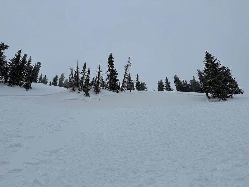
Both soft and hard slabs of wind-drifted snow will be found at the mid and upper elevations, as seen by all the recent avalanche activity from yesterday. It's no secret that these wind slabs will remain reactive today. The common theme was that these avalanches failed around a dirt layer just above an ice crust now buried 6-12 inches deep across the range. In some locations (heavily wind loaded), this layer is buried 1-3 feet deep. These avalanches can run fast and far due to the smooth and slick bed surfaces.
Terrain will be the deciding factor of how serious a ride in one of these avalanches would be. Small avalanches in high-consequence terrain can be just as deadly as large avalanches in mellow terrain.
Photo: Wind Slab in Wolverine Bowl. (Johnston & Heilweil) Click the image to be linked to their observation.
Avalanche Problem #2
Wet Snow
Type
Location
Likelihood
Size
Description
Strong April sun will quickly heat the south half of the compass (east through west) making the 3-7 inches of cold dry snow damp/wet and reactive to humans. Today, we will see long-running Wet Loose avalanches that could run fast and far on the underlying slick crusts (bed surfaces). Do not overstay your welcome on steep, sunlit slopes.
On the north (shady) side of the compass, look for the dry new snow becoming damp and wet. If this happens, we will see reactive Wet Loose avalanches across all aspects and elevations. Remember, it's spring, and temperatures can change everything. Be quick to alter your plans and tune into changing conditions.
General Announcements
This information does not apply to developed ski areas or highways where avalanche control is normally done. This forecast is from the U.S.D.A. Forest Service, which is solely responsible for its content. This forecast describes general avalanche conditions and local variations always occur.