Forecast for the Provo Area Mountains

Trent Meisenheimer
Issued by Trent Meisenheimer for
Sunday, April 16, 2023
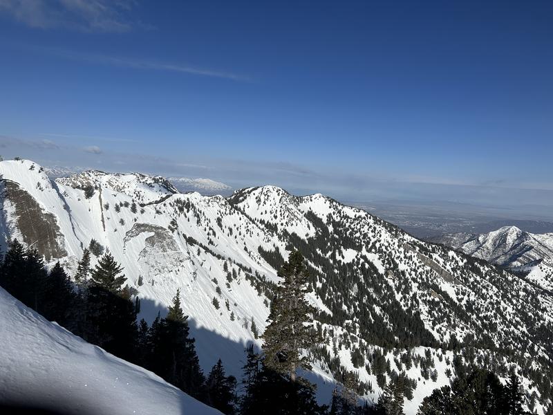
The avalanche danger will quickly rise to MODERATE on slopes facing east, south, and west at all elevations for wet snow avalanches due to the sun and warm temperatures. Both natural and human-triggered avalanches will be possible during the day's heat once the snow becomes wet and unstable.
Other slopes facing the north side of the compass will not heat up as much, and therefore you will find a LOW avalanche danger.

Slide-for-life conditions (where you cannot arrest after falling) are possible on smooth, hard, and frozen snow surfaces.
Low
Moderate
Considerable
High
Extreme
Learn how to read the forecast here
Special Announcements
The final UAC report for the Upper Weber Canyon avalanche accident on March 9 has been published and is available HERE. The UAC would like to thank Park City Powder Cats for sharing information about the timeline of the accident and allowing UAC staff access to the avalanche after the incident.
Weather and Snow
Under clear skies, the current mountain temperatures range from 26-39 °F. There is a strong temperature inversion in place, as you can see Aspen Grove (6,900') at 26°F, and Arrowhead (8,300') sitting at a temperature of 39°F this morning. Therefore some slopes will be frozen solid while others have a more shallow freeze. Winds blow southwest at speeds of 10-15 mph.
High pressure, sunshine, and increasing southerly winds are on tap for today. This morning we will warm much quicker as the temperatures are about 10 degrees warmer than yesterday at this time. Mountain temperatures will climb into the mid-40s and low 50s °F this afternoon, and winds will increase out of the southwest and blow 10-15 mph, gusting into the 20s.
The sun warmed the snow surface yesterday, allowing many riders to enjoy smooth turns on many aspects and elevations. Some even found 1-3 inches of dry powder snow in the upper alpine. Today will be no different, except it might get too hot and mushy in the afternoon eliminating the "its corn" song party on Instagram's story and reels.
Recent Avalanches
No new avalanches were reported from Saturday. Find all the observations HERE.
Ad
Avalanche Problem #1
Wet Snow
Type
Location
Likelihood
Size
Description
Today will be a different story as I think the sun and warming temperatures will be too much for the steep sunlit slopes. The snow surface will likely turn completely wet, allowing for both natural and human-triggered wet avalanches.
As the sun heats this morning's frozen snow surface, it will first turn soft, damp, and wet, and eventually, if there is enough heat, it will start to avalanche. Your window for safe riding and turning conditions is in the soft to damp category. Once it turns wet, it is time to leave.
If you find yourself on any slope where the sun has warmed the surface too much, and you're sinking into unconsolidated wet snow, it's time to leave or change aspects. Have an exit strategy in mind when leaving the Alpine.
Avalanche Problem #2
Cornice
Type
Location
Likelihood
Size
Description
Massive cornices are draped and drooped on almost all mid and upper-elevation ridgelines and these cornices demand respect. When traveling on ridgelines give those cornices a very wide berth, as they will break back much further than you think. Also, avoid being underneath these cornices as they can break at any moment sending massive chunks of ice and snow your way.
Avalanche Problem #3
Gliding Snow
Type
Location
Likelihood
Size
Description
Glide avalanches are extremely dangerous and destructive as the entire season's snowpack avalanches to the ground. One full-depth glide avalanche on the Raymond Slabs in Porter Fork of Mill Creek (image below) released on Tuesday. Another glide avalanche was reported yesterday in Broads Fork that likely happened on Wednesday, April 12th.
Avoid traveling in areas known for glide avalanches, such as Stairs Gulch, Broads Fork, Mill B South, Mineral Fork, Porter Fork, and others.
General Announcements
This information does not apply to developed ski areas or highways where avalanche control is normally done. This forecast is from the U.S.D.A. Forest Service, which is solely responsible for its content. This forecast describes general avalanche conditions and local variations always occur.