March Kicks Off Our Spring Campaign- Donate Now to Support Forecasting

Forecast for the Provo Area Mountains

Dave Kelly
Issued by Dave Kelly on
Sunday morning, March 9, 2025
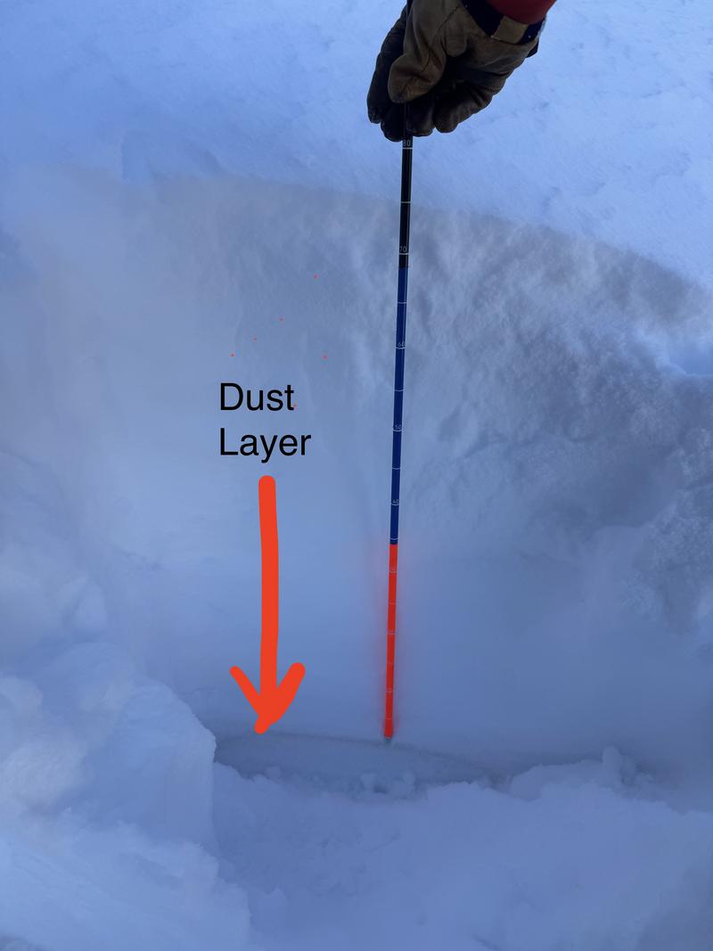
The avalanche danger is CONSIDERABLE on steep northwest-north-east facing mid and upper elevation slopes where it is possible that humans will trigger an avalanche failing on of two buried weak layers. These avalanches could be 1'-4' deep.
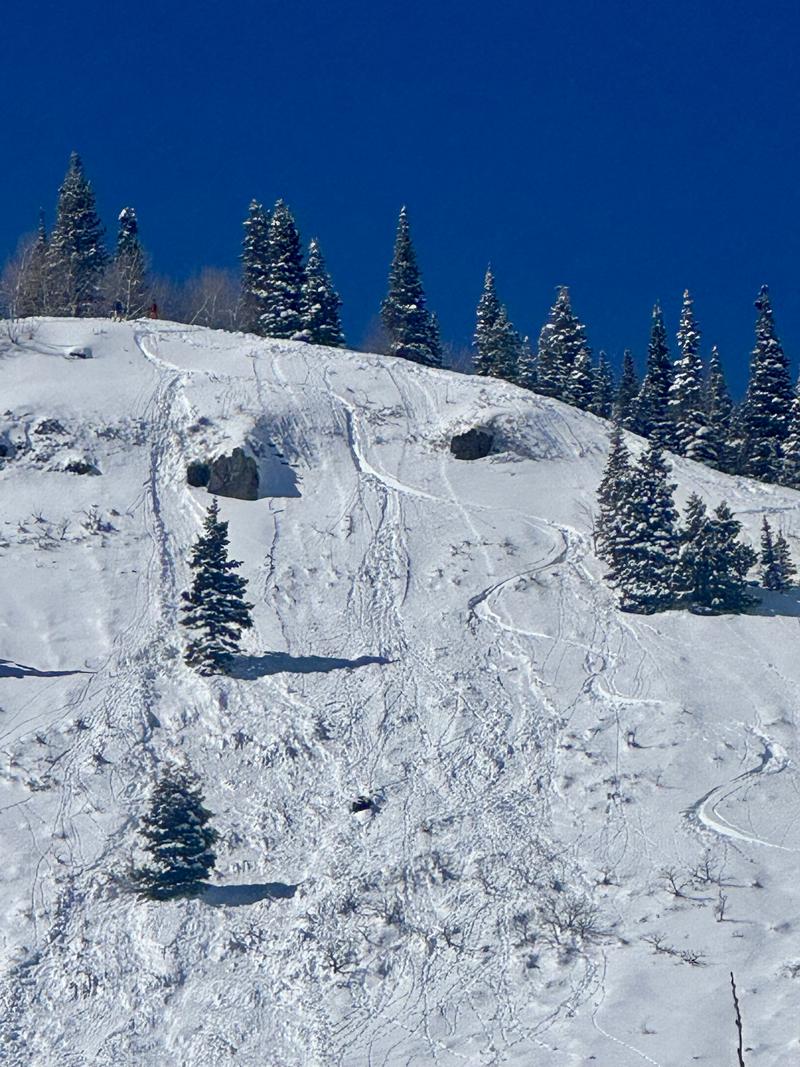
The avalanche danger will rise to CONSIDERABLE on all other aspects where we will see wet snow avalanches with daytime warming. This wet snow problem is a matter of timing, with the danger of these avalanches rising throughout the day. Start early and get off of slopes in the sun as they start to heat up.
Wet snow avalanches in the Provo Region can be long running and overtake the snow line, hitting summer hiking trails. This makes people not traveling directly in avalanche terrain susceptible to being involved in a late afternoon wet avalanche that comes down from above.
Low
Moderate
Considerable
High
Extreme
Learn how to read the forecast here
Special Announcements
We come to you with heavy hearts and great sadness this morning to confirm an avalanche accident on Friday, March 7th near Hoyt Peak, involving 51-year-old Micheal Janulaitis from Marion, Utah. Micheal was caught, carried, and killed in an avalanche while skiing a steep, northeast facing run in Hoyt Bowl. Huge thanks to the Department of Public Safety, Park City Mountain Resort and Canyons Village Snow Safety and Ski Patrol teams, along with Wasatch Backcountry Rescue for the hard work recovering Micheal and returning him to his family. Micheal was a friend of Utah Avy and we feel privileged for the time we got to spend together. This is a tremendous loss for our backcountry family and we will miss him deeply. We are compiling accident details and a preliminary report can be found HERE.
March kicks off our Spring Campaign! If everyone in Utah’s backcountry community donates the cost of something they regularly enjoy on an adventure—like a dawn patrol burrito, a backpack snack, or post-ride trailhead drinks—we could fund not just one but two forecasters for the entire season! Donate here. Thank you!
Weather and Snow
Currently, under clear skies temperatures are in the 20's °F. Winds are blowing lightly from the south.
Today, look for clear skies and temperatures from 42-48 °F. Winds will be light at the lower elevations and blowing from the west in the teen's gusting to the 20's MPH at the higher elevations.

Yesterday's warm temperatures cooked the snow on south-west facing aspects and expect to find a melt-freeze crust on the surface that will turn to mush very quickly with daytime heating. Lower angle north facing slopes above 9,000' are still holding soft snow.
Recent Avalanches
Yesterday, there were reports of natural and human-triggered wet loose avalanches on southerly and westerly facing terrain during the afternoon warmup, and of shallow wind-drifted snow avalanches near ridgelines. With warmer temperatures forecast for today expect wet avalanches to start earlier in the day.
Check out all avalanches and observations HERE, including a great observation from south of the Provo Region near Mt. Nebo.
Ad
Avalanche Problem #1
Persistent Weak Layer
Type
Location
Likelihood
Size
Description
The start of last week's storm is marked by a layer of dirt that is harboring weak faceted snow. The other layer of concern is the same one that has been with us since the Holidays. This layer of sugary faceted snow formed near the ground and has been the culprit in a number of avalanche fatalities in Utah this season. This layer near the ground will now be 2'-4' deep and any avalanche failing here would be large enough to bury, injure, or kill a person. Slopes likely to be holding this layer are thinner, shallower, and have potentially already avalanched a couple of times this season (repeaters).
The best way to find out if either of these layers exist is to take your shovel and probe out and check the snowpack before committing to steep terrain.
Photo (Porter) showing the depth of the dirt layer below the surface.
Avalanche Problem #2
Wet Snow
Type
Location
Likelihood
Size
Description
Today, expect to see wet snow avalanches. These will likely start early afternoon on steep southerly facing slopes at all elevations and westerly facing slopes later in the afternoon. You may also find wet avalanches in low elevation northerly facing terrain. These avalanches can be managed with timing. Get off of steep slopes in the sun as they begin to warm up where the danger will rise to CONSIDERABLE and natural wet avalanches will be possible.
Roof slides are possible this afternoon. Pay close attention to children playing or shovelers near roof lines as things heat up this afternoon and roofs start to shed their most recent storm snow.
Photo (Sam M.) of wet loose avalanches near Aspen Grove.
General Announcements
This information does not apply to developed ski areas or highways where avalanche control is normally done. This forecast is from the U.S.D.A. Forest Service, which is solely responsible for its content. This forecast describes general avalanche conditions and local variations always occur.