Forecast for the Provo Area Mountains

Drew Hardesty
Issued by Drew Hardesty for
Monday, March 4, 2019
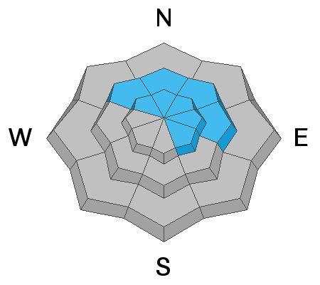
A MODERATE DANGER exists in the Provo Mountains. Shallow wind drifts and loose snow avalanches may be found in steep terrain of the mid and upper elevations. Wet loose avalanches will again be likely with sun and daytime warming. Human triggered avalanches remain possible in thinner snowpack areas or areas that have avalanched previously this winter. Extra caution is advised.
Low
Moderate
Considerable
High
Extreme
Learn how to read the forecast here
Special Announcements
Announcement: Join Drew Hardesty at 7PM on Wednesday, March 6 at Rocksteady Bodyworks in SLC for an interactive discussion on the State of the Snowpack.
The latest podcast is out. In this episode, we sit down with Ian McCammon. Ian has done as much for the avalanche community as nearly anyone over the past 20 years and recently received the highest award given by the American Avalanche Association. Tune in -
Weather and Snow
Skies are mostly cloudy. Winds are hardly a whisper. Mountain temperatures are in the teens. Snow depths are 90"+ in the high elevations with excellent coverage. The snow became damp with greenhousing on some slopes yesterday.
Weak ridging will develop today and early tomorrow ahead of another series of wet, warm, and windy storms slated for overnight Tuesday through early Saturday. An initial rain/snow line Wednesday may be as high as 7000'. Areas favored by a southwest flow such as the Provo area mountains, upper Big Cottonwood, and the southern end of the Park City ridgeline may see upwards of 1-2' of heavy dense snow by early Saturday. Cold air doesn't arrive until later Friday eve. Another storm possible for early next week.
Recent Avalanches
Due to greenhousing, the Provo mountains experienced something of a wet loose avalanche cycle in the mid/low elevations yesterday. Look for evidence of wet debris under steep slopes today. There will likely be more today.
Ad
Avalanche Problem #1
New Snow
Type
Location
Likelihood
Size
Description
Sluffing in the new snow on steep (40°+) slopes is expected. These are easily managed from above with ski cuts and by moving diagonally across the slope to avoid being caught up in your own loose snow avalanche. In forgiving terrain, these offer great opportunities to learn about moving snow. In, above, and below extreme terrain, they can be outright terrifying. Remember that radical terrain amplifies the overall risk.
Avalanche Problem #2
Persistent Weak Layer
Type
Location
Likelihood
Size
Description
The Provo mountains have had a number of large avalanche cycles in January and February with many avalanches stepping down into early season or mid-December snow layering 3-8' deep. These avalanches were predominantly in the upper elevation (or wind loaded ridgelines in the mid-elevation) north through southeast facing slopes both along the Cascade ridgeline, Timpanogos, and in the upper American Fork drainages (Mill Canyon Peak environs).
These areas that avalanched remain susceptible to continued avalanching in the upper elevations that have seen significant snow and wind. The large avalanches in the UFO Bowls north of Aspen Grove (from the 3rd week of February) did not seem to have enough of a new load yesterday but will be something to watch with additional storms this week.
Note: assessing these slopes individually requires a high degree of skill and experience and risk....and may still produce some uncertainty. A very conservative approach is required if traveling in the avalanche terrain of Provo.
Avalanche Problem #3
Wet Snow
Type
Location
Likelihood
Size
Description
Greenhousing may yet again feature prominently to enable wet loose sluffs on all aspects at the low and mid elevations of all aspects. They'll certainly run fast and far...and even more-so in steep confined gullies and particular on the east-south-west facing aspects that holds a nice crust/bed surface below. IF the clouds thin enough to allow for some sun...or the sun comes out altogether, the avalanche potential of the sluffs will rise accordingly.
What is greenhousing? It's when the radiation/energy balance gets thrown out of whack (ok this is a snow and avalanche guy's description) where thin clouds allow for some solar heating but hamper much of the snow's ability to release long wave energy back to the sky. The clouds themselves emit long wave energy back to the snow as well. These are all things you can feel - it's warm, humid, muggy (feels like stepping into a true greenhouse) - and the snow can become damp and unstable independent of aspect and typically more common at the low to mid elevations.
TAKE HOME POINT: If you can feel the greenhousing, the snow can feel the greenhousing - wet loose sluffing can be expected. Especially when there's recent cold snow on the ground.
Additional Information
Cornices remain huge and unruly. Avoid being on or beneath these large waves of snow. PC Bombard.
General Announcements
This information does not apply to developed ski areas or highways where avalanche control is normally done. This forecast is from the U.S.D.A. Forest Service, which is solely responsible for its content. This forecast describes general avalanche conditions and local variations always occur.